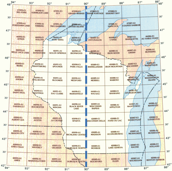
WhAEM BBM Files - Wisconsin
To find binary base map data for a specific geographic area, click on the appropriate 30 by 60 minute quadrangle on the state map below. A Web page containing a graphic of the 30 by 60 minute quadrangle will display eight subdivided 15 by 15 minute quadrangles. Alternatively, you can choose from an alphabetical text list of available 30 by 60 minute quadrangles.

| Appleton | Ashland | Black River Lake | Bloomer | Decorah | Dubuque | Duluth | Eau Claire | Elgin | Escanaba | Fond du Lac | Grantsburg | Hastings | Iron Mountain | Iron River | Ironwood | La Crosse | Lake Geneva | Madison | Manitowoc | Marinett | Marshfield | Medford | Merrill | Milwaukee | Monroe | Oconomowoc | Oelwein | Outer Island | Park Falls | Port Wing | Racine | Rhinelander | Richland | Rochester | Rockford | Sandstone | Shawano | Sheboygan | Solon Springs | Sparta | Spooner | Stillwater | Sturgeon | Wabeno | Wakefield | Washington Island | Waukegan | Wausau | Winona | Wisconsin Dells | Wisconsin Rapids |
