WhAEM2000 BBM Files - Florida
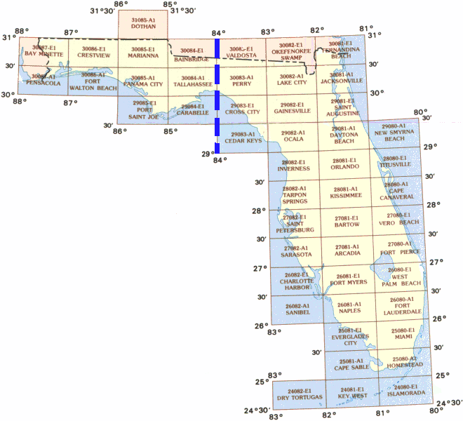
To find binary base map data for a specific geographic area, click on the appropriate 30 by 60 minute quadrangle on the state map below. A Web page containing a graphic of the 30 by 60 minute quadrangle will display eight subdivided 15 by 15 minute quadrangles. Alternatively, you can choose from an alphabetical text list of available 30 by 60 minute quadrangles.

| Arcadia | Bainbridge | Bartow | Bay Minette | Cape Canaveral | Cape Sable | Carrabelle | Cedar Keys | Charlott | Crestvie | Cross City | Daytona Beach | Dothan | Dry Tortugas | Everglades | Fernandi | Ft Lauderdale | Ft Myers | Ft Pierce | Ft Walton Beach | Gainesville | Homestead | Inverness | Jacksonville | Key West | Kissimmee | Lake City | Marianna | Miami | Naples | New Smyrna Beach | Ocala | Okefenokee Swamp | Orlando | Panama City | Pensacola | Perry | Port St Joe | St Augustine | St Peter | Sanibel | Sarasota | Tallahassee | Tarpon Springs | Titusville | Valdosta | Vero Beach | West Palm Beach |
