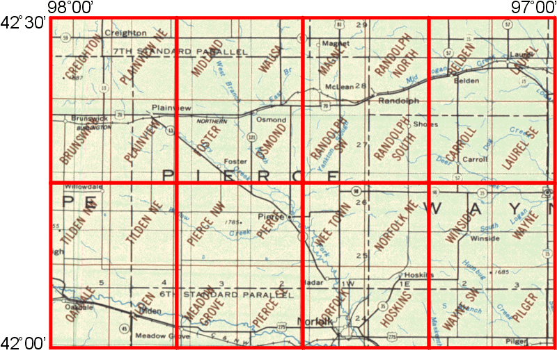
WhAEM2000 BBM Files - Norfolk, Nebraska
Click on any of the eight 15 by 15 minute quadrangles (outlined in red) to download binary base map files for that area. Alternatively, you can choose from a text list of available 15 by 15 minute quadrangles.
The download files contain the map layers: roads, miscellaneous transportation, railroads, streams, and topographic contours. Roads and topographic contours are unavailable for some quadrangles. The download files are compressed as self-extracting Zip files and can be extracted to the directory of your choice.

| Quad 1 | Quad 2 | Quad 3 | Quad 4 | Quad 5 | Quad 6 | Quad 7 | Quad 8 |
