Diving Case Study: Coral Reef Survey in the U.S. Virgin Islands
Location
 EPA scientist Cheryl Hankins (right) conducts a coral demographics survey while National Park Service intern Kelly O'Connell (left) conducts a line-point intercept survey in St. John, U.S. Virgin Islands. Photo courtesy of National Park Service (Shaun Wolfe).
  EPA scientist Peggy Harris conducts a coral demographic survey (St. John, USVI, 2017). Photo courtesty of National Park Service (Shaun Wolfe).
 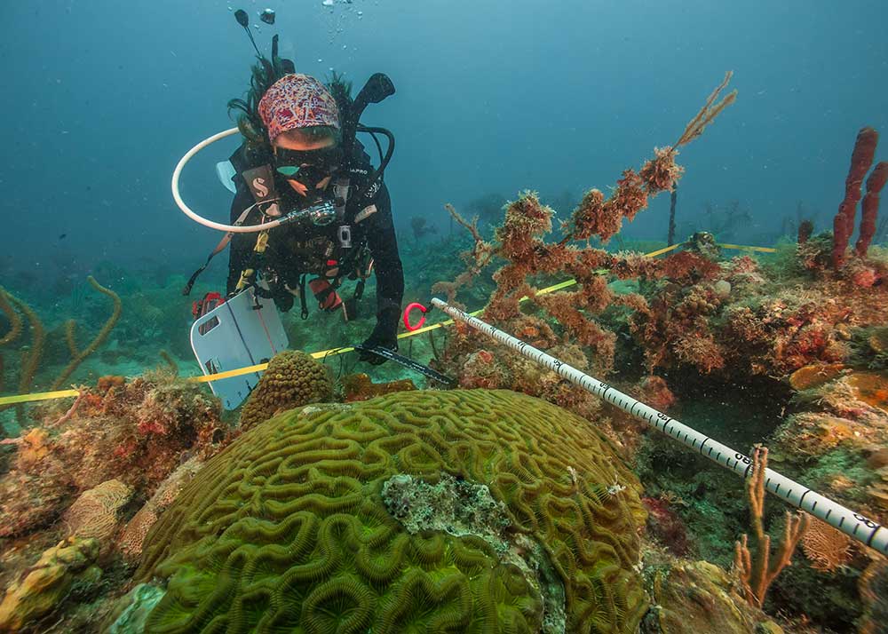 EPA scientist Cheryl Hankins conducts a coral demographic survey (St. John, USVI, 2017). Photo courtesy of National Park Service (Shaun Wolfe).
 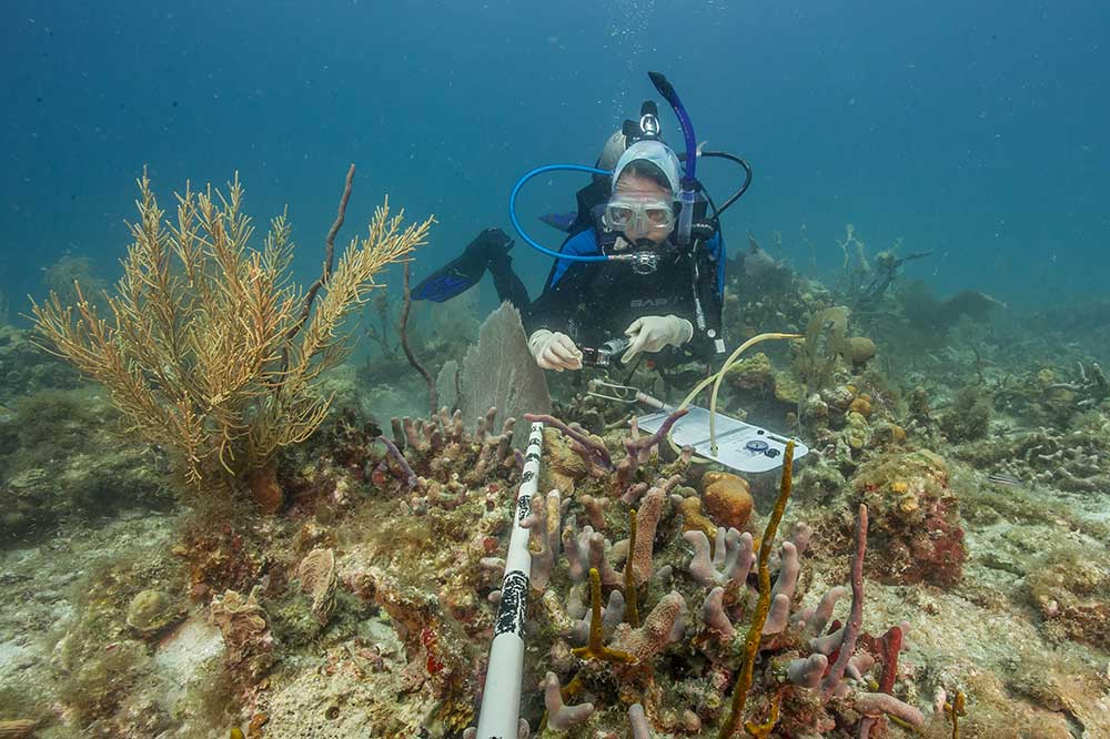 EPA scientist Deborah Santavy conducts a coral demographic survey (St. John, USVI, 2017). Photo courtesy of National Park Service (Shaun Wolfe).St. John, Caribbean Sea
Summary
Each year EPA divers assist with the National Oceanic and Atmospheric Association’s (NOAA) annual National Coral Reef Monitoring Survey (NCRMP). These monitoring assessments focus on fish and coral diversity and abundance, and track shifts in "hard bottom" substrate (which provides a necessary surface for the corals to attach).
In July 2017, divers from EPA's Office of Research and Development Gulf Ecology Division collaborated with the NOAA and the National Park Service to perform coral reef assessments in the U.S. Virgin Islands.
The data collected by our divers will assist researchers in generating a biological condition gradient (see description below) that will help in establishing stressor![]() stressorAny substance or condition that adversely impacts the aquatic ecosystem. thresholds to protect coral reef habitats.
stressorAny substance or condition that adversely impacts the aquatic ecosystem. thresholds to protect coral reef habitats.
EPA divers also assisted with previous surveys in the Florida Keys (2016) and St. Croix (2015).
Method
The divers conducted fish and benthic (bottom) surveys. The fish surveys consisted of species counts and size estimations. Benthic surveys included coral demographics (e.g. species, size) and observations on substrate![]() substrateThe surface or material that an organism lives on or in. For example, oyster reefs provide hard substrate for invertebrates to attach themselves to. using the line-point intercept protocol.
substrateThe surface or material that an organism lives on or in. For example, oyster reefs provide hard substrate for invertebrates to attach themselves to. using the line-point intercept protocol.
About the Biological Condition Gradient Model
The biological condition gradient (BCG) is a conceptual model developed by EPA and others to help scientists interpret biological responses from the cumulative effects of stressors to coral reefs.
The BCG model describes six levels of condition — from natural or minimally disturbed to severely altered. Coral habitat data collected by scientists can be compared to a particular level of impact to support local water quality programs and other coral reef management objectives.
The BCG model is similar to a dose-response curve where the dose (x-axis) represents increasing level of human-caused stress (reflecting such factors as changes to water quality, species diversity, and three-dimensional habitat) and the response (y-axis) represents biological condition (such as community structure, organism condition, and ecosystem function).
For more information, see EPA's Practitioner’s Guide to the Biological Condition Gradient: A Framework to Describe Incremental Change in Aquatic Ecosystems.
Learn More
- Developing a Multi-stressor Gradient for Coral Reefs (scientific paper abstract)
- Coral Reefs
For more information about this diving project, contact Cheryl Hankins (hankins.cheryl@epa.gov). See more photos at EPA divers on Facebook.