About the Delaware Bay Wetland Projections
About the Delaware Bay Wetland Projections
Get the Report
 (Main Report,74 pp, 5 MB, About PDF)
Coastal salt marshes--which provide valued ecosystem services such as flood control, water purification and critical habitat—are vulnerable to ongoing sea level rise, which is interacting with physical and biological attributes of the system to induce complex changes in salt marsh habitats.
For salt marshes such as those in the Delaware Bay, management techniques need to be adapted to account for these effects when carrying out activities to preserve valued salt marsh areas.
To explore the dominant processes involved in determining distributions of wetlands across space and time under conditions of accelerated sea level rise (SLR) in the Lower Delaware Bay, we used SLAMM (version 6.7) to generate spatially-explicit projections of SLR-induced changes in acreage for seven salt marshes. Four of the marshes are located in New Jersey (Dividing, Lower Maurice, Dennis, Reeds Beach) and three are located in Delaware (Broadkill, Mispillion, Lower St. Jones).
The EPA report presenting the results is divided into three sections:
- projected changes in all SLAMM land cover categories,
- projected changes in high, low and total salt marsh acreage, and
- sensitivity analyses to assess the relative effect on model outputs of key input variables (Great Diurnal Tide Range (GT), salt elevation, marsh erosion, and accretion rates).
SLAMM is widely recognized as an effective model to study and predict wetland responses to long-term SLR and has been applied in every coastal U.S. state.
SLAMM is widely recognized as an effective model to study and predict wetland responses to long-term SLR and has been applied in every coastal U.S. state. Our methods differ from prior SLAMM work performed in the Delaware Bay, in that we derived results for specific marsh areas (habitat types) and utilized more recent, higher resolution elevation data, the most recent SLR projections, and site-specific accretion data. These SLAMM simulations support a larger project by the EPA on frameworks and methods for characterizing relative wetland vulnerabilities and applying the results to support adaptation for more effective management strategies.
History of the Delaware Bay Wetland Project
Below is a list of important milestones.
| Date | Milestone |
|---|---|
| May 2020 | The Delaware Bay Wetland Projections were incorporated into the Global Climate Explorer (GCX) set of tools and website. |
| Apr 2019 |
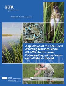
EPA released the report, Application of the Sea-Level Affecting Marshes Model (SLAMM) to the Lower Delaware Bay, with a Focus on Salt Marsh Habitat. |
Datasets
ESRI raster files of projections for Delaware Bay Wetlands
Publications
EPA Reports
-
U.S. EPA. Application of the Sea-Level Affecting Marshes Model (SLAMM) to the Lower Delaware Bay, with a Focus on Salt Marsh Habitat. U.S. Environmental Protection Agency, Washington, DC, EPA/600/R-18/385, 2019.
For assistance/questions please use the Contact Us About the Delaware Bay Wetland Projections project. For general Global Climate Explorer questions, separate from the products available above, please use the link below.