Floodplain Properties of the GE-Pittsfield/Housatonic River Site
Overview of the Floodplain Properties
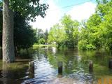
The cleanup agreement requires General Electric to investigate and clean up PCBs in the soil of specific properties that lie within the Housatonic River floodplain, downstream of the Lyman Street Bridge. These floodplain areas have been identified using historic information about flood conditions along the river, as well as hydraulic models of the floodplain showing where soil PCB concentrations were predicted to equal 1 ppm. The floodplain properties located above Woods Pond that were identified in the cleanup agreement are presented on the following Figure: Housatonic River Floodplain Properties Under Investigation (PDF) (1 pg, 1.3 MB, About PDF).
The cleanup agreement identifies three different categories of the floodplain properties, known as Removal Action Areas (RAAs):
- Floodplain Current Residential Properties Adjacent to 1½-Mile Reach- Actual/Potential Lawns
- Floodplain Non-Residential Properties Adjacent to 1½-Mile Reach (Excluding Banks)
- Floodplain Residential Properties Downstream of Confluence - Actual/Potential Lawns
- Floodplain Non-Residential Properties Downstream of Confluence
Current status:
Clean up is complete at the Floodplain Current Residential and Non-Residential Properties Adjacent to 1½-Mile Reach RAAs and at the Current Residential Properties Downstream of the Confluence.
Floodplain Current Residential Properties Adjacent to 1½-Mile Reach - Actual/Potential Lawns
The 1½-Mile Reach consists of the river section between the Lyman Street bridge (upstream) and the confluence with the West Branch (downstream). This area includes the non-bank portion of 37 residential properties that are located within the floodplain. The riverbank and river bottom portion of these properties are excluded from the RAA and were remediated as part of the 1½ Mile Reach Removal Action.
GE conducted remediation and restoration activities at 27 of the 37 properties between June 2005 and October 2007. This consisted of the removal and proper disposal of 10,810 cubic yards of soil. The remaining 10 properties did not require soil remediation to meet residential health-based Performance Standards.
In July 2008, GE submitted a Final Completion Report certifying that all actions required by the Consent Decree (excluding Post-Removal Site Control Activities) were completed and that the soil-related cleanup standards were met. On August 21, 2008, Massachusetts DEP sent a letter to EPA concurring that GE completed all actions required by the Consent Decree (excluding Post-Removal Site Control Activities).
On August 27, 2008, EPA issued GE a Certificate of Completion for the Floodplain Current Residential Properties Adjacent to 1½-Mile Reach- Actual/Potential Lawns RAA and transmitted the Certificate of Completion to GE, along with an approval letter for GE's Final Completion Report.GE is currently performing all required Post-Removal Site Control Activities, including inspection, monitoring and maintenance activities, as required by the Final Completion Report.
Return to Removal Action Areas List
Floodplain Non-Residential Properties Adjacent to 1½-Mile Reach (Excluding Banks)
As noted above, the 1½-Mile Reach is defined by the Lyman Street bridge (upstream) and the confluence with the West Branch (downstream), including Fred Garner Park. This area includes non-bank portions of approximately 10 non-residential properties along this reach where such portions are located within the floodplain. Excluded from this area are those properties associated with the Former Oxbow Areas. In addition, the riverbank and river bottom portion of these properties are excluded from the RAA and were remediated pursuant to the 1½ Mile Reach Removal Action.
GE conducted remediation and restoration activities at six of the ten properties between May 2006 and October 2007. This consisted of the removal and properly disposed of 3,375 cubic yards of soil. The remaining four properties did not require soil remediation to meet the applicable Performance Standards.
In April 2010, GE submitted a Final Completion Report certifying that all actions required by the Consent Decree (excluding Post-Removal Site Control Activities) were completed and that the soil-related Performance Standards were met. On May 17, 2010, EPA issued GE a Certificate of Completion for the Floodplain Non-Residential Properties Adjacent to 1½-Mile Reach (Excluding Banks) RAA and transmitted the Certificate of Completion to GE, along with an approval letter for GE's Final Completion Report.
GE is currently performing all required Post-Removal Site Control Activities, including inspection, monitoring and maintenance activities, as required by the Final Completion Report.
Return to Removal Action Areas List
Floodplain Residential Properties Downstream of Confluence - Actual/Potential Lawns
This is one of the twenty contaminated removal action areas (RAAs) outside the Housatonic River which GE is required to address under the Consent Decree. This RAA consists of the actual and potential lawns at 28 residential properties located between the confluence of the East and West Branches of the River in Pittsfield and Rising Pond Dam in Great Barrington. The RAA consists of 8 residential properties between the confluence and Woods Pond Dam in Lenox, and 20 residential properties downstream of Woods Pond Dam within the floodplain in Lenox, Lee, and Stockbridge that have PCB contamination above 2 parts per million (ppm).
Per the Consent Decree, GE, from 2013-2015, investigated each Floodplain Residential Property Downstream of the Confluence to determine if the levels of contamination of PCBs and/or other hazardous substances exceed the Decree's Performance Standards (2 ppm average concentration, or any individual concentration of 10 ppm). Based on the results of that investigation which were presented in several reports, culminating in GE's November 2015 Pre-Design Investigation Report, EPA required that GE remove and replace contaminated soils on 9 of the properties that were investigated because they did not meet applicable performance standards. No remediation is required on the actual or potential lawns of the remaining 19 properties. If any of these properties have contamination in a part of the property that is not an actual/potential lawn, e.g., riverbanks, they may be subject to clean up actions as part of Rest of River.
GE presented their evaluation and proposed clean up of these properties in several reports culminating in the September 12, 2016 Revised Removal Design/Remedial Action (RD/RA Work Plan), conditionally approved by EPA on September 19, 2016. Based on this revised RD/RA Work Plan, as conditionally approved by EPA, GE would remediate 7 of the properties in 2017. Two of the nine properties (one in Lenox and one in Pittsfield) did not meet applicable Performance Standards based on current conditions, but have not yet been remediated. Remediation at one of the properties, which is located in Pittsfield, has been delayed at the owners' request such that remediation can be conducted in conjunction with remediation associated Rest of River. For the second parcel, which is in Lenox, a use restriction on the property precludes converting the heavily vegetated wetland area of contamination into a lawn. Remediation to meet residential standards is no longer required, however, additional remediation for other purposes may be required as part of Rest of River.
GE conducted remediation and restoration activities at the seven properties between June 2017 and June 2018. This consisted of the removal and proper disposal of 4,585 cubic yards of soil. In February 2019, GE submitted a Final Completion Report certifying that all actions required by the Consent Decree (excluding Post-Removal Site Control Activities) were completed and that the soil-related Performance Standards were met. On March 12, 2019, EPA issued GE a Certificate of Completion for the Floodplain Residential Properties Downstream of Confluence - Actual/Potential Lawns RAA and transmitted the Certificate of Completion to GE, along with an approval letter for GE's Final Completion Report.
GE is currently performing all required Post-Removal Site Control Activities, including inspection, monitoring and maintenance activities, as required by the Final Completion Report.
Return to Removal Action Areas List
Floodplain Non-Residential Properties Downstream of Confluence
Non-residential floodplain properties downstream of the confluence are considered part of the Rest of River area of the site, and are discussed with the Rest of River Investigations.
Return to Removal Action Areas List
Reports for the Floodplain Properties
- Residential and Non-Residential Floodplain Properties Adjacent to the 1 1/2 Mile Reach – General
- 1 1/2 Mile Reach Phase 1 Floodplain Properties - Submittals, Reports and Correspondence
- 1 1/2 Mile Reach Phase 2 Floodplain Properties - Submittals, Reports and Correspondence
- 1 1/2 Mile Reach Phase 3 Floodplain Properties - Submittals, Reports and Correspondence
- 1 1/2 Mile Reach Phase 4 Floodplain Properties - Submittals, Reports and Correspondence
- Floodplain Residential Properties Downstream of the Confluence