Environmental Modeling and Visualization Laboratory
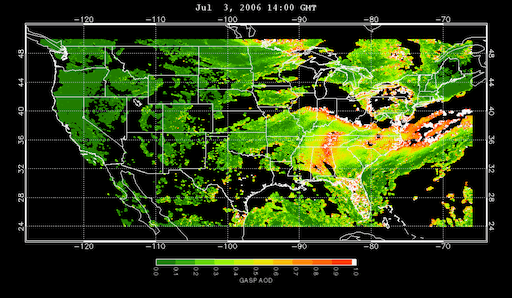
An image from the Remote Sensing Information Gateway (RSIG) showing air quality data from a satellite.
Environmental modeling allows scientists and researchers to test hypotheses, run experiments and examine potential future scenarios to better support EPA decision makers in our regions, program offices and laboratories. Through collaboration with researchers, EMVL staff explore, evaluate, and test new methods for scientific and information visualization and develop the best of these methods into working prototypes. EMVL projects include a model of the human respiratory system and the Coastal General Ecosystem Model that helps researchers better inform EPA policy makers of anticipated impacts of changes in nutrient runoff.
Scientific visualization is an important tool for environmental research: by representing numerical data in a visual format, it allows environmental scientists and analysts to better understand the results of their research and to effectively convey those results.
Environmental Modeling and Visualization Laboratory (EMVL) services consist of computational expertise in support of EPA research and include:
- development/optimization of environmental and human health models
- computational fluid dynamics
- scientific visualization
- data analytics
- parallel programming
EMVL Projects
EMVL’s main goal is to develop projects that support Agency science and research. Some have websites where users can download data, examine their own data, and perform analysis.
Custom Module Development
EMVL develops custom modules, drivers, data translators/filters, and other software tools to support Agency science and policy. Custom System Development also includes the rehosting of software to new platforms (from a vector to a massively parallel environment, for example). This is done to speed up computation and research efforts.
Digital Media Design and Production
EMVL is the EPA’s facility for visualization and animation. EMVL staff create animations, 3D environmental visualizations and tutorials describing how to use the EPA software products EMVL has developed.
EMVL staff regularly produce visualization output in a variety of formats. Using a digital editing system, EMVL staff provide EPA with visualizations that are demonstrated to others.
Partnerships and Consulting
EMVL is a partner in EPA science and research. We work with partners including research staff at the National Aeronautics and Space Administration (NASA) and the Naval Research Laboratory. We provide consulting services, including troubleshooting, advice on hardware and software selection, problem diagnosis and resolution, and technical guidance.
Demonstrations
EMVL staff frequently provide demonstrations of EMVL work to EPA scientists, managers, and guests of the EPA. The purpose of these demonstrations varies, from highly technical analyses of modeling results to high-level presentations of decision-making tools.
Projects Include
- Benchmark Dose Software: Contains thirty (30) different models that are used by Agency risk assessors to derive benchmark dose values for use in Agency risk assessments.
- Estuary Data Mapper: An interactive graphical application enabling researchers to quickly and easily view and select data for estuary-scale geographical regions of interest.
- Real Time Geospatial Data Viewer (RETIGO): A web-based application that can be used by anyone to explore the air quality data they collect.
- Remote Sensing Information Gateway: The RSIG3D application enables quick and easy access to subsets of multi-terabyte, environmental datasets from satellites, land- and water-based monitoring sites, and other sources.
- Virtual Embryo: An application under active development to develop prediction techniques that will aid understanding of how specific chemicals could impact embryo development.