Examples of Hydrology Assessments for Watershed Health
Watershed hydrology is driven by climatic processes; surface and subsurface characteristics, such as topography, vegetation and geology; and human activities, such as water and land use. Natural disturbance processes are critical to establishing hydrologic regimes (flows in rivers and water levels in lakes and groundwater systems) within a natural range of variation, and contribute to critical ecological functions such as creating habitat and providing cues for spawning and migration during discrete times of the year.
Natural flow regimes are composed of seasonally varying environmental flow components, including high flows, base flows, pulses and floods that can be characterized in terms of their magnitude, frequency, duration, timing and rate of change of hydrologic conditions (Poff et al., 1997). Natural lake levels will vary depending on precipitation, evaporation and/or ground and surface water hydrology. Below are resources for planning and implementing a hydroecological assessment and examples of previous efforts to characterize hydrologic conditions.
You may need a PDF reader to view some of the files on this page. See EPA's PDF page to learn more. Most of the following links exit the site. EXIT
National
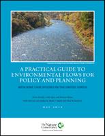 Ecological Limits of Hydrologic Alteration The Ecological Limits of Hydrologic Alteration (ELOHA) is a framework offering a flexible, scientifically defensible compromise for broadly assessing environmental flow needs when in-depth studies cannot be performed for all rivers in a region. ELOHA is especially useful for state-level assessments. The ELOHA website provides numerous technical resources and case studies on the use of ELHOA to accelerate the integration of environmental flows into regional water resource planning and management, including A Practical Guide to Environmental Flows for Policy and Planning, which presents nine case studies in regional environmental flow management in the United States. The ELOHA newsletter on the web site provides updates on progress towards incorporating environmental flows protection into state, regional, and basin water resource management programs. Read case studies of the ELOHA method
The Indicators of Hydrologic Alteration (IHA) Developed by scientists at The Nature Conservancy, this software program allows users to input long-term daily streamflow records and calculates 67 different ecologically-relevant measures of the flow regime. Measures describe the magnitude, frequency, duration, timing, and rate of change of high flows, base flows, large floods, and extreme low flows. Annual values and long-term averages are reported and can be used to analyze the hydrologic effects of abrupt disturbances such as dam construction or more gradual trends corresponding to land and water use changes over time.
Hydroecological Integrity Assessment Process The Hydroecological Integrity Assessment Process (HIP) is a framework and set of tools developed by the US Geological Survey to characterize the 5 major components of the Natural Flow Regime. HIP uses a Hydrologic Index Tool (HIT) to calculate 171 biologically relevant stream flow statistics, stream classification, and a Hydrologic Assessment Tool (HAT) to determine the degree of departure from baseline conditions. The two tools are available for download from USGS and allow the user to calculate all 171 hydroecological indices using daily and peak stream flow data imported directly from the National Water Information System.
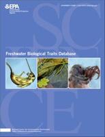
Freshwater Biological Traits Database and Report The Freshwater Biological Traits Database, developed by U.S. EPA’s Office of Research and Development, contains traits data for 3,857 North American river and stream macroinvertebrate taxa, and includes location, habitat, life history, mobility, morphology, and ecological trait data along with tolerance calculations for temperature and flow. Of the 14 sources of data, the main sources are the USGS traits database (Vieira et al. 2006) and the Poff et al. trait matrix (2006). These data can be used to evaluate biological responses to changes in temperature and hydrology.
A National Streamflow Network Gap Analysis USGS conducted an assessment of the ability of its stream gage network to produce various streamflow statistics at locations that have stream gages in place (gaged) and that do not have stream gages (ungaged). The assessment identifies where gaps exist in the network of gaged locations, explains how accurately useful statistics can be calculated with a given length of record, and notes whether the current network allows for estimation of these statistics at ungaged locations. The results of the assessment indicate that coverage provided by the streamflow data-collection network varies both spatially and temporally. The goal of this study was to help USGS identify and strategically address the existing gaps in the stream flow network.
Regional
Characteristics and Classification of Least Altered Streamflows in Massachusetts USGS characterized the natural streamflow regime throughout southern New England using long-term streamflow records from 85 gaging stations considered to be least altered. Flow statistics were used to classify streams according to multiple hydrologic indices that represent different aspects of the flow regime. River basins having similar hydrological properties also had similar basin and climate characteristics.
USGS Report on Lake Level Variability and Water Availability in the Great Lakes (PDF) (32 pp, 1.3MB) This report provides recorded and estimated (prior to data collection) changes in water levels in the Great Lakes, relates those changes to impacts such as climate change, and highlights major water availability implications for storage, coastal ecosystems, and human activities.
Flow Recommendations for the Tributaries of the Great Lakes in New York and Pennsylvania (PDF) (182 pp, 7.7MB) Developed by The Nature Conservancy, this report defines and quantifies the ecological processes necessary to maintain intact aquatic ecosystems in streams ranging from headwaters to large rivers, while providing sufficient water for human needs. The results of this study support decision making for management of water withdrawals and water use at a regional scale for the Tributaries of the Great Lakes in New York and Pennsylvania. This study supports the states in their effort to meet their obligations under the Great Lakes-St. Lawrence River Basin Sustainable Water Resources Compact (the “Great Lakes Compact”) to create a management program for new or increased withdrawals and consumptive uses, in order to help prevent adverse impacts to the quantity or quality of the waters and water-dependent natural resources” of the Great Lakes Basin.
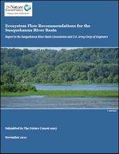
Ecosystem Flow Recommendations for the Susquehanna River Basin (PDF) (101 pp, 2MB) Developed by The Nature Conservancy, this report presents a set of recommended flows to protect the species, natural communities, and key ecological processes within the various stream and river types in the Susquehanna River Basin. The flow recommendations address the range of flow conditions relevant to ecosystem protection, including extreme low and drought flows, seasonal (and monthly) flows, and high flows. Along with magnitude of these key flows, recommendations address timing, frequency, and duration of flow conditions.
Unified Hydrologic Model for Assessing Human and Climate Impacts on Streamflows at Multiple Geographic Scales This project predicts natural baseline instream flows for all NHDPlus catchments in the South Atlantic Landscape Conservation Cooperative, altered flows under existing conditions, and future flows based on urban growth and climate change projections. The result is a hydrologic data foundation that can be used to implement the ELOHA framework for determining environmental flow needs for rivers and streams throughout the South Atlantic region.
Groundwater-Dependent Ecosystem Methods Guide (PDF) (176 pp, 6.6MB) The Nature Conservancy developed this document to assist resource managers in identifying where and when ground water is critical to sustain species and habitat diversity and what activities threaten ground water in these critical times and places in the Pacific Northwest.
State
The Massachusetts Sustainable-Yield Estimator The Massachusetts Sustainable-Yield Estimator is a decision-support tool that calculates a screening-level approximation of a basin’s sustainable yield, defined as the difference between natural stream flow and the flow regime required to support desired uses, such as aquatic habitat. The tool also estimates daily streamflow for ungaged stream sites based on physical and climate basin characteristics. Because this tool was developed with considerations specific to the hydrology of Massachusetts, it can potentially be adapted for use in other New England states, but may not be applicable outside this geographic region.
Factors Influencing Riverine Fish Assemblages in Massachusetts (PDF) (74 pp, 4.9MB) The U.S. Geological Survey, in cooperation with the Massachusetts Department of Conservation and Recreation, Massachusetts Department of Environmental Protection, and the Massachusetts Department of Fish and Game, conducted an investigation of fish assemblages in small- to medium-sized Massachusetts streams. The objective of this study was to determine relations between fish-assemblage characteristics and anthropogenic factors, including impervious cover and estimated flow alteration, relative to the effects of environmental factors, including physical-basin characteristics and land use.
Michigan Water Withdrawal Assessment Tool An ecological classification of river segments, catchment size, and July river temperature is used to assess the effects of reduced baseflow on fish species and assemblages. The method is useful for identifying streams with healthy baseflows and streams vulnerable to ecological disruption as a result of reduced baseflow. The method provides a framework for developing regional environmental flow standards across Michigan Rivers that parallels ELOHA.
Regional-scale Habitat Suitability Model to Assess the Effects of Flow Reduction on Fish Assemblages in Michigan Streams (PDF) (50 pp, 3.10MB) This model was developed as part of Michigan’s Water Withdrawal Assessment Process to predict changes in characteristic fish assemblages in 11 stream types throughout Michigan due to base flow changes resulting from water withdrawals. Model outputs were used to produce fish response curves for each stream type that guided discussions of adverse resource impacts and maximum allowable withdrawals. The models are also a key component of the online Michigan Water Withdrawal Assessment Tool to screen proposed withdrawals for risks to stream ecosystems.
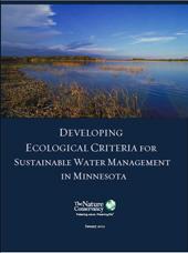
Developing Ecological Criteria for Sustainable Water Management in Minnesota (PDF) (129 pp, 3.5MB) The goal of this project was to develop recommendations and indicators for ecological criteria for instream flow protection in Minnesota, with special attention to rivers and streams in Minnesota’s Great Lakes basin. Products were developed through a collaborative process with public agencies in Minnesota and other experts, building on partnerships between The Nature Conservancy and U.S. Geological Survey across the Great Lakes. The final report assesses available data, tools and approaches that can be used to establish ecologically-based instream flow protections in Minnesota.
Users’ Manual for New Jersey Hydroecological Integrity Assessment Process Software (PDF) (80 pp, 1.7 MB) This software presents a customized application of the USGS Hydroecological Integrity Assessment Process for New Jersey streams. The New Jersey Stream Classification Tool uses long-term daily streamflow records to classify a stream into one of four classes based on the degree of skewness of daily flows and frequency of low flow events. The New Jersey Hydrologic Assessment Tool uses flow records to calculate 171 flow measures and identify reference flow conditions using trend analysis. The software also suggests environmental flow standards for 10 primary flow measures specific to a given stream class, and evaluates past or proposed hydrologic modifications against reference conditions.
Method to Support Total Maximum Daily Load Development Using Hydrologic Alteration as a Surrogate to Address Aquatic-Life Impairment in New Jersey Streams (PDF) (98 pp, 6.9MB) The primary objective of this USGS study was to develop a hydro-TMDL approach to address aquatic-life impairments associated with hydrologic alteration for New Jersey streams. The hydro-TMDL approach provided an opportunity to evaluate proportional differences in flow attributes between observed and baseline hydrographs and to develop complementary flow-ecology response relations at a subset of Raritan River Basin sites where available flow and ecological information overlapped. Numerous flow deviations were identified that were indicative of streams that are highly regulated by reservoirs or dams, streams that are affected by increasing amounts of surface runoff resulting from impervious surface cover, and streams that are affected by water abstraction (that is, groundwater or surface-water withdrawals used for agricultural and human supply).
Tool for Estimating Streamflow for Pennsylvania Waterways Water-resource managers use daily mean streamflows to generate streamflow statistics and analyze streamflow conditions. An in-depth evaluation of flow regimes to promote instream ecological health often requires streamflow information obtainable only from a time series hydrograph. Historically, it has been difficult to estimate daily mean streamflow for an ungaged location. The U.S. Geological Survey, in cooperation with the Pennsylvania Department of Environmental Protection, Susquehanna River Basin Commission, and The Nature Conservancy, has developed the Baseline Streamflow Estimator (BaSE) to estimate baseline streamflow at a daily time scale for ungaged streams in Pennsylvania using data collected during water years 1960–2008.
 Texas Instream Flow Program Environmental flow analyses are being performed to develop recommended environmental flow regimes for each of the state’s river basin and bay systems. Stakeholder committees and expert science teams have thus far been formed for the Trinity and San Jacinto Rivers and Galveston Bay system; the Sabine and Neches Rivers and Sabine Lake Bay system; the Colorado and Lavaca Rivers and Matagorda and Lavaca Bays system; the Guadalupe, San Antonio, Mission, and Aransas Rivers and Mission, Copano, Aransas, and San Antonio Bays system; the Nueces River and Corpus Christi and Baffin Bays system; the Rio Grande, the Rio Grande estuary, and the Lower Laguna Madre system; and the Brazos River and associated bay and estuary system. This website describes progress made for each system towards adoption of environmental flow standards.
Texas Instream Flow Studies: Technical Overview (PDF) (148 pp, 6MB) This report describes the technical approach to developing environmental flow standards for the river basin and bay systems of Texas. It provides a review of the Texas Instream Flow Program, background information on hydrologic variability throughout Texas, and outlines methods for assessing and integrating information on the hydrologic, physical, biological, and chemical conditions of a stream to determine environmental flow needs.