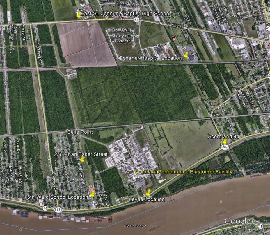
LaPlace, Louisiana - Air Monitoring Map
This map shows the locations of air monitors in LaPlace. These sites were selected to gauge levels of chloroprene in the outside air, using monitor siting criteria outlined in the Clean Air Act. There are six locations, including:
- Chad Baker Street
- Acorn and Highway 44
- East St. John High School
- 5th Ward Elementary School
- Mississippi River Levee
- Ochsner Hospital

