How the National Estuary Programs Address Alteration of Natural Hydrologic Flows
People alter the environment, including how water flows. With development and water-related infrastructure (e.g., dams, flood control structures, diversions), we can change the volume and rate that water runs off the landscape, into the ground and into streams.
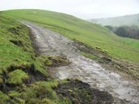
Increased runoff can result in erosion and sedimentation. Changes in freshwater inflows to estuaries can adversely affect shellfish survival and fish reproduction and distribution.
NEP Approach/Success Stories
On this page:
Barataria-Terrebonne National Estuary Program
Hydrologic modifications to the Mississippi River for flood control have dramatically reduced freshwater flows, and contributed to wetland losses and saltwater intrusion, in the Barataria-Terrebonne estuary (located in Louisiana).
The Davis Pond Diversion structure (upstream of New Orleans) is the largest Mississippi River diversion into the Barataria Basin. The diversion helps control salinity and enhance vegetation in the Barataria system by sending freshwater, nutrients and small amounts of sediment.
The Barataria-Terrebonne National Estuary Program represents local stakeholders on the Davis Pond Advisory Committee, which authorizes and directs the operation of the structure. The advisory committee is re-evaluating the Davis Pond operational plan so that the diversion can be operated to enhance a greater area of wetlands in the lower Barataria Basin without adversely affecting estuarine-dependent species.
Morro Bay National Estuary Program (Morro Bay NEP)
While estuaries naturally fill with sediment as part of the geologic process, the rate of sedimentation in Morro Bay (located in California) is as much as ten times the natural rate, due largely to changes caused by people. Moreover, major factors contributing to increased sedimentation in the estuary include:
- Fires
- Overgrazing
- Erosion from development
- Loss of floodplains
The estuary could lose all of its open-water and inter-tidal habitat within 300 to 400 years. Increased sedimentation also adversely affects plants and animals. Increased sedimentation in the water can bury, or partially block sunlight from reaching, eelgrass beds, destroying these underwater meadows. Sediment also buries and clogs gravel spawning beds for steelhead trout.
The Morro Bay NEP and its partners take a holistic approach to restore the natural sedimentation process by:
- Stopping sediment at the source; and
- Catching it downstream before it reaches the estuary.
As one measure to stop sediment at the source, the program developed a fire management plan to help local fire districts reduce the risk of large catastrophic fires that leave bare slopes vulnerable to erosion.
The program also teamed with the local Resource Conservation District and ranchers to improve grazing practices and to fence cattle out of creeks, further reducing erosion. To date, approximately 35 percent of stream miles in the watershed have been fenced from cattle.
In another source-control strategy, the program partnered with land owners to improve eroding ranch roads. For example, Camp San Luis Obispo road improvements, funded partially through the program, will prevent an estimated 2,800 cubic yards of soil from entering the nearby creek.
 Further, floodplain restoration efforts help these areas catch sediment before it reaches the estuary. The program and its partners work to restore the expansive historic floodplains diminished by past agriculture practices. One such project, the Chorro Creek Enhancement Project, is estimated to have prevented over 150,000 cubic yards of sediment from reaching the bay.
To date, approximately 300 acres of historic riparian floodplain have been protected or restored. These floodplains not only trap sediment from reaching the bay, but also provide important fish and wildlife habitat.
Through the program's monitoring efforts, staff are working to determine accurate annual sediment loading values for the tributaries in the watershed. The program will use this information to better target areas for project implementation and help refine the current sediment TMDL in the watershed.
