Norwood Historic Photos
Norwood Borough landfilling and waste disposal activities ceased in the highlighted areas below around 1962-1963. The photos outlining the dump and landfill in the photos from 1965 onward indicate where landfilling occurred between 1960 and 1963.
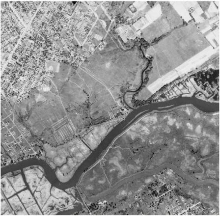 Lower Norwood 1937 Aerial
Source: http://www.pennpilot.psu.edu Exit
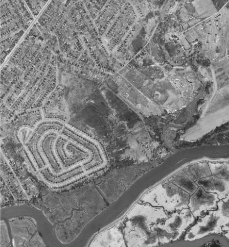 1953 Aerial – Norwood Dump not seen in this photo. Muckinipates Wastewater Treatment Plant under construction. Winona Avenue homes not yet constructed. Source: USGS Earth Explorer https://earthexplorer.usgs.gov/Exit
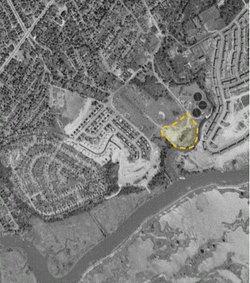 1957 Aerial – Outline of the former “Norwood Dump” boundaries highlighted in yellow (approximate based on imagery). Source: USGS Earth Explorer https://earthexplorer.usgs.gov/ Exit
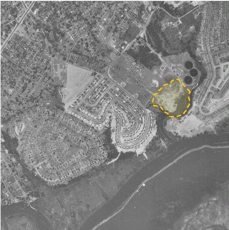 1958 Aerial from June 7, 1958. Outline of the former “Norwood Dump” boundaries highlighted in yellow (approximate based on imagery). Source: http://www.pennpilot.psu.edu Exit
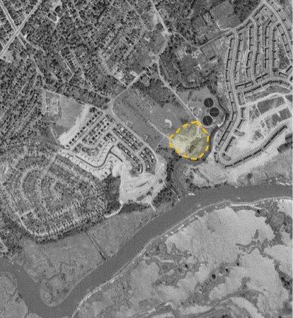 1958 Aerial from June 14, 1958. Outline of the former “Norwood Dump” boundaries highlighted in yellow (approximate based on imagery). Source: http://www.pennpilot.psu.edu Exit
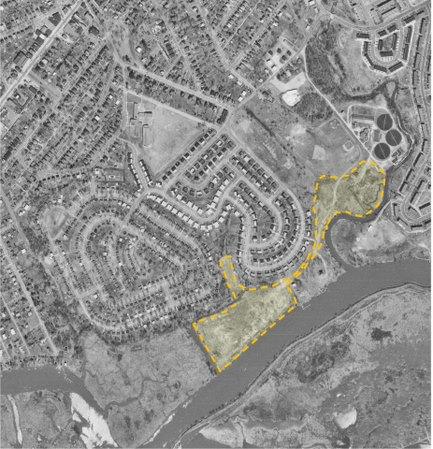 1965 Aerial – Outline of known landfill boundaries highlighted in yellow (approximate based on imagery). Includes “Old Norwood Dump,” “Norwood Landfill,” and access road between the two. Source: USGS Earth Explorer https://earthexplorer.usgs.gov/ Exit
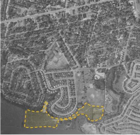 1967 Aerial - Outline of known landfill boundaries highlighted in yellow (approximate based on imagery). Includes “Old Norwood Dump,” “Norwood Landfill,” and access road between the two. Source: USGS Earth Explorer https://earthexplorer.usgs.gov/ Exit
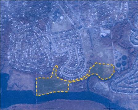 1970 Aerial - Outline of known landfill boundaries highlighted in yellow (approximate based on imagery). Includes “Old Norwood Dump,” “Norwood Landfill,” and access road between the two. Source: USGS Earth Explorer https://earthexplorer.usgs.gov/ Exit
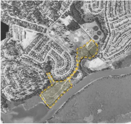 1971 Aerial - Outline of known landfill boundaries highlighted in yellow (approximate based on imagery). Includes “Old Norwood Dump,” “Norwood Landfill,” and access road between the two. Source: http://www.pennpilot.psu.edu Exit
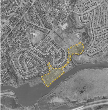 1973 Aerial - Outline of known landfill boundaries highlighted in yellow (approximate based on imagery). Includes “Old Norwood Dump,” “Norwood Landfill,” and access road between the two. Source: USGS Earth Explorer https://earthexplorer.usgs.gov/ Exit
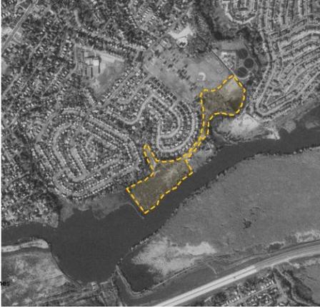 1975 Aerial - Outline of known landfill boundaries highlighted in yellow (approximate based on imagery). Includes “Old Norwood Dump,” “Norwood Landfill,” and access road between the two. Source: USGS Earth Explorer https://earthexplorer.usgs.gov/ Exit
