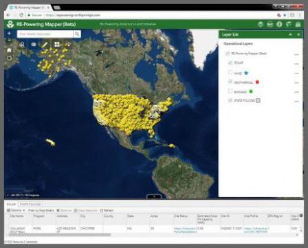
RE-Powering Mapper
EPA’s RE-Powering Mapper, an online interactive web application, allows users to visualize EPA’s information about renewable energy potential on contaminated lands, landfills and mine sites.
Using screening criteria developed in collaboration with the National Renewable Energy Laboratory (NREL), EPA has pre-screened over 130,000 sites for their renewable energy potential. As part of this effort, EPA collaborated with state agencies from California, Colorado, Connecticut, Florida, Hawaii, Illinois, Maryland, Massachusetts, Minnesota, New Jersey, New York, Oregon, Pennsylvania, Texas, Virginia, and West Virginia. This screening was performed in August 2018.
Mapper features include:
- Screening results for over 130,000 sites for solar, wind, biomass, and geothermal energy
- Search options by a number of attributes including state, acreage, renewable energy capacity, distance to nearest urban center, and more.
- Site–specific screening reports
- Links to EPA or state program managing the site clean-up
Access the Mapper
To launch the RE-Powering Mapper, click on the image below.

