CyAN Mobile App Helps Communities Detect Cyanobacteria in U.S. Water Bodies
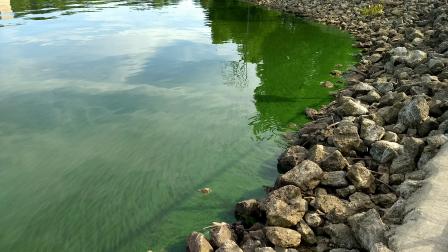 A cyanobacteria harmful algal bloom in Lake Hersha, Ohio. Read about EPA researchers new mobile app to detect algal blooms in freshwater systems. Published July 16, 2019; Updated January 6, 2020
Since the passing of the Clean Water Act in 1972, water quality in the United States has improved significantly, but threats to clean and safe water still exist. One of these threats is harmful algal blooms or HABs.
Certain environmental conditions in water bodies can intensify algae growth, causing algal blooms. Blooms with the potential to release toxins and cause harm are referred to as HABs. One of the most common types that occur in the U.S. are caused by cyanobacteria, also known as blue-green algae. These blooms have the potential to produce toxins and cause nuisance odors, hypoxia, and unappealing surface scums that can cause negatively affect human and pet health, aquatic ecosystems, and local economies. When cyanobacterial HABs occur in drinking water sources and recreational waters, resulting economic impacts can be increased drinking water treatment costs and revenue loss from recreation and businesses that rely on safe and clean water.
The most effective way of protecting human and pet health from algal toxins is knowing ahead of time to avoid water containing cyanobacteria. However, this can be challenging because most warning notices are posted after a bloom has occurred and in response to visual, odor, or toxin confirmation. This is why EPA developed the Cyanobacteria Assessment Network mobile app (CyAN app) ―an early warning indicator system for cyanobacterial blooms in U.S. freshwater systems. This easy to use app is helping local and state water quality managers make faster and better-informed management decisions in their communities.
Water quality managers need access to current, inexpensive and quality data to protect water resources. In 2015, EPA, NASA, NOAA, and USGS began work on the collaborative CyAN Project which led to the development of the CyAN app. In 2017, EPA made the CyAN app available to project collaborators for testing before it was released to the public. In July 2019, it was released to the public for use on Android™ devices and is available for download on Google Play™. To make the CyAN app accessible to more people, it is currently being developed as a web-based app, which will be compatible with most devices. Learn more about and download the CyAN app.
Though satellite data have been available for many years, use in decision-making has been hindered by complicated data formats and the time burden to process and access the data. The CyAN app is giving water quality managers the ability to easily assess satellite derived cyanobacteria biomass concentrations for over 2,000 of the largest lakes and reservoirs across the country. This app reduces the need for scientific expertise in satellite data processing, analysis and interpretation, and eliminates barriers to computer hardware requirements associated with the use of satellite data files. With this easy to use, customizable interface, managers can rapidly distill critical water quality information for their communities.
The georeferenced data in the app allow water quality managers the ability to passively monitor a specific water body without having to filter through other numerous satellite images that aren’t associated with their area of interest. Simply, users open the app once a week to receive the updated imagery and monitoring data for locations of interest for the current season. The app provides approximately 70% of the monitoring information, whereas the remaining information (such as identifying site locations of interest and setting warning thresholds) is input by the user during the app settings setup process.
During the app testing phase in 2017, functionality and satellite data were successfully demonstrated against 25 state health advisories across seven states, including Utah and Vermont.
Benjamin Holcomb from the Utah Department of Water Quality provided helpful feedback on the use of CyAN in his community.
“The images we've been receiving through the CyAN project have been tremendously helpful to the Utah Division of Water Quality (UDWQ), providing the foundation for a wide range of useful outputs,” Holcomb shared. “It allows UDWQ to better target field sampling and more efficiently use our limited resources to protect public health. Finally, images are easily shared with response agencies as a useful visual communication aid.”
Angela Shambaugh from the Vermont Department of Environmental Conservation has used Cyan to monitor the lakes in her state, saying that “large lakes like Lake Champlain have an extremely patchy distribution of cyanobacteria due to varying environmental conditions and lake shape. The CyAN app helps viewers visualize that patchiness and provides additional context for our [cyanobacteria] Tracker Map which shares data gathered by our cyanobacteria monitoring program.”
A training video and a highlight video are available for those that wish to learn more about how to use the CyAN app.