EPA Researchers Collaborate with States to Assess the Health of the Coastal Waters of the Great Lakes
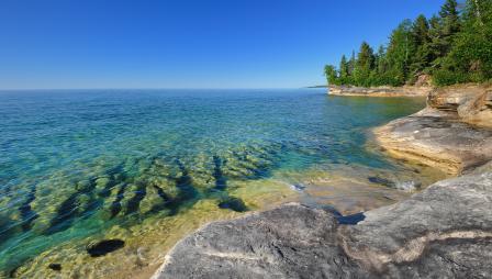 View of the shoreline of Lake Superior near Munising, Michigan.Published July 7, 2020
We all depend on clean water for drinking, swimming, and fishing. To measure the ability of water bodies to provides these resources, EPA conducts national surveys of their ecological, biological, and recreational conditions. Information from these surveys helps states determine the number of lakes, the length of streams, and the area of wetlands, nearshore waters, or estuaries meeting water quality benchmarks. The National Coastal Condition Assessment (NCCA) is one of these surveys. It has been conducted every five years since 2010 and covers the nearshore waters of the Great Lakes. EPA is conducting the NCCA this summer.
Since this work is currently ongoing, getting EPA, state, and contractor crews trained and in the field during the pandemic has been challenging. Everyone is working together on ways to minimize exposure to the virus while collecting these important samples. Field work began in June and will run through September in the U.S. portions of the Great Lakes.
The immense size of the Great Lakes makes measuring conditions everywhere impossible, so scientists typically sample a small number of locations that are representative of the whole area. While this approach provides the big picture of water quality in the nearshore waters of the lakes, it may not always give states the information needed to manage localized problems like harmful algal blooms. EPA scientists have worked closely with state resource managers in the Great Lakes to learn what information they need from the NCCA. To make the NCCA more responsive to states’ needs, EPA has enhanced the number and types of samples collected from the Great Lakes.
In Lake Erie, for example, summertime water quality often declines because excessive nutrients coming into the western basin of the lake cause algal blooms. As water circulates through the central and eastern basins, nutrients are consumed and diluted which reduces problem blooms in these areas. To better measure this issue, EPA collaborated with states to enhance NCCA data collection so that water quality in each of Lake Erie’s basins could be assessed rather than just assessing conditions for the whole lake. Similarly, in Lake Michigan, researchers working on the NCCA are collecting additional samples from Green Bay to assess water quality. Green Bay is of special interest to Wisconsin and Michigan because of the historical impacts of industrial pollution and agricultural runoff from its local watershed. Lastly, NCCA researchers are assessing the water quality around some large islands and in coastal national parks and lakeshores. Knowing whether different land uses in these areas affect nearby water quality could assist with better management of these places.
In addition to more sampling, NCCA enhancements in the Great Lakes measure the types of algae present and the type and amounts of contamination in fish that can drive fish consumption advisories. EPA scientists use this information to assess the current conditions of algae and fish in nearshore areas. They also compare current conditions with previous surveys to track how conditions have changed. Data from the NCCA help states decide how to protect areas that are in very good condition and restore areas that have suffered environmental damage. Knowing how conditions are changing over five-year periods helps states anticipate where protection or restoration work may be needed in the future.
By enhancing the NCCA, EPA is showing the flexibility of surveys for environmental assessment and our commitment to provide timely and unbiased data for managing the condition of the Great Lakes. The NCCA is an important source of information on the status and trends of condition across all the lakes, and it can also be used to assess conditions in parts of the lakes of special interest to states.
Learn More