Linking Minnesota Land Cover Changes to Drinking Water Treatment
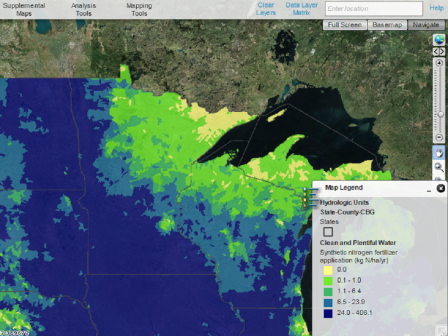 EnviroAtlas map of synthetic nitrogen fertilizer application rates, showing Minnesota and surrounding states.Published: May 18, 2017
The headwaters of the Mississippi River (52,000 km2) supply drinking water to about one million people in the Minneapolis, St. Paul, and St. Cloud areas of Minnesota. Since 2001, over 570 km2 of forests and wetlands in the Upper Mississippi River Basin have been lost to urbanization, agricultural expansion, and forest cutting. These land use changes have the potential to degrade water quality in the region.
EPA scientists and partners are using EnviroAtlas to model recent land cover changes (like forest loss, urbanization, and agriculture) in the region and to understand how projected changes could affect future water quality and associated treatment costs. EPA’s EnviroAtlas is an interactive set of resources that allows users to analyze data, maps, and other information.
Residents in Minnesota and across the U.S. can use EnviroAtlas to inform decision-making at multiple scales and for educational opportunities. They can also use the tool to visually compare local ecosystems’ health and understand how those systems can be conserved and enhanced.
To determine how the area might need to modify their drinking water treatment approaches, the EPA team is using EnviroAtlas datasets such as land cover data, synthetic and manure fertilizer use, and atmospheric deposition of nitrogen to model historic and future land cover changes. First, they use the National Land Cover Database to track landscape changes from 2001, 2006, and 2011. Then, they model projected land cover change in 2040, 2050, and 2060 using the United States Geological Survey’s (USGS) FOREcasting SCEnarios of Land-use Change model. As EPA models recent and future land cover changes, scientists can begin to link how those changes affect water quality, the costs of chemically treating drinking water, and community needs.
EPA applies recent and projected land cover change to the Soil and Water Assessment Tool to assess how land use change affects water quality in the Mississippi River and its tributaries. The modeled relationships between land cover change and water quality can be used by drinking water treatment plant managers to adjust treatment options and anticipate previously unforeseen changes. The forests in the source watershed can also be “valued” in terms of their ability to reduce chemical treatment costs at the drinking water facility. EPA scientists expect to complete the analyses by the end of 2017.
“This research will help Minnesota communities understand connections between land use and drinking water quality, and anticipate likely effects of projected future land use changes on their drinking water resources,” says Sean Woznicki, an EPA researcher leading the project.
By understanding how changes to the landscape will impact their drinking water, community stakeholders can make informed decisions to manage their lands and drinking water treatment facilities. Woznicki also emphasized the importance of these stakeholders’ active involvement in the research through sharing information, providing their local expertise, and participating in the forecasting of future land cover changes.
James Wickham (EPA) and Terry Sohl (USGS) are working alongside Woznicki. Additional partners working with EPA in this exploration are Minnesota Department of Health; St. Paul Regional Water Services; City of St. Cloud; City of Minneapolis; The Nature Conservancy; USGS; and the Upper Mississippi River Source Water Protection Project.
Learn more: