Staging a Comeback Along the St. Louis River
 Published: May 9, 2017
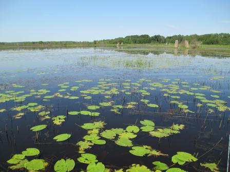
EPA and a host of partners have been working to restore the St. Louis River estuary and help local communities reap the full benefits of a clean, healthy environment.
The estuary, located at the head of Lake Superior, was designated as an 'area of concern' due to a legacy of chemical contamination, degraded habitat, and non-point-source pollution. Water quality improvements provide a growing sense of hope that the estuary will once again be home to large runs of walleye, lake sturgeon, and northern pike; support bountiful stands of wild rice; and provide nesting habitat for terns, piping plovers, and other birds.
“From the start, the program goal has always been to remove the contaminants so that the ‘area of concern’ designation could be removed, allowing nearby residents to fully enjoy the suite of beneficial uses of the estuary such as fishing, boating, and beach-going” explains Joel Hoffman, Ph.D., an EPA research biologist. He is leading an effort to supply the science needed to do just that.
Significant improvements have already been made. A 2016 study found that 60-85% of the estuary surface now meets pollution limits set for total phosphorus, suspended sediments, and chlorophyll a. Spurred by these results, EPA and local stakeholders are moving forward with the delisting of the “excessive loading of sediment and nutrients” impairment.
Over the past several years, Hoffman and his colleagues have ushered in a new wave of multidisciplinary, collaborative research. Their work builds on the growing recognition that for nearby communities to fully benefit, clean-up operations need to go beyond unleashing an army of specialists in hazmat suits to remove and haul away contaminated soils and sediments.
They are now employing a three-step process known as R2R2R: remediation to restoration to revitalization. It means making sure that the steps taken to clean up contaminated sites also reconnect people to their surroundings in ways that enhance community well-being, environmental justice, and prosperity.
That kind of work is especially promising for sites as far-reaching and complex as the St. Louis River Estuary, where the goal is to fully integrate environmental clean-up and protection with community economic vitality and access to natural amenities.
Accordingly, social scientists now play an important role on the research team, and input from local stakeholders and representatives is explicitly part of the roadmap for delisting as an area of concern.
“Letting people speak for themselves is critical. Rather than have specialists define what success means for bringing back beneficial uses of the nearby ecosystem, we can see what people pick for themselves and apply the resources available for remediation efforts in ways that maximize those benefits,” says Hoffman.
One example of how EPA’s research complements and supports local efforts is the Duluth Planning Department’s Imagine Duluth 2035. The program is the centerpiece of a comprehensive strategic plan that integrates the principles of health and fairness to meet Duluth’s goal on behalf of its citizens: “The city will encourage access to health resources, quality food, recreation, social opportunities, and a clean and secure environment.” The EPA team is employing a host of innovative research methods to help Duluth achieve those goals. For example, they and their research partners used predictive models, input from local experts, and other sources to create high resolution maps illustrating specific ecosystems services across aquatic and riparian habitats. They identified 23 specific benefits those habitats can provide to the local community, ranging from boating and harvesting wild rice to preserving sacred Native American sites and fishing for the area’s famous walleye and lake sturgeon. The maps provide a powerful tool to support local environmental decision-making.
As other such aspects of the local environment are identified, mapped, and quantified, clean up funds can be directed to where impacts are maximized, providing a critical link in moving from restoration to revitalization by linking environmental protection with enhancing human health and wellbeing.
The kind of research and community involvement EPA and their partners are conducting is designed to incorporate local input and provide the flexibility to adjust as conditions improve.
Hoffman explains, “One of the most exciting science lessons we are incorporating is the need to have the trust of local stakeholders so together we can adapt our plans to utilize what we learn from ecosystem services research. Gaining continual feedback informs the remediation-restoration-revitalization continuum so coastal communities grappling with multiple environmental challenges can truly benefit.”
As part of EPA’s commitment to partnership, collaboration, and community engagement, Hoffman and colleagues recently shared their latest findings at the Seventh Annual St. Louis River Summit in mid-March on the campus of the University of Wisconsin, Superior. The yearly Summit actively fosters communication, networking, and problem-solving on issues affecting the environmental health of the estuary and related community well-being.
While much work remains to be done, there are many encouraging signs that the list of beneficial use impairments will begin to shrink, and the “area of concern” designation will be lifted by the 2020 goal. By then, the cargo vessels moving in and out of the harbor will have plenty of company in the form of people fishing, harvesting wild rice, birding, and waving from the shores of their favorite, open-for-swimming beach.
Sources and References
Angradi, T. R., Launspach, J. J., Bolgrien, D. W., Bellinger, B. J., Starry, M. A., Hoffman, J. C., & Hollenhorst, T. P. (2016). Mapping ecosystem service indicators in a Great Lakes estuarine Area of Concern. Journal of Great Lakes Research, 42(3), 717-727.Exit
Bellinger, B.J., et al. (2016). Water quality in the St. Louis River Area of Concern, Lake Superior: Historical and current conditions and delisting implications. Journal of Great Lakes Research, 42(1), 28-38. Exit
Limnotech. (2013). St. Louis River Area of Concern Implementation Roadmap for Delisting (Remedial Action Plan for Update) (PDF)ExitYou may need a PDF reader to view some of the files on this page. See EPA’s About PDF page to learn more.
Martin and Associates. (2011.). The Economic Impacts of the Port of Duluth-Superior. Accessed from: http://www.duluthport.com/port-stats-economic.phpExit