Palmer River Source Tracking, Water Quality Trends Summary, and Watershed Plan
A technical direct assistance project funded by the U.S. EPA Southern New England Program (SNEP)
You may need a PDF reader to view some of the files on this page. See EPA's About PDF page to learn more.
Some of the following links exit the site. Exit
- Summary
- EPA's Project Team Consists Of
- Project Background
- Project Deliverables
- Proposed Project Schedule
- Contacts
- Project Partners
Summary:
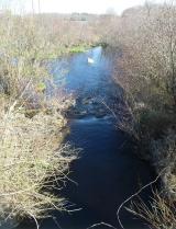
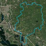
The Palmer River, which flows across the Massachusetts (MA) and Rhode Island (RI) state border, is a major second order tributary in the Narragansett Bay watershed. The upper freshwater reaches of the Palmer River begin in Rehoboth, MA with the east and west branches of the river extending into Seekonk and Swansea, MA. Head of tide for the Palmer River is at the outlet of the Shad Factory Pond Dam, downstream of which the Palmer River joins with the Barrington River at Tyler Point in RI to form the Warren River before emptying into the Narragansett Bay. While still dominated by forest, the Palmer River watershed contains significant agriculture and development and faces increasing development pressure. Moreover, multiple studies by both states since 1992 have repeatedly documented continuing impairments in the Palmer River due to elevated levels of fecal indicator bacteria as well as total suspended solids (TSS) and nutrients (nitrogen and phosphorus (RIDEM, 2002 (PDF) (103 pp, 3.7 MB); ESS Group Inc, 2004 (PDF) (54 pp, 1.8 MB)).
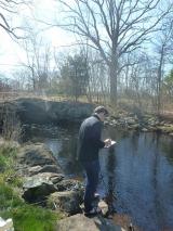
These studies led to the inclusion of the Palmer River watershed in the National Water Quality Initiative (NWQI), a joint effort between EPA/state nonpoint source programs and the U.S. Department of Agriculture to abate fecal contamination through the installation of agricultural conservation practices or best management practices (BMPs). Water quality sampling since 2012 by the Massachusetts Department of Environmental Protection (Mass DEP), the Rhode Island Department of Environmental Management (RIDEM), and US EPA Region 1 has been correlated with the installation of agricultural BMPs to enable these agencies to monitor the effectiveness of remediation efforts. However, until this project, much of the water quality data collected have yet to be evaluated for trends, and the current status of water quality and the effectiveness of agricultural BMP implementation work in the watershed were unknown. To address this gap, beginning in 2017, samples were collected for ribonucleic acid (RNA) microarray analysis using PhyloChip and are awaiting analysis. The PhyloChip is a cutting-edge analytical tool that uses specific genetic markers to determine the relative contribution to fecal contamination by different sources (i.e. human, cow, bird, etc.).
The purpose of the project was to assist US EPA Region 1 with: (1) developing recommendations for use of the PhyloChip to maximize the ability to identify fecal contamination sources with limited resources; (2) analyzing water quality trends in the Palmer River watershed using existing water quality data, geospatial information, and summary papers; and (3) assessing the impact that changing land use is expected to have in the Palmer River watershed and providing recommendations for reducing the impacts of land development on water quality.
Results will be used by US EPA Region 1, state agencies, and local municipalities to 1) revise the current water quality monitoring program, including site selection and parameters (e.g., use of PhyloChip), 2) apply water quality monitoring strategies for use of PhyloChip as a source tracking method in other regional watersheds in the Southeast New England Program (SNEP), 3) determine the water quality status of the Palmer River (e.g., improving, degrading) and its relationship to agricultural BMPs on the landscape, 4) better inform future effectiveness and placement of agricultural BMP work in the watershed, and 5) review local land use regulations and their impacts on water quality.
EPA's Project Team Consists Of:
- U.S. EPA Region 1
- U.S. EPA Region 1 New England Regional Laboratory
- Horsley Witten Group
- FB Environmental
- Massachusetts Department of Environmental Protection
- Rhode Island Department of Environmental Management
- Massachusetts Conservation Districts & Natural Resource Conservation Service
- Town of Rehoboth, Massachusetts
The overall organization of the Project (by Task) is set forth below, along with a proposed schedule. As they become final, Project Reports (deliverables) are provided below:
Project Background:
- EPA Region 1's Performance Work Statement (PWS) (PDF) (10 pp, 588 K)
- Appendix A
Project Deliverables:
Task 0: Work Plan and Budget Development
Task 1: Project Management and Administration
- Subtask 1A: Kickoff Conference Call Notes (10-26-18) (PDF) (4 pp, 219 K)
- Subtask 1B: Conference Calls, Meetings, and Project Team Support (Ongoing)
Task 2: Development of Quality Assurance Project Plan (QAPP)
- QAPP (PDF) (30 pp, 2 MB)
Task 3: Source Tracking Sample Selection and Lab Analysis by PhyloChip
- Final Sample Selection Memorandum (PDF) (34 pp, 3 MB)
Task 4: Water Quality Trends Summary Memorandum
- Final Water Quality Trends Summary Memorandum (PDF) (32 pp, 3 MB)
Task 5: Stakeholder Workshop
- Changed to Targeted Interviews with Municipalities
Task 6: Land Use and Regulatory Analysis Recommendations
Proposed Project Schedule:
| Task / Deliverable | Date | |
|---|---|---|
| Task 0: Work Plan and Budget Development | ||
| Work Plan and Budget | 10/9/18 | |
| Progress and Financial Reports | Monthly | |
| Task 1: Project Management and Administration | ||
| Subtask 1a: Kick-Off Call | ||
| Kick-Off Conference Call | 10/23/18 | |
| Call Summary | 10/30/18 | |
| Subtask 1b: Conference Calls, Meetings, and Project Team Support | ||
| Conference Calls & Summaries, Correspondence to Support Project | Monthly | |
| Task 2: Development of QAPP | ||
| Draft QAPP | 11/30/18 | |
| Final QAPP | 2/4/19 | |
| Task 3: Source Tracking Sample Selection | ||
| Subtask 3a: Source Tracking Sample Selection and Lab Analysis by PhyloChip | ||
| Draft Memo with Prelim. Subset of Samples for PhyloChip Analysis | Apr-19 | |
| Subtask 3b: Best Practice Recommendations for PhyloChip | ||
| Final Memo with PhyloChip Results and Recommendations | Jun-19 | |
| Task 4: Water Quality Trends Summary | ||
| Draft WQ Trends Summary Memo | Jun-19 | |
| Final WQ Trends Summary Memo | Jul-19 | |
| Task 5: Stakeholder Workshop | ||
| Stakeholder Workshop | Jun-19 | |
| Workshop Notes and Action Plan | Jul-19 | |
| Task 6: Land Use and Regulatory Analysis and Recommendations | ||
| Draft Land Use and Regulatory Analysis and Recommendations Summary | Aug-19 | |
| Review Meeting | Aug-19 | |
| Final Land Use and Regulatory Analysis and Recommendations Summary | Sep-19 | |
Note: Timeline may change
Contacts:
USEPA Project Lead:
Ian Dombroski (dombroski.ian@epa.gov)
Watersheds and Nonpoint Source Unit
Phone: (617)-918-1342
USEPA Project Team:
Tim Bridges (bridges.tim@epa.gov)
Jack Paar III (paar.jack@epa.gov)
New England Regional Lab
Ray Cody (cody.ray@epa.gov)
Caitlyn Whittle (whittle.caitlyn@epa.gov)
Surface Water Branch
Margherita Pryor (pryor.margherita@epa.gov)
Alicia Grimaldi (grimaldi.alicia@epa.gov)
Ocean & Coastal Protection Unit
USEPA SNEP Coordinator:
Karen Simpson (simpson.karen@epa.gov)
Watersheds and Nonpoint Source Unit
Phone: (617) 918-1672
Project Partners:
Jennifer Sheppard
Regional Monitoring Coordinator
MassDEP Southeast Regional Office
Phone: (508)-946-2701
Heidi Traver (heidi.travers@dem.ri.gov), RIDEM