Impaired Waters and TMDLs in Region 2
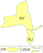
EPA Region 2 serves New York, New Jersey, Puerto Rico and the U.S. Virgin Islands.
Water resources are central to the region’s aesthetics, economics and health. There are some 60,000 miles of rivers and streams in Region 2, including waterways of major importance such as the Hudson and Passaic Rivers, the ports of San Juan and the New York/New Jersey Harbor, Lake Ontario, Niagara Falls and the St. Lawrence Seaway. New York, New Jersey, Puerto Rico and the U.S. Virgin Islands have a combined 685 miles of ocean coastline. Clean and safe water is essential to the health and livelihood of the region’s 31 million residents.
Learn about impaired waters in: