Impaired Waters and TMDLs in Region 7
Region 7's water priority is protecting and improving water quality across America's greatest watershed, the Missouri-Mississippi Basin.
Basic Information
Region 7 Information
Public Notices for CWA 303(d) Impaired Waters Lists and TMDLs in Region 7
TMDL Public Notices
CWA 303(d) List of Impaired Waters Public Notices
Public Notice for Missouri's 2020 303(d) List of Impaired Waters Requiring a TMDL: EPA opened a 60-day public comment period on Dec. 7, 2020, to receive comments concerning the decision to add or restore 40 water bodies to Missouri’s 2020 List of Impaired Waters for chlorophyll-a (W). EPA has received several requests to extend the Public Comment Period for EPA’s action to add waters to Missouri’s Impaired Waters List. The comment period has been extended for an additional 45 days. Comments will now be accepted until 3/22/2021.
-
The Public Notice and links to additional information are available here: https://19january2021snapshot.epa.gov/mo/state-missouri-2020-list-impaired-waters
-
The data sources used for EPA’s Decision to Partially Disapprove and Identify 40 Waters for Inclusion on Missouri’s 2020 303(d) List are available here: https://19january2021snapshot.epa.gov/sites/static/files/2020-12/documents/mo-2020-303d-list-data-sources.pdf
EPA requests that any written comments be sent by email to R7-WaterDivision@epa.gov on or before March 22, 2021.
*Public Notice links provided here are for informational purposes only and do not convey EPA approval of documents on public notice.
Highlighted TMDLs and TMDL Alternatives in Region 7
Cheney Lake, Kansas, TMDL Approved 5/4/2017
 Cheney Lake is a reservoir constructed in the early 1960s as a water supply system for Wichita and recreational resource for the area. It’s located south of Hutchinson, Kansas, and west of Wichita, Kansas. Counties around Lake Cheney include Kingman, Pratt, Reno, Sedgwick and Stafford. The newly approved TMDL revises a TMDL from 2000 for Eutrophication.
 Cheney Lake Watershed in KansasThe Lake’s designated uses are impaired by eutrophication based on assessment data collected by the Kansas Department of Health and Environment and the United States Geological Survey. Excessive nutrient loads are contributing to increased Chlorophyll a (domestic water supply criterion), and increased objectionable algal blooms impairing the primary contact recreation use and expected aquatic life use. The revised TMDL has a lower Total Phosphorus load, includes a more robust analysis of pollutant sources and adds a new load for Total Nutrients. A Chlorophyll a endpoint of 10 micrograms per liter achieved by reductions in Total Phosphorus and Total Nitrogen is the numeric link to the narrative water quality standards protective of Lake Cheney’s uses. It’s one of the premier sailing lakes in the nation with ample fishing (channel catfish and white bass, crappie, striped bass, wipers, and walleye), three swimming areas and many recreational sports. Through a phased implementation of the TMDL’s targets, all uses of the lake will be met. Read the TMDL.
Mussel Fork Creek, Missouri, TMDL Approved 06/14/2017 Mussel Fork in Missouri
Mussel Fork Creek flows 29 miles through Adair, Linn, Macon and Sullivan counties in Missouri. Located just west of Kirksville, Missouri, Mussel Fork is classified as a Class C Stream, meaning that it may cease to flow during dry periods, but maintain permanent pools that support aquatic life. The E. Coli TMDL addresses the pathogen impairment of Mussel Fork’s Whole Body Contact Recreation Category B and Secondary Contact Recreation uses. See the TMDL for other uses.
The TMDL document identifies both point and nonpoint sources of bacteria. The eight permitted sources in the watershed are comprised of two municipal facilities, five concentrated animal feeding operations and one land disturbance site. While the nonpoint sources identified in the TMDL are agricultural runoff from cropland or grassland and livestock production where bacteria is likely generated from over application of manure. The TMDL document expresses the loading capacity as Escherichia coli counts per day. The loading capacity in the TMDL is determined to attain and maintain the water quality standard for Mussel Creek. Read the TMDL.
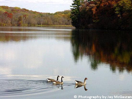 Upper Pine Lake, IA
Photo courtesy of Jay McGavren
Upper Pine Lake, Iowa, TMDL Approved 10/23/2014
Upper Pine Lake is a man-made impoundment built by the Civilian Conservation Corps in 1935. It is located approximately 2 miles northeast of Eldora, or 15 miles southeast of Iowa Falls, in Hardin County, Iowa. The lake lies within Pine Lake State Park, which encompasses 572 acres and is managed by the Iowa Department of Natural Resources. Recreational opportunities include fishing, bird watching, boating, camping, cabin rental, hiking and swimming. Read the TMDL.
Beaver Lake, Iowa, TMDL Approved 11/03/2014
Beaver Lake is a 28.9 acre man-made lake surrounded by a 1,026 acre watershed in Dallas County, Iowa. The lake is surrounded by a 299 acre wildlife management area. The dam that impounds Beaver Lake was constructed in 1989. Currently, the lake is about 38.8 feet deep at the deepest point, with an average depth of 9.5 feet. Read the TMDL.
State and Tribal Programs for CWA 303(d) in Region 7
The following links exit the site Exit
State TMDL Programs in Region 7
- Iowa Department of Natural Resources
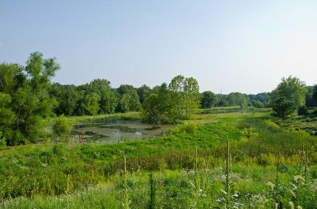 Hinkson Creek Watershed, MO
Photo courtesy of Toni Castro - Kansas Department of Health and Environment
- Missouri Department of Natural Resources
- Nebraska Department of Environmental Quality
State 303d Listing (Impaired Waters) Programs in Region 7
- Iowa Department of Natural Resources
- Kansas Department of Health and Environment
- Missouri Department of Natural Resources
- Nebraska Department of Environmental Quality
Tribal Environmental/Water Programs in Region 7
- Iowa Tribe of Kansas and Nebraska
- Kickapoo Nation in Kansas
- Meskwaki Nation: Sac & Fox Tribe of the Mississippi in Iowa
- Omaha Tribe of Nebraska
- Ponca Tribe of Nebraska
- Prairie Band Potawatomi Nation
- Sac & Fox Nation of Missouri
- Santee Sioux Nation
- Winnebago Tribe of Nebraska
EPA TMDL and 303(d) Listing Program Contacts in Region 7
-
Jason Daniels, Integrated Reports Coordinator, 913-551-7443
-
Jennifer Kissel, TMDL Coordinator, 913-551-7982
-
Jeffery Robichaud, Region 7 Water Division, Division Director, 913-551-7146
-
Amy Shields, Standards and Water Quality Branch, Branch Chief, 913-551-7396
-
Debby White, Regional ATTAINS and Data Management Coordinator, 913-551-7886