No-Discharge Zones Map
The interactive map linked below depicts all currently designated vessel sewage no-discharge zones (NDZs).
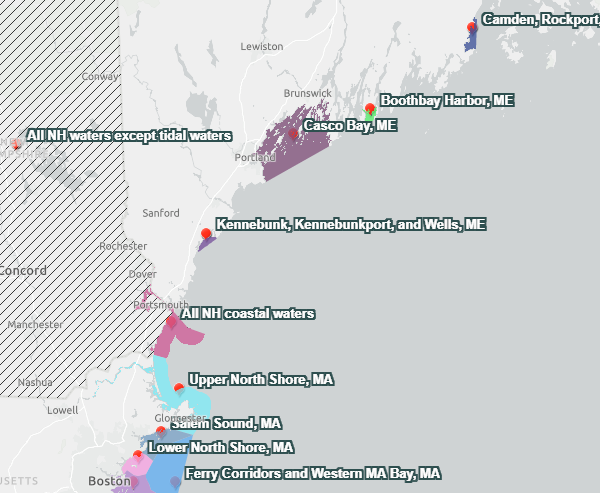 A screenshot of the map zoomed in on the northeast United States.Each NDZ is identified using point markers with the name of the NDZ when the map is zoomed out. As the map is zoomed in, each NDZ is depicted using a colored polygon showing the extent and boundaries of the NDZ. Instances where all state waters have been designated are represented using black diagonal lines across the state. The image on the right demonstrates these different features.
-
zoom in on a red point marker to find the corresponding NDZ,
-
use the search bar located at the top of the map, or
-
click the bookmark tool directly under the search bar to view a complete list of the NDZs displayed on the map. To zoom directly to an NDZ’s polygon, click the icon next to the name of the NDZ in the bookmark list.
For more information on an individual NDZ, click anywhere within the NDZ’s colored polygon on the map to bring up a pop-up box with the date and type of designation, as well as a written description of the NDZ boundaries.
Disclaimer: This map serves as an informational tool only and does not display exact boundaries of established NDZs. The map should not be used for enforcement purposes and does not impose binding requirements. Contact the appropriate state agency or consult the relevant federal regulations for further questions about precise NDZ boundaries.