Regional Haze Program
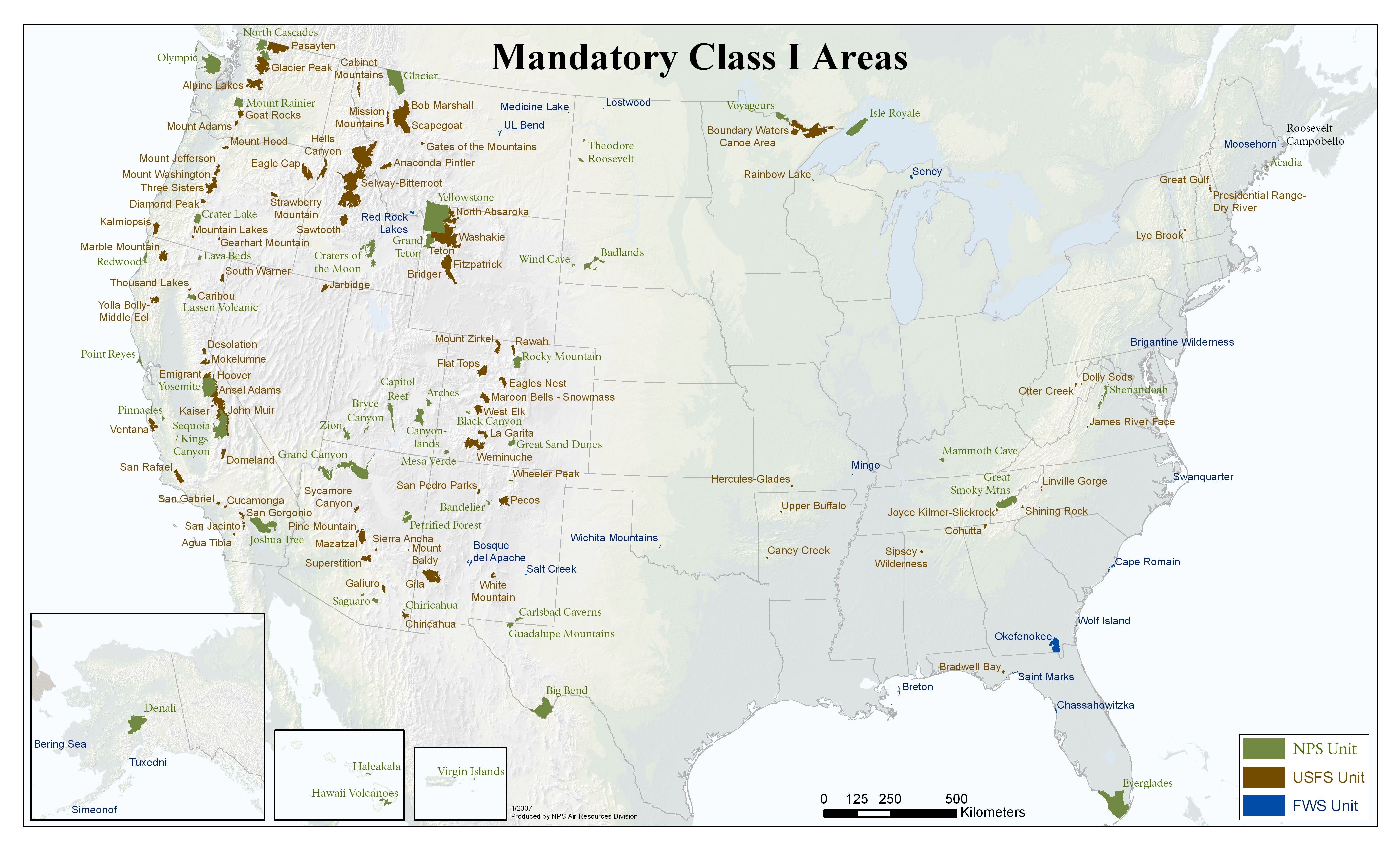
EPA and other Agencies have been monitoring visibility in national parks and wilderness areas since 1988. In 1999, the U.S. Environmental Protection Agency announced a major effort to improve air quality in national parks and wilderness areas. The Regional Haze Rule calls for state and federal agencies to work together to improve visibility in 156 national parks and wilderness areas such as the Grand Canyon, Yosemite, the Great Smokies and Shenandoah.
Below is a map of the 156 areas protected by the Regional Haze Rule.
The rule requires the states, in coordination with the Environmental Protection Agency, the National Park Service, U.S. Fish and Wildlife Service, the U.S. Forest Service, and other interested parties, to develop and implement air quality protection plans to reduce the pollution that causes visibility impairment. The first State plans for regional haze were due in December 2007. States, tribes, and five multi-jurisdictional regional planning organizations worked together to develop the technical basis for these plans. Comprehensive periodic revisions to these initial plans are currently due in 2021, 2028, and every 10 years thereafter.
- List of 156 National Parks and Wilderness Areas (Class I Areas) Protected Under the Regional Haze Program.
- State Implementation Milestones - Timeline for state implementation activities, beginning in 1999.