EPA Science Matters Newsletter: Helping Pittsburgh and Other Cities Expand Green Infrastructure
EPA tool helps communities adopt green infrastructure and other best management practices (BMPs) to improve stormwater management.
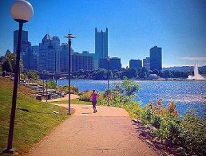
 Photo Credit to John Yeso.
Even though the City of Pittsburgh stopped dumping raw sewage directly into the rivers that surround it in 1939, big storms can essentially set its water management back in time. Pittsburgh, like many other cities, relies on a “combined sewer system” that routes both wastewater and stormwater away from streets, homes, and businesses and into the same large pipes that flow toward treatment facilities.
Constructed from the early 1800’s until the mid-1900’s, the system can become overwhelmed during wet weather events. When that happens, billions of gallons of stormwater runoff mixed with sewage and other contaminants bypass treatment and flow directly into the rivers.
In 2012, the nonprofit organization 3 Rivers Wet Weather helped Allegheny County Sanitary Authority conduct a study on the feasibility of using green infrastructure as a cost-effective, long-term sustainable solution for Pittsburgh’s wet weather problems. Water resources engineers from the organization turned to an EPA tool for help identifying specific “best management practices” (BMPs) for the area: EPA’s BMP Siting Tool.“Gray infrastructure,” the distribution systems and pipes throughout the city, is expensive to replace or upgrade. In order to control some of the stormwater overflow and the costs associated with upgrading the gray infrastructure, cities around the country are turning to “green infrastructure” alternatives—such as rain gardens, riparian buffers, and porous pavement—that use or mimic natural hydrologic features to stem the flow of water. Pittsburgh is one of those cities.
According to Agency scientist Michelle Simon, Ph.D., “The BMP Siting Tool was developed to help experienced engineers or hydrologists identify suitable locations for different types of low impact development techniques or conventional best management practices.”
Using the BMP Siting tool, 3 Rivers Wet Weather engineers were able to identify the right locations for the right best management practice—or green infrastructure technology—to address the region’s challenges with stormwater overflow.
“We’ve determined the potential benefits of green infrastructure in relation to the potential to capture stormwater and cost-effectiveness,” said John Schombert, Executive Director of 3 Rivers Wet Weather. “The analysis is essential to define the role that source reduction and green infrastructure will have in the future, including what gray infrastructure can be replaced.”
He adds that the biggest challenge for the region has been educating the more than 500 local elected officials representing the 83 municipal system owners on the benefits of green infrastructure. The BMP Siting tool results, he says, were one of the key tools used in discussions with local leaders.
“The Siting Tool screens areas within a watershed and delineates potential locations suitable for ‘best management practices.’ Areas identified by the tool can then undergo more rigorous hydrologic analysis to support decisions regarding final placements,” explains Dr. Simon. The tool should make the process of locating stormwater controls more efficient and robust. It will allow a designer to easily identify areas aptly suited for best management practice placement, and eliminate areas from further consideration if they are not.
The siting tool defines criteria values for green infrastructure technologies, as well as other parameters important to the flow of stormwater, including the size of the drainage area and its topography, hydrological soil group, depth of the groundwater table, property type, and distance between buffers and buildings, roads, and streams.
While the BMP Siting Tool can analyze up to fourteen types of green infrastructure technologies, 3 Rivers Wet Weather personnel were able to focus on six to tailor their siting analysis to local conditions:
- Bioretention–Rain Garden
- Constructed Wetland–Wet Pond
- Grassed Swale–Bioswale
- Infiltration Basin–Trench
- Porous Pavement
- Vegetated Filter Strip–Grass Buffer
EPA researchers have made the BMP siting tool accessible for engineers and hydrologists working with nonprofits, municipalities, and others looking to tap into the potential of green infrastructure for their own areas. It does require specialized knowledge of geographic information systems and software, such as ArcGIS, as well as green infrastructure stormwater control design.
