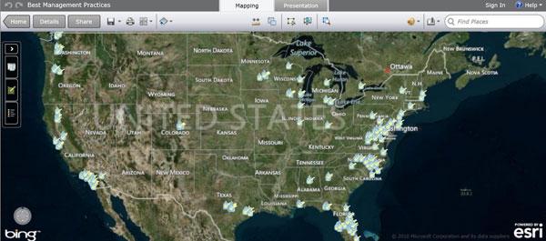
GeoPlatform Stormwater BMP Performance Database
 Click the map to open it in ArcGIS Explorer online and view it interactively. Exit
See how well certain Best Management Practices (BMPs) and Low Impact Development (LID) approaches control stormwater runoff in different parts of the U.S.
This web map displays sites where the performance of BMPs and LID approaches for controlling stormwater runoff have been monitored and reported on. The data come from the International Stormwater BMP Database Information for each site includes the following:
- Type of BMP or LID approach utilized
- Amount of stormwater volume reduction achieved (where available)
- Select soil, land cover, water table, and climatic properties
- A link back to the database where more detailed information on the site and its performance can be found
International Stormwater BMP Database Exit
Helpful Resources
- EPA's National Stormwater Calculator is a desktop application that estimates the annual amount of rainwater and frequency of runoff from a specific site anywhere in the United States (including Puerto Rico). Estimates are based on local soil conditions, land cover, and historic rainfall records.
- EPA's Storm Water Management Model (SWMM) is used throughout the world for planning, analysis, and design related to stormwater runoff, combined and sanitary sewers, and other drainage systems in urban areas. There are many applications for drainage systems in non-urban areas as well.
- EPA's Green Infastruture Modeling Toolkit provides decision makers quick and relevant information about available EPA models and tools for use in their communities. The toolkit can be used as a teaching tool, a quick reference resource for use by planners and developers when making green infrastructure implementation decisions, and a tool for low impact development design competitions.
- EPA's Green Infrastructure website provides basic information, useful tools, as well as research, case studies and a publication library.
