How's My Waterway
Description
 Click on the map to launch the application
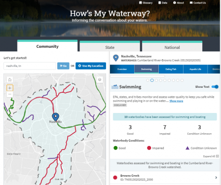
How's My Waterway was designed to provide the general public with information about the condition of their local waters based on data that states, federal, tribal, local agencies and others have provided to EPA. Water quality information is displayed on 3 scales in How’s My Waterway; community, state and national. More recent or more detailed water information may exist that is not yet available through EPA databases or other sources. Check out the How's My Waterway Fact Sheet.
What will I find in How’s My Waterway?
Community:
- Water quality in your local watershed.
- Information on swimming, eating fish and aquatic life.
- Restoration and protection efforts.
- Permitted discharger information.
- Identified Issues (impairments and discharge violations).
- Local drinking water information.
- Water monitoring information.
State:
- Information about a states water program.
- Summaries of specific water assessments.
- A state-wide survey of water quality where available.
- State drinking water metrics.
National:
- The quality of water resources nationwide and their main challenges.
- National drinking water information and metrics.
