An official website of the United States government.

This is not the current EPA website. To navigate to the current EPA website, please go to www.epa.gov. This website is historical material reflecting the EPA website as it existed on January 19, 2021. This website is no longer updated and links to external websites and some internal pages may not work. More information »

Clean Air Markets

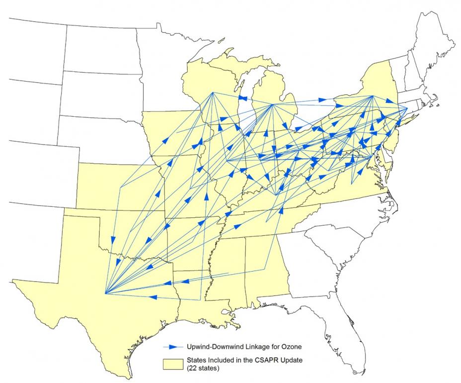
Interconnected Nature of Regional Pollution Transport

This map illustrates the interconnected, regional nature of interstate air pollution transport. The map shows "linkages" between pollution from upwind states and receptors in downwind states that had problems meeting the 2008 ozone NAAQS. These linkages were identified in the context of the Cross-State Air Pollution Rule (CSAPR) Update.

Map of the eastern U.S. showing how emissions from upwind states affect downwind states