Manage Flood Risk
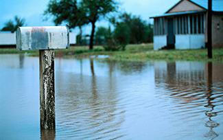 Heavy downpours have increased in frequency and intensity worldwide in the last 50 years. They are expected to become more frequent and intense as global temperatures continue to rise. As a result, the risk of flooding is likely to increase dramatically across the United States.
The average 100-year floodplain is projected to increase 45 percent by the year 2100, while the annual damages from flooding are predicted to increase by $750 million. Among the types of flooding that will likely become more frequent are localized floods and riverine floods. Localized flooding happens when rainfall overwhelms the capacity of urban drainage systems, while riverine flooding happens when river flows exceed the capacity of the river channel.
By reducing stormwater runoff and protecting floodplains, green infrastructure can help manage both localized and riverine floods. In areas impacted by localized flooding, green infrastructure practices absorb rainfall, preventing water from overwhelming pipe networks and pooling in streets or basements. Green infrastructure practices that enhance infiltration include rain gardens, bioswales, and permeable pavements. In areas impacted by riverine flooding, green infrastructure, open space preservation, and floodplain management can all complement gray infrastructure approaches. These practices reduce the volume of stormwater that flows into streams and rivers, protecting the natural function of floodplains, and reducing the damage to infrastructure and property. See: Flood Loss Avoidance Benefits of Green Infrastructure for Stormwater Management
On this page:
This page contains technical information and references for state and local government officials working in the field of stormwater management.
How To
Localized Flooding: Communities susceptible to localized flooding can use models to learn more about the impact green infrastructure can have on managing the flood risk. Hydrologic and hydraulic (H&H) modeling can help identify green and gray infrastructure practices that will meet flood reduction and water quality goals.
For example, the Capitol Region Watershed District in Ramsey County, Minnesota Exit, developed an H&H model to select a set of green infrastructure practices to address localized flooding and phosphorus loading. Selected practices included:
- rain gardens,
- underground infiltration trenches,
- an underground storage and infiltration system, and
- a regional stormwater pond.
All of the practices—except the stormwater pond, which was not completed at the time—reduced runoff volumes by 99–100 percent (PDF). Installing green infrastructure—at an estimated cost of $2 million—was more cost-effective than installing an all-gray infrastructure alternative—at an estimated cost $2.5 million for a new 60-inch diameter storm sewer pipe. See: Arlington Pascal Stormwater Improvement Project Presentation from Saint Paul, Minnesota (PDF)(7 pp, 728 K, About PDF) Exit and Arlington Pascal Best Management Practices Performance and Cost-Benefit Analysis Project 2007-2010 (PDF)(16 pp, 10 MB, About PDF) Exit
Riverine Flooding: Communities susceptible to riverine flooding can more effectively manage their flood risk by combining green infrastructure practices with conserving land in or around the floodplain. Geographic-information-based models can help with the following:
- estimate the flood damage benefits of green infrastructure
- compare the benefits to the cost of conservation
- target investments in conservation towards the most cost-effective areas
When preserving open space throughout a watershed, communities may want to target areas with water-absorbing soils in regions experiencing high growth. For example, the Milwaukee Metropolitan Sewerage District (MMSD) partnered with The Conservation Fund to protect land with those characteristics. As of 2013, the Greenseams program Exit had protected over 2,700 acres of land capable of storing an estimated 1.3 billion gallons of water. Protecting that land reduced future flows and contaminants into receiving rivers, mitigating future flooding.
Technical Assistance
Design for Resilience in Brattleboro's Lower Whetstone Brook Corridor — The Town of Brattleboro, Vermont applied for EPA technical assistance to address flooding in the neighborhoods along the stretch of Whetstone Brook that flows through the downtown. The design solutions developed through a public process in 2016 identify options for creating resilient redevelopment and recreational opportunities within flood prone areas of the town while protecting water quality and connecting people with the Whetstone Brook.
Green Street Charrette and Concept Design Report for Huntington, West Virginia — EPA-supported technical assistance for a green street charrette for the Huntington Stormwater Utility in West Virginia. This effort helped the community identify concerns related to stormwater and opportunities for implementing green infrastructure concepts.
Regional Design Assistance in the Mid-Atlantic Webinar — In 2019, EPA worked directly with stakeholder communities including Huntington WV to identify and facilitate policy and planning measures that promote green infrastructure and help address flood management and water quality needs using the Resilient Design Assistance Tool developed by EPA's Office of Research and Development.
Smart Growth Implementation Assistance for Caño Martín Peña, San Juan, Puerto Rico — This EPA technical assistance project supported the community in developing design options to address stormwater management and fl ooding problems in tandem with the proposed improvements to the area's traditional drainage infrastructure system and ecosystem restoration project while also providing parks and plazas, and making the neighborhoods more walkable and bikeable.
Mexico Beach FL Recovery and Resiliency Partnership — EPA and FEMA worked with the City of Mexico Beach FL to support coastal recovery from Hurricane Michael and improve the city’s future resilience to stormwater impacts.
Rio Reimagined - Rio Salado Urban Waters Partnership — EPA-supported project to protect, restore and revitalize the Salt and Middle Gila River Watershed by restoring ecosystem functions and balancing revitalization with issues of urban resilience and public safety including flood mitigation.
Resources
Regional Resilience Tool Kit Presentation -- EPA recently released its Regional Resilience Toolkit, for addressing regional resilience planning needs to address hazards from natural disasters and is working with a handful of pilot communities: https://19january2021snapshot.epa.gov/smartgrowth/regional-resilience-toolkit#2020.
Flood Loss Avoidance Benefits of Green Infrastructure for Stormwater Management —This modeling study estimates the flood loss avoidance benefits from application of small storm retention practices for new development and redevelopment nationwide. Over time, the use of green stormwater infrastructure can save hundreds of millions of dollars in flood losses, while just applying the practices to new development and redevelopment only. If retrofitting were to occur, the avoided losses would be even more significant.
Two Webcasts: Lessons Learned Integrating Water Quality and Nature Based Approaches for Hazard Mitigation Webinar and Building Resilient Communities with Green Infrastructure and Hazard Mitigation Planning Webcast-- EPA and FEMA worked with three regions - Ashland OR, Albany NY, and the Commonwealth of MA - to pilot projects that have successfully integrated watershed planning, green infrastructure practices and source water protection into FEMA hazard mitigation plans.
Including Watershed Planning and Green Infrastructure into State Hazard Mitigations Plans — EPA fact sheet on the four main benenfits of integrating planning and resources for getting started.
Why Connect with your State Hazard Mitigation Office? — EPA fact sheet on the benefits of, and opportunities for, integrating Watershed Plans with FEMA Hazard Mitigation Plans.
Reducing Damage from Localized Flooding: A Guide for Communities (PDF)(180 pp, 9 MB, About PDF) Exit —This guide was produced by the Federal Emergency Management Agency to help U.S. cities, towns, villages, and counties reduce damage, disruption, and public and private costs caused by localized flooding within their jurisdictions.
A Flood of Benefits – Using Green Infrastructure to Reduce Flood Risk Exit —This report describes how restoration or conservation of forests, wetlands, rivers, and floodplains can reduce flood risk while supporting an array of other benefits.
Strategically Placing Green Infrastructure: Cost-Effective Land Conservation in the Floodplain Exit —This paper estimates the flood damage and costs that can be avoided by preventing development of floodplain parcels in the East River watershed of Wisconsin’s Lower Fox River Basin. The analysis demonstrates how to use a geographic-information-based model to estimate the benefits of green infrastructure in reducing flood damage, compare the benefits to the costs, and target investments to develop cost-effective nonstructural flood damage mitigation policies.
Rain Garden Reserve (PDF)(2 pp, 2 MB, About PDF) Exit —This case study from the city of Cuyahoga Falls, Ohio, demonstrates how using a series of rain gardens can mitigate localized flooding. The 24,000-square foot park drains an approximately 3-acre residential area and enhances outdoor recreational opportunities for the community.
Envision® Sustainable Infrastructure Rating System – Business Case Evaluator (BCE) for Stormwater Exit —This tool from the Institute for Sustainable Infrastructure includes estimates for the value of green infrastructure benefits, including reduced flooding resulting from green infrastructure improvements.
Economic Assessment of Green Infrastructure Strategies for Climate Change Adaptation: Pilot Studies in the Great Lakes Region Exit —This National Oceanic and Atmospheric Administration study assesses stormwater management practices that can help communities reduce flooding by capturing, storing, or absorbing more water from precipitation events.
Planning for Flood Recovery and Long-Term Resilience in Vermont: Smart Growth Approaches for Disaster-Resilient Communities (PDF)(64 pp, 390 K, About PDF) - This report describes strategies that communities can use to become more flood resilient, including:
- conserving land in flood-prone areas
- directing new development to safer areas
- using green infrastructure practices to manage stormwater.
References
US EPA. Climate Change Indicators in the United States.
Heavy downpours more intense, frequent in a warmer world | NOAA Climate.gov Retrieved July 1, 2014.
AECOM, Michael Baker Jr., Inc., and Deloitte Consulting, LLP. 2013. The Impact of Climate Change and Population Growth on the National Flood Insurance Program through 2100 (PDF)(257 pp, 12 MB, About PDF) Exit Retrieved July 1, 2014.
Wobus, C., M. Lawson, R. Jones, J. Smith, and J. Martinich. 2013. Estimating monetary damages from flooding in the United States under a changing climate. Journal of Flood Risk Management (PDF)(13 pp, 1.3 MB, About PDF) Exit Retrieved July 1, 2014.
Qin, H., Z. Li, and G. Fu. 2013. The effects of low impact development on urban flooding under different rainfall characteristics. Environmental Management 129:577-585 Exit. Retrieved July 1, 2014.
Baker, M. 2010. BMP Performance and Cost-Benefit Analysis (PDF). (7 pp, 728 K, About PDF) Exit Retrieved July 1, 2014.
Kousky, C., S. M. Olmstead, M. A. Walls, and M. Macauley. 2013. Strategically placing green infrastructure: Cost-effective land conservation in the floodplain. Environmental Science and Technology 47:3563-3570 Exit.
The Conservation Fund. Greenseams: Milwaukee Flood Management Exit. Retrieved July 1, 2014.