Estuary Data Mapper (EDM)
With around 2,000 estuaries along the five US coastal regions (Atlantic, Gulf of Mexico, Pacific, Alaska, and Hawaii), scientists in many agencies and organizations have collected enormous amounts of current and historic data on estuary conditions.
An ongoing challenge is to pull that disparate information together to help estuary managers make informed decisions on protecting and preserving these unique environments.
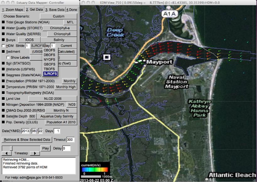
EPA’s Estuary Data Mapper (EDM) helps researchers and estuary managers do just that. The application provides a fast, easy way for researchers to zoom into a specific estuary of interest and find current, available data—from many sources—for that system.
- Inputs to a Geographic Information System-based data model for estuaries and their watersheds.
- Data for tools and model outputs to assess, visualize, diagnose, predict, prioritize, and manage condition of estuaries and coastal watersheds.
- A wealth of environmental data such as tidal, hydrologic, weather, water quality, and sediment quality.
- Ground, satellite, air, and water data from EPA, the National Aeronautics and Space Administration (NASA), the National Oceanic and Atmospheric Administration (NOAA), and the US Geological Survey’s National Water Information System (NWIS).
- Environmental scientists (aquatic biologists and chemists)
- Water ecosystem managers
- Non-governmental organizations and citizen groups focused on water ecosystems
 EDM also includes information about coastal rivers, tributaries, and watersheds. It gives users the ability to display background information, such as cities and roads, to help them explore areas of interest and learn more about the context. This data can help researchers gauge the status of estuary environments and possible threats—facilitating the use of decision-support tools to help them visualize the effects of potential management actions. For example, having access to nitrogen loading sources and predictive models of seagrass habitat can help communities and watershed organizations research ways to reduce nitrogen loads.
EDM contains data sources on atmospheric deposition, nonpoint and point nitrogen sources, and nitrogen loads to estuaries and their associated watersheds. EPA researchers will continue to incorporate new data resources and update the mapper to help protect these vital, productive ecosystems.
