Frequent Questions about Estuary Data Mapper (EDM)
- What is an estuary?
- What is the Estuary Data Mapper (EDM)?
- Which estuaries are available for study in EDM?
- Who uses EDM?
- What data are available in EDM?
- Where/how does EDM get its input data? (web services)
- Where does EDM get its estuary polygons?
- Can it read my data files? (No)
- What output file formats does EDM support? (GIS, etc.)
- Is EDM free and open-source software? (Yes)
- Do I need system administrator privilege to install EDM? (No)
- Who do I contact for technical support and comments?
Q: What is an estuary?
A: "An estuary is a partially enclosed body of water along the coast where freshwater from rivers and streams meet and mix with salt water from the ocean. Estuaries and the lands surrounding them are places of transition from land to sea, and although influenced by the tides, they are protected from the full force of ocean waves, winds, and storms by such landforms as barrier islands or peninsulas". The National Estuary Program has more information about the importance of estuaries.

Q: What is the Estuary Data Mapper (EDM)?
A. The Estuary Data Mapper (EDM) is a free, interactive graphical application under development at the US EPA that allows environmental researchers and managers to quickly and easily retrieve, view and save subsets of online US coastal estuary-related data.
Q: Which estuaries are available for study in EDM?
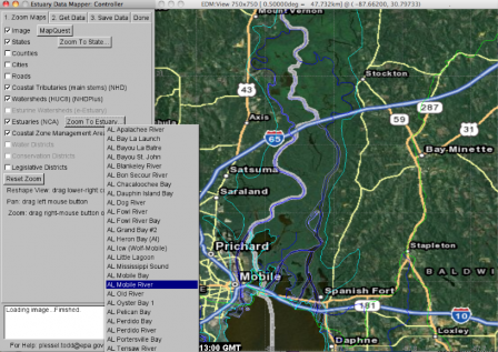
A: Any of the approximately 2,000 named estuaries along the five US coastal regions: Atlantic (Maine to Florida), Gulf of Mexico (Texas to Florida), Pacific (Washington, Oregon, California), Alaska and Hawaii. EDM menus allow you to select a coastal state then select one of that state's estuaries and it will zoom to view it.

A: EDM is used by:
- Environmental science researchers (aquatic biologists, chemists, physicists, mathematicians, statisticians, etc.) with expertise and interest in watersheds and estuaries.
- Water ecosystem managers and decision-makers (e.g., of watersheds, water districts, wildlife preserves, etc.).
- NGO and citizen groups concerned with water ecosystem issues.
Q: What data are available in EDM?
A: The list of available maps and data is expanding during development. See the Data Inventory page for the current list.
If you know of other relevant data you'd like EDM to access please let us know.
Q: Where/how does EDM get its input data?
A: For small, static data, EDM reads from 'built-in' files (e.g., county borders) which are included in the downloaded EDM folder.
For large and/or time-varying data, EDM reads such data streamed on-demand from specific remote webserver applications ("web-services") hosted at EPA, NOAA, USGS, etc.
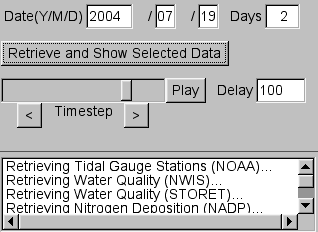
For example, when the Retrieve Button is pushed

EDM requests data from each source webservice using commands such as:
https://nwis.waterdata.usgs.gov/nwis/dv?format=rdb&list_of_search_criteria=lat_long_bounding_box&coordinate_format=decimal_degrees&range_selection=date_range&date_format=YYYY-MM-DD&nw_longitude_va=-77.6572&nw_latitude_va=40.1987&se_longitude_va=-73.8377&se_latitude_va=36.3792&begin_date=2004-07-19&end_date=2004-07-20&index_pmcode_00300=1
which stream back data which is then displayed by EDM.
Q: Where does EDM get its estuary polygons?
A: We started with the estuary and coastal system polygons created for the Environmental Monitoring & Assessment Program's National Coastal Condition Assessment sampling.
We edited that collection to identify systems that were truly estuaries based on both freshwater and saltwater connections and partial closure on the seaward boundary. For example, the National Coastal Assessment sample frame includes open systems that are not true estuaries as they are too open to the ocean.
EDM's estuarine polygon set includes all systems for which a watershed can be constructed based on an aggregation of NHDPlus Exit catchments.
EDM's estuarine polygon set was circulated among EPA regions for review and input. In EDM, individual estuaries are identified by the ESTCODE and Estuary Name and a SUBCODE and Subestuary Name when subsystems could be identified.
Q: Can it read my data files?
A: No. EDM only reads its own "built-in" files (e.g., county borders) and data streamed from specific remote webserver applications. EDM has no provision for reading arbitrary user-specified local files.
However, if you have relevant data files you'd like to share with others through EDM, please let us know.
Q: What output file formats does EDM support?
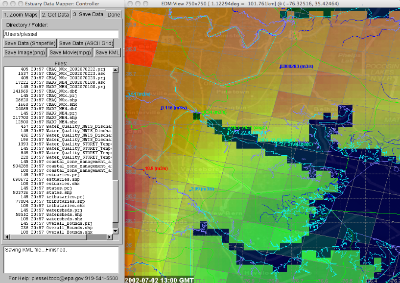
A: PNG image Exit, MPG movie Exit, KML (GoogleEarth) Exit, ESRI Shapefile Exit, and ESRI ASCII Grid Exit.

Q: Is EDM free, open-source software?
A: Yes. The software is being developed under US Federal Government Contract. It is freely available via download to the public and includes executables for Windows, OS X, and Linux. The download includes the application's C/C++ source code.
Q: Do I need system administrator privilege to install EDM?
A: No. Simply download the platform-specific zip file to your home directory Exit, click on it to unzip it which creates the EDM directory/folder under your home directory. To uninstall EDM, simply remove the EDM directory/folder. EDM only reads from and writes to the EDM directory and your home directory. EDM does not depend on any other software installed on your computer. EDM requires an Internet connection and the ability to open socket connections (http/80) to retrieve data from the following public web services:
- https://ofmpub.epa.gov/rsig/rsigserver
- https://maps.google.com/maps/api/staticmap
- https://www.mapquestapi.com/staticmap/v4/getmap
If EDM detects that it cannot make a connection, it displays the above URLs. Share these URLs to your system administrator so they can configure your computer to allow these socket connections.
Who do I contact for technical support and comments?
A: If you have suggestions for additional data that EDM could serve, or you have technical issues running EDM, please send an email to EDM Technical Support.
