Region 7 Land Revitalization Success Stories
 On this page:
- Dubuque's Revitalization Goals Come Alive by Strengthening Urban Centers - Dubuque, Iowa
- Iowa City Riverfront Crossings District - Iowa City, Iowa
- Iowa Redevelopment Projects Spurred by Community Partnerships - Manchester, Council Bluffs, and Iowa City
- John Deere (Dubuque Works) Superfund Site - Dubuque, Iowa
- Ogden Health Clinic - Ogden, Iowa
- Peoples Natural Gas Superfund Site - Dubuque, Iowa
- Kansas City Structural Steel Superfund Site - Kansas City, Kansas
- Carter Carburetor Superfund Site - St. Louis, Missouri
- Fulbright Landfill Superfund Site - Springfield, Missouri
- Missouri Projects Look to Industrial Past for Inspiration - Kansas City, North Kansas City, Springfield, and St. Louis
- National Geospatial-Intelligence Agency West Relocation - St. Louis, Missouri
- Oronogo-Duenweg Mining Belt Superfund Site - Joplin, Missouri
- PCB Inc. - Missouri Superfund Site - Kansas City, Missouri
- Pruitt Igoe Redevelopment - St. Louis, Missouri
- Urban Core Redevelopment - Kansas City, Missouri
- Utah Station Grill - St. Louis, Missouri
- Nebraska Communities Discover Hidden Treasures in Plain Sight - Cozad, Kimball and Omaha
- Reuse of Former Gas Stations - Sutherland, Nebraska
Iowa
Dubuque's Revitalization Goals Come Alive by Strengthening Urban Centers
-
North Port Area
-
Millwork District
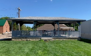
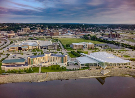 Dubuque’s North Port area after revitalization. (Photo credit: City of Dubuque)Dubuque is one of the nation's great success stories for the revitalization of central neighborhoods and cleaning up brownfield sites.
The city’s successful renewals of the North Port Area and Millwork District took vision, planning, and a strong commitment to sustainability. Dubuque leveraged resources and expertise from EPA, local businesses, and other community partners to make it all happen.
 Original elements of the historic mill buildings in the Millwork District, such as open staircases, south-facing windows, and thick, insulating exterior walls, showcase the neighborhood’s character while creating sustainable, energy-efficient spaces. (Photo credit: U.S. EPA)
Brownfields funding leveraged over half a billion dollars in public and private investment for a remarkable turnaround in the North Port area, offering educational, entertainment, recreational and business options to both residents and visitors.
The city created a walkable environment in the Millwork District with a variety of retail, commercial, social, art and civic spaces, featuring energy-efficient infrastructure, creek "daylighting" to reduce flooding, and a focus on the arts through festivals, classes, and gallery space.
By catalyzing redevelopment of these vibrant urban places, Dubuque shows that nothing is more sustainable than strengthening existing neighborhoods.
Iowa City Riverfront Crossings District
Iowa City, Iowa
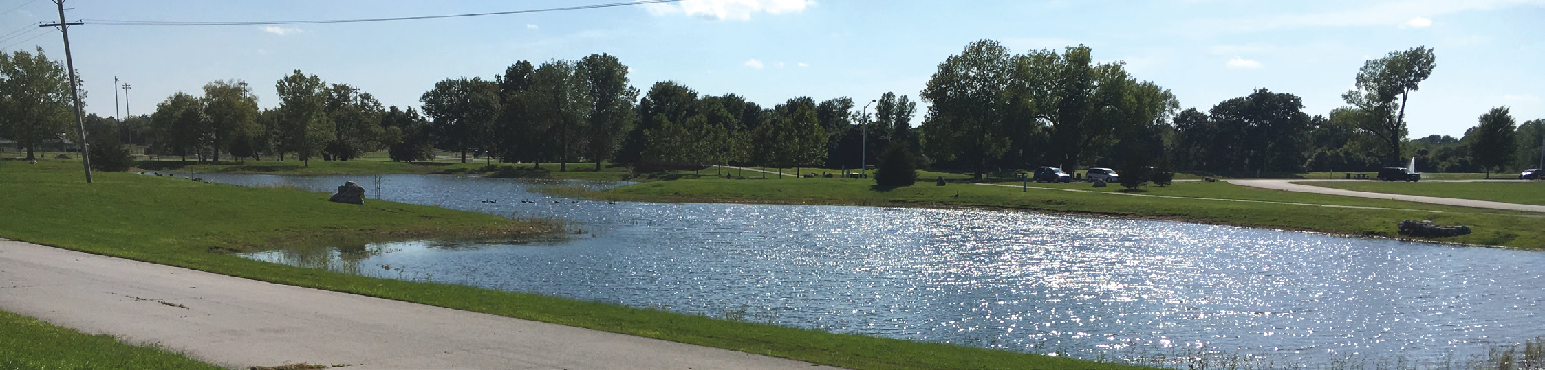
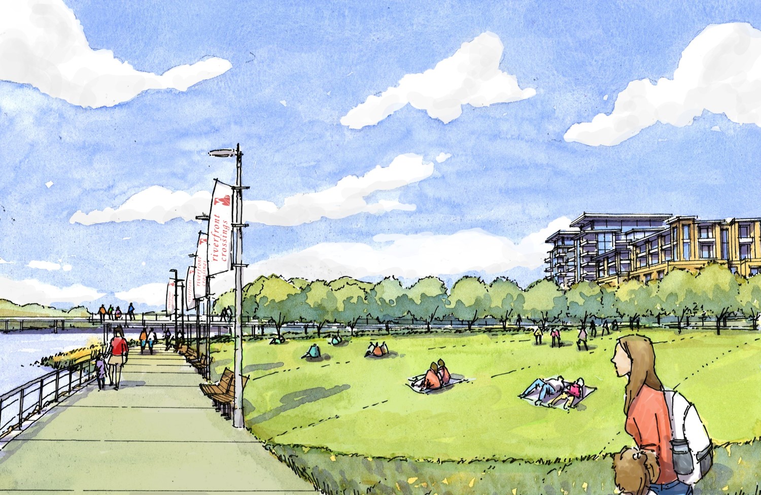 In 2008, eastern Iowa was hit with a 500-year flood event. One of the cities impacted was Iowa City, which was declared a federal disaster area. The Federal Emergency Management Agency (FEMA) tasked EPA with working with the local government to create a redevelopment plan for areas impacted by the flooding, focusing on an area south of downtown that became known as the Riverfront Crossings District.
EPA initially developed a retail and housing market analysis, along with a transit-oriented development study for this area, with the results indicating that the area had great potential for mixed use/transit-friendly development. EPA then worked with local stakeholders to develop the Riverfront Crossings Sub-Area Plan. This plan recommended the development of a park and constructed wetlands in the 100-year floodplain, along with infrastructure improvements and zoning code changes to act as catalysts for new housing and retail to be constructed in the district. Since the plan was finalized, several hundred million dollars worth of new construction have been completed in the district with comparable construction project values planned for the future.
Iowa Redevelopment Projects Spurred by Community Partnerships
-
Riverfront Park – Manchester
-
Harvester Warehouses – Council Bluffs
-
Riverfront Crossings District – Iowa City
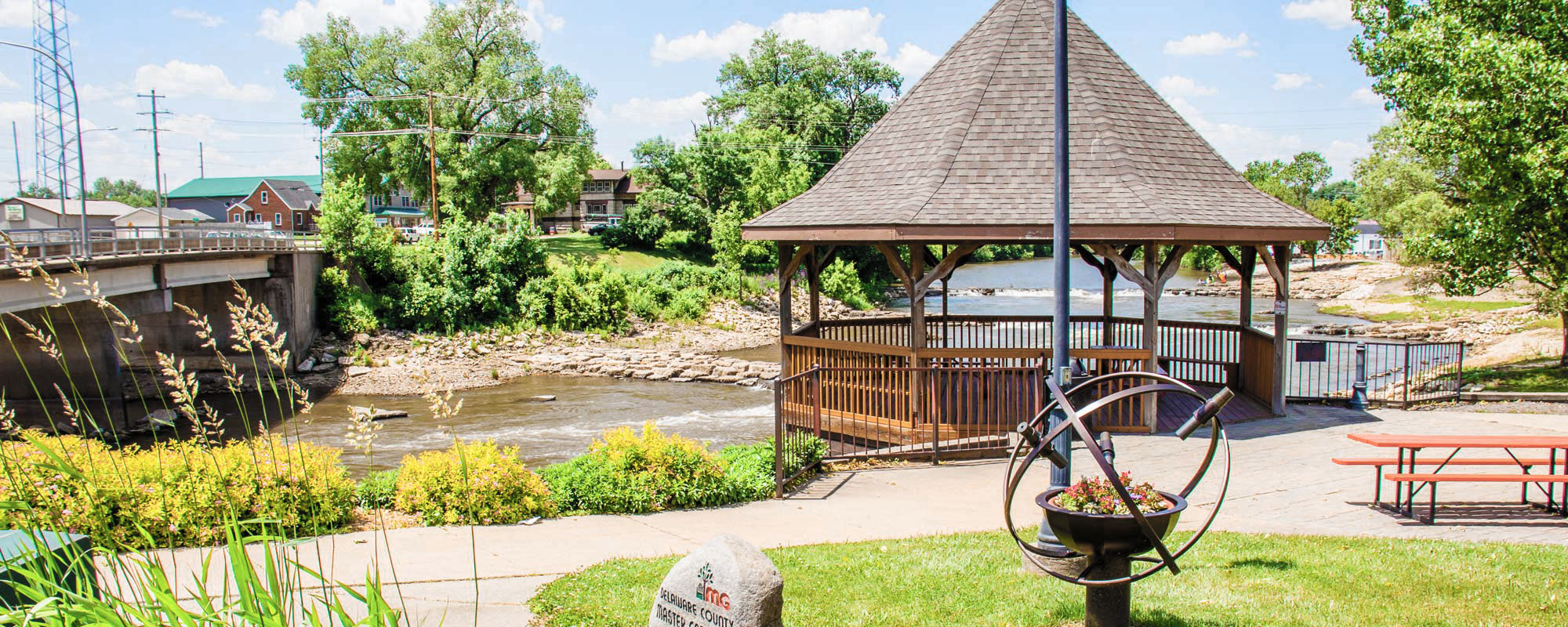 Manchester’s Riverfront Park. (Photo credit: City of Manchester.)With over 100 brownfield sites in the state, Iowa communities have been hard at work redeveloping abandoned and contaminated properties.
Manchester redeveloped an abandoned appliance shop into a bustling public access point for the city’s Whitewater Park. While the shop once blocked access to the Maquoketa River, with help from EPA, the site now serves as an access point, complete with amenities such as public restrooms, showers, event space, walking and biking trails, and kiosks telling the story of the park.
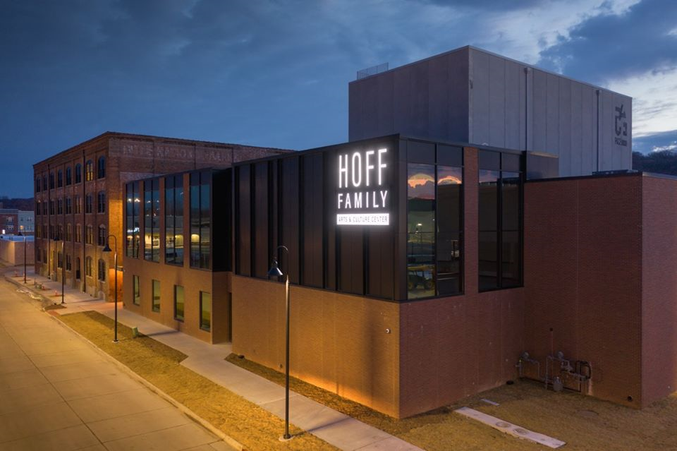
Council Bluffs utilized an EPA Brownfield’s Assessment Grant to evaluate one of the Harvester Warehouses in their community. The abandoned brick warehouse in the heart of the city’s industrial district was impacted by heavy metal and polycyclic aromatic hydrocarbon (PAH) contamination in its upper soils. With community collaboration, Council Bluffs cleaned up and revitalized the site. What was once an abandoned, contaminated warehouse is now the Hoff Family Arts and Culture Center.
 Iowa City’s Riverfront Crossings District. (Photo credit: David Doyle, EPA.)Following a 500-year flood event, Iowa City transformed the riverfront, which sustained immense damage during the floods. They restored Ralston Creek and created wetlands and trails alongside the riverbank. In 2018, they added a nature play area. The Riverfront Crossings District is now home to retail, restaurants, housing and breweries, with plans to continue building in the area.
Collaboration between local, state and federal partners transformed former abandoned, destroyed or contaminated properties into vibrant and active public spaces.
John Deere (Dubuque Works) Superfund Site
Dubuque, Iowa
 The John Deere (Dubuque Works) Superfund Site covers nearly 1,500 acres about 2½ miles north of the city of Dubuque in Dubuque County, Iowa. Former waste disposal activities and a fuel line leak in 1980 contaminated groundwater at the site. Cleanup at the site included provision of a safe potable water supply for the facility, groundwater extraction and containment, land and groundwater use restrictions, and a contingency plan to prevent contaminant migration in the event of a facility shutdown. In 2009, an environmental covenant was placed on the site, pursuant to the Iowa Uniform Environmental Covenants Act, to enhance the future enforceability and permanence of existing deed restrictions.
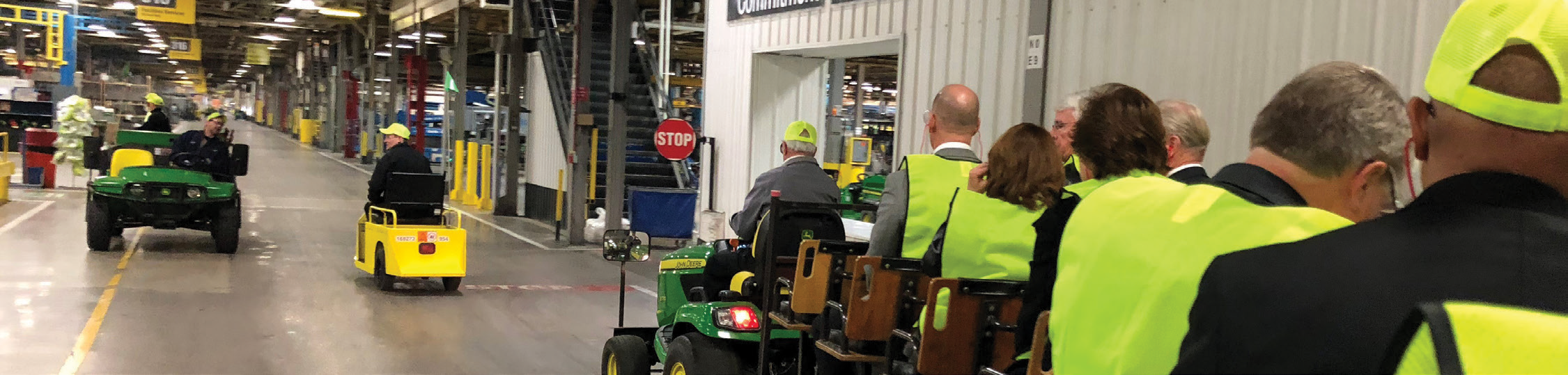
Thanks to collaboration between EPA and Deere & Company, the John Deere facility has continued operating during the cleanup process and protects site workers from contamination. Deere & Company is proactively addressing uncertainties noted in a 2014 Ecological Risk Assessment by placing a vegetative cover over areas of exposed soil on the former landfill. The cover includes native grasses and wildflowers. The site’s soil improvement plan will make sure that ecological receptors are not exposed to contamination, while also providing pollinator habitat and a walking area for facility employees. In April 2018, EPA Region 7 recognized the company’s restoration efforts at the site with its Leading Environmentalism and Forwarding Sustainability (L.E.A.F.S.) Award.
Ogden Health Clinic
Ogden, Iowa
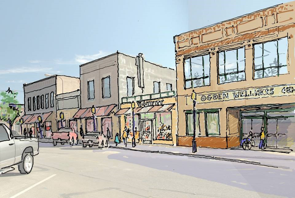 EPA worked the Ogden mayor, Iowa Department of Natural Resources (IDNR), U.S. Department of Agriculture (USDA) Rural Development, and a hospital in Boone, Iowa (15 miles east of Ogden), along with one of EPA's contractors, to replace several abandoned buildings along Ogden’s main street.
EPA conducted a market analysis and an asset/needs assessment and developed some site reuse concepts, which led to the building of a new medical clinic on the site.
The existence of the clinic resulted in several new businesses springing up nearby.
Peoples Natural Gas Superfund Site
Dubuque, Iowa
 The Peoples Natural Gas Superfund Site covers 5 acres in a commercial and industrial area in Dubuque, Iowa. Beginning in the 1890s, a series of businesses owned and operated a gas plant on site that contaminated the soil. EPA began cleanup in 1990, which included excavation and incineration of contaminated soil and pumping and treatment of contaminated groundwater.
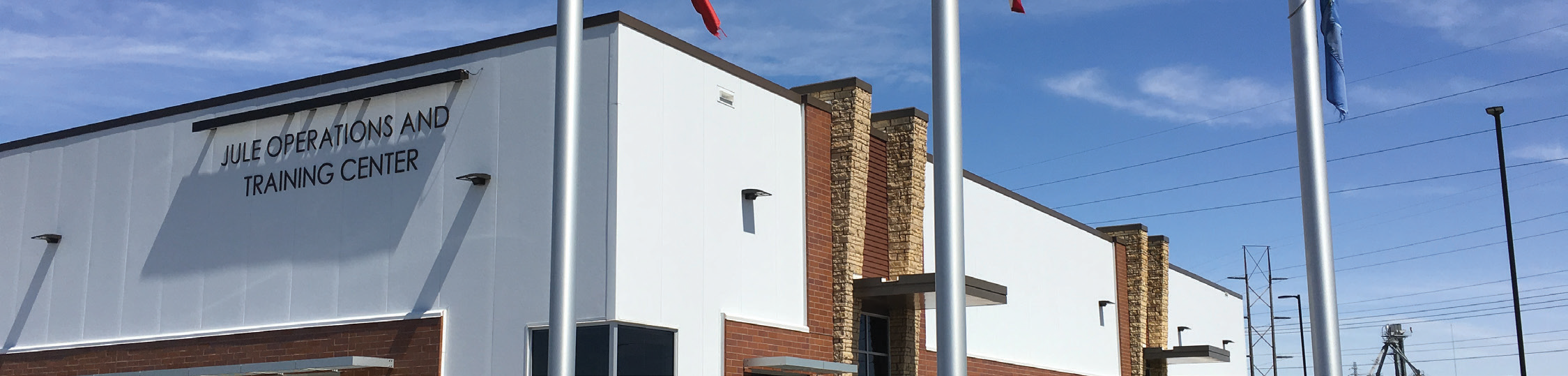
The city of Dubuque worked closely with EPA throughout site investigations and cleanup. The site is part of the community’s waterfront revitalization area, which includes several brownfields projects, major stormwater improvements, and private-sector redevelopment. After gasification plant operations ended on site, the locality had operated the Dubuque Public Works Garage on site for four decades. The city and the East Central Intergovernmental Association sought to replace the former public works garage with a bus storage and maintenance facility for The Jule, the city’s public transit system. Conversion of the property required that the city demolish the former facility, place fill material on top of the old foundation, and construct the new facility on the existing foundation. Work on the facility began in 2016 and finished in 2017. The Jule Operations and Training Center now provides storage and light maintenance space, houses dispatch and management offices, and provides meeting and training facilities for employees. In April 2018, EPA Region 7 recognized the Dubuque’s redevelopment efforts at the site with its Leading Environmentalism and Forwarding Sustainability (L.E.A.F.S.) Award.
Kansas
Kansas City Structural Steel Superfund Site
Kansas City, Kansas
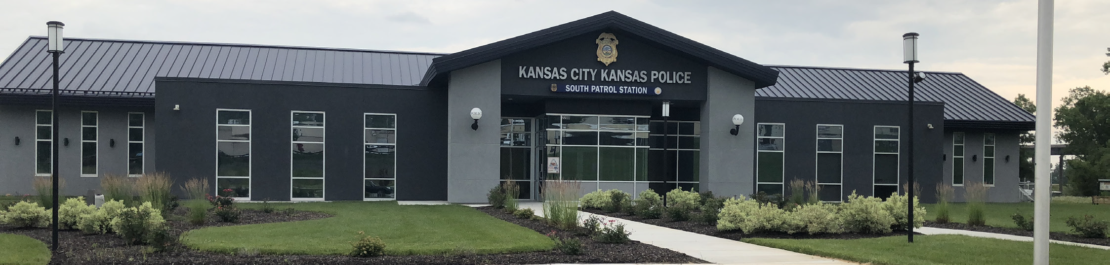 For more than a century, smelting and steel fabrication at the Kansas City Structural Steel Superfund Site contaminated soil and groundwater with heavy metals. After cleanup in the 1990s, collaboration between EPA and local stakeholders transformed the once hazardous waste site into a new grocery center with 61,000 square feet of commercial opportunity for the Argentine neighborhood in Kansas City, Kansas. El Centro, a local nonprofit that aims to improve the lives of Latinos and strengthen communities, worked with EPA in the 1990s to acquire the property and seek out reuse opportunities. Then in 2013, the real estate group Lane4 Property Group expressed interest in developing a grocery and retail center at the site. EPA worked to provide El Centro, Lane4 Property Group, state of Kansas, neighborhood groups, and the developer with the tools to move toward reuse of the site.
This development provides affordable food options as well as economic opportunities for the Argentine neighborhood through a new Walmart grocery store and development pads for additional retail. EPA also recognized reuse efforts by Walmart and the Argentine Neighborhood Development Association by awarding the parties with Region 7’s Leading Environmentalism and Forwarding Sustainability (L.E.A.F.S.) Award in 2014.
- EPA Region 7 Feature - Argentine Community in Kansas City, Kansas, Transforms Through Environmental Cleanup
- EPA Superfund Site Profile Page
Missouri
Carter Carburetor Superfund Site
St. Louis, Missouri
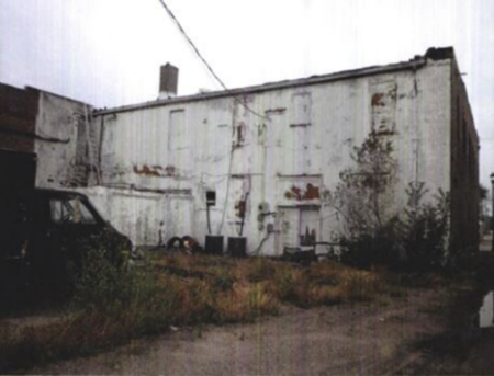
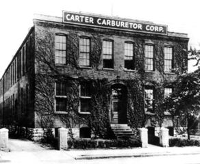 Undated photo showing the front of the Carter Carburetor building. (Photo credit: U.S. EPA)In its prime, Carter Carburetor was an energetic manufacturing plant, boasting 480,000 square feet of space in the heart of St. Louis. The plant housed numerous buildings for offices, testing and manufacturing of carburetors for gasoline- and diesel-powered engines.
 Building demolition following asbestos abatement in 2016. (Photo credit: U.S. EPA)During its tenure, Carter Carburetor supplied parts to major companies across the U.S., including Chevrolet, Buick, Oldsmobile, Chrysler and Packard.
The company supplied carburetors until 1984, when ACF Industries Inc. closed the factory following automakers’ switch from carburetors to electronic fuel injection. The property was then deeded to the Land Reutilization Authority of St. Louis.
 Among the dignitaries at the cleanup completion celebration in September 2020 were: EPA Region 7 Administrator Jim Gulliford; Dr. Flint Fowler, Boys & Girls Club of Greater St. Louis president; EPA Administrator Andrew Wheeler; William Lacy Clay, U.S. Representative from Missouri’s 1st congressional district; and Ozzie Smith, Gateway PGA REACH president. (Photo credit: U.S. EPA)Later, EPA discovered hazardous contaminants at the Carter Carburetor Site including polychlorinated biphenyls (PCBs), trichloroethylene (TCE), and asbestos.
EPA initiated removal actions, including demolishing the former die-cast building and placing a temporary cap on the die-cast soils; constructing a security fence to prevent exposures to individuals who entered the former dilapidated buildings; and asbestos and debris removal to prepare the buildings for demolition.
What was once an environmental hazard will now serve the Boys & Girls Club of Greater St. Louis as a youth golf training and mentoring facility. In partnership with the Gateway PGA REACH organization, they will build the facility on most of the site property.
The St. Louis Land Reutilization Authority owns part of the site, which it wants to develop into a pollinator park, urban prairie feature, or community garden to support the surrounding reuse.
- EPA Region 7 Feature - From Carburetors to Golf: Youth Sports Facility to Arise from Decades-Long Site Cleanup in St. Louis
- EPA’s Site Cleanup Page
Fulbright Landfill Superfund Site
Springfield, Missouri
 From 1962 to 1968, Springfield used the Fulbright Landfill for the disposal of industrial waste. Once the city closed the landfill, it lay untouched for a decade before, in 1978, a local geology student discovered high concentrations of copper, chromium and manganese in the soil. EPA became involved at the site in 1983, and has partnered since then with the city of Springfield and other local and state partners to clean up and redevelop the site.
The former landfill is now home to a new, 7-mile trail system – the Fulbright Spring Greenway Trail. Ozark Greenways, a local nonprofit, hired a construction company in 2019 to fill in a 1.5-mile gap in the trail. They completed this new section in early 2020, and Ozark Greenways opened the trail to the public in July 2020. Decades of collaboration between EPA, the city of Springfield, Ozark Greenways, and others contributed to the successful redevelopment of this former Superfund site.
- EPA Region 7 Feature - Springfield, Missouri, Transforms Superfund Landfill into New Community Trail
Missouri Projects Look to Industrial Past for Inspiration
-
Kansas City Terminal Railway
-
Armour Road Superfund Site - North Kansas City
-
Jordan Valley Park, Hammons Field and others - Springfield
-
St. Louis’ City Foundry
 EPA staff and partners celebrate their work to reuse the Armour Road Site.Industries like rail, mining and manufacturing have shaped the history of Missouri. Unfortunately, as new technologies have replaced these industries, environmental contamination has often been left behind as aging industrial facilities are abandoned.

However, with help from EPA Region 7’s Brownfields and Land Revitalization Program, communities across the state have reimagined these former industrial sites and transformed them from areas of contamination to sources of social and economic benefit.
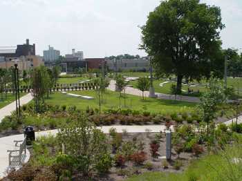 Today, Jordan Valley Park is a thriving community greenspace. (Photo credit: City of Springfield.)In Kansas City, a former railyard contaminated with arsenic was cleaned up and converted to an office space, using the original 1903 architectural drawings as design inspiration.
In North Kansas City, community planners leaned on EPA support to redevelop the Armour Road Superfund Site from an herbicide mixing facility to a jewelry store, restaurant, and medical office, paving the way for further community revitalization.
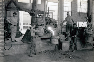 Workers at Century Electric in St. Louis perform a pour. (Photo credit: Missouri Historical Society Collections.)Further south, Springfield has leveraged over $8 million in EPA land revitalization funding and technical assistance to spur about $460 million in public and private investment. This has allowed the city to redevelop environmentally contaminated sites like former industrial plants, quarries, and gas stations into parks, housing developments, and businesses.
And in St. Louis, a former iron foundry that grounded the Prospect Industrial District has been given new life as a public market with shops, food halls, and entertainment.
These projects from across the Ozark State demonstrate the transformative power of EPA land revitalization funding and civic partnerships, which help communities realize their vision for blighted corridors.
National Geospatial-Intelligence Agency West Relocation
St. Louis, Missouri
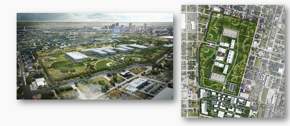 The National Geospatial-Intelligence Agency West (NGA West) is operated by the U.S. Department of Defense (DOD) and is located on the south side of St. Louis. The site is landlocked and subject to occasional flooding, so DOD decided to relocate the operation. A 100-acre site in north St. Louis, next to the former Pruitt Igoe housing complex, was offered by city officials as a replacement site. While deliberations proceeded on where to relocate the operation, EPA worked with local government agencies and the Missouri Department of Natural Resources (MDNR) to conduct extensive environmental assessment and remediation of the many parcels that made up the site.
DOD officially selected the St. Louis site over a number of other sites located in St. Louis County and in Illinois. The work done by EPA led to MDNR issuing a "no further action" notice for the property and ownership was transferred from the city to DOD in late 2018. Construction of the operation is expected to commence sometime in 2019, with completion of the new NGA West expected by 2022.
Oronogo-Duenweg Mining Belt Superfund Site
Joplin, Missouri
 The Oronogo-Duenweg Mining Belt Superfund Site is about 250 square miles in size and constitutes the Missouri portion of the larger Tri-State Mining District. In its heyday, about 200 mines were operating in and around the Oronogo and Duenweg areas. Distribution of nearly 150 million tons of mining and milling wastes across an 11,000-acre area, as well as the 10 million tons of waste remaining on site, have resulted in heavy metal contamination of surface water, groundwater, and surface soils.
EPA placed the site on the National Priorities List (NPL) in 1990, and conducted a time-critical removal action to address high blood lead levels in local children. An agreement between EPA and the state of Missouri enabled the Missouri Highway and Transportation Department to build the Route 249 highway bypass across part of the site in 2001. The project reused mine wastes as fill material and developed a guideline for the proper development of areas containing mining wastes. EPA also developed other innovative solutions for disposal of site wastes to allow for future development. Areas on the east side of Webb City have been cleaned up and are being developed for commercial use. With over 4,000 acres of cleaned-up land ready for redevelopment at the site, Jasper County is open for business, attracting new residential, commercial and recreational opportunities.
PCB Inc. - Missouri Superfund Site
Kansas City, Missouri
 PCB Treatment Inc. (PTI) began treating and disposing of materials containing polychlorinated biphenyls (PCBs) at the Kansas City, Missouri, site in 1982. From 1982 to 1987, PTI removed PCBs from electrical transformers, capacitors, and waste oil discarded by the federal government, rural electric cooperatives, utility companies, cities, states and businesses. A group of former PTI customers (Steering Committee) who were responsible for site cleanup met with EPA in 1995. The Steering Committee agreed to assess contamination at the PTI facilities, evaluate cleanup methods, and then implement the cleanup. The committee planned and implemented all required work, with oversight provided by EPA and the Missouri Department of Natural Resources (MDNR).
Building removal began in late 2004. After it was completed, developers quickly recognized the property’s potential. After a few false starts, work began on a high-rise apartment building in July 2017. The property is now home to the Arterra 12-story luxury residential tower, the first high-rise apartment project built in the Crossroads Arts District area of downtown Kansas City. Copaken Brooks and Altus Properties jointly developed the project, which serves as a visual beacon of development and growth in the District. Arterra offers 126 state-of-the-art residential units; first-floor retail; an integrated parking garage; an infinity pool overlooking Liberty Memorial, Penn Valley Park, and the Arts District; and a 12th-floor amenity suite that offers a free coffee bar and views of the Kansas City skyline.
Pruitt Igoe Redevelopment
St. Louis, Missouri
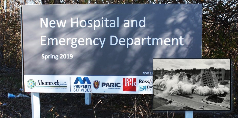 Pruitt Igoe was a public housing complex of 33 identical 11-story buildings on the near north side of St. Louis that was built in the early 1950s. Due to poor design and lack of maintenance on the part of the city housing agency, the complex became a site of considerable social disorder and ended up being demolished in the early 1970s. The site was then bulldozed by the city and surrounded by a fence, and it was used for a short period as a demolition landfill in the early 1990s.
The city approached EPA in 2014 and asked for help in putting the site back into reuse. EPA completed an environmental health risk assessment and soil management plan, which led to MDNR issuing a "no further action" notice in 2015 that allowed for the site to be used for non-residential purposes without further environmental review. EPA also conducted a detailed topographic survey of the site. As result of these efforts, the site was purchased from the city by a local developer with plans to construct a medical clinic and hotel on the property.
Urban Core Redevelopment
Kansas City, Missouri
 In parts of Kansas City’s urban core, vacant lots are not entirely uncommon. According to community members, neighborhoods were devastated by the effects of redlining, blockbusting, and White flight following the Brown v. Board of Education decision in 1954. The number of vacant lots skyrocketed as shops closed, homeowners moved away, and buildings fell into disrepair. Crumbling buildings leached environmental contaminants into the soil of vacant lots. Some vacancies grew into illegal dumping grounds for tires, appliances and electronics. In turn, brownfield sites became widespread.
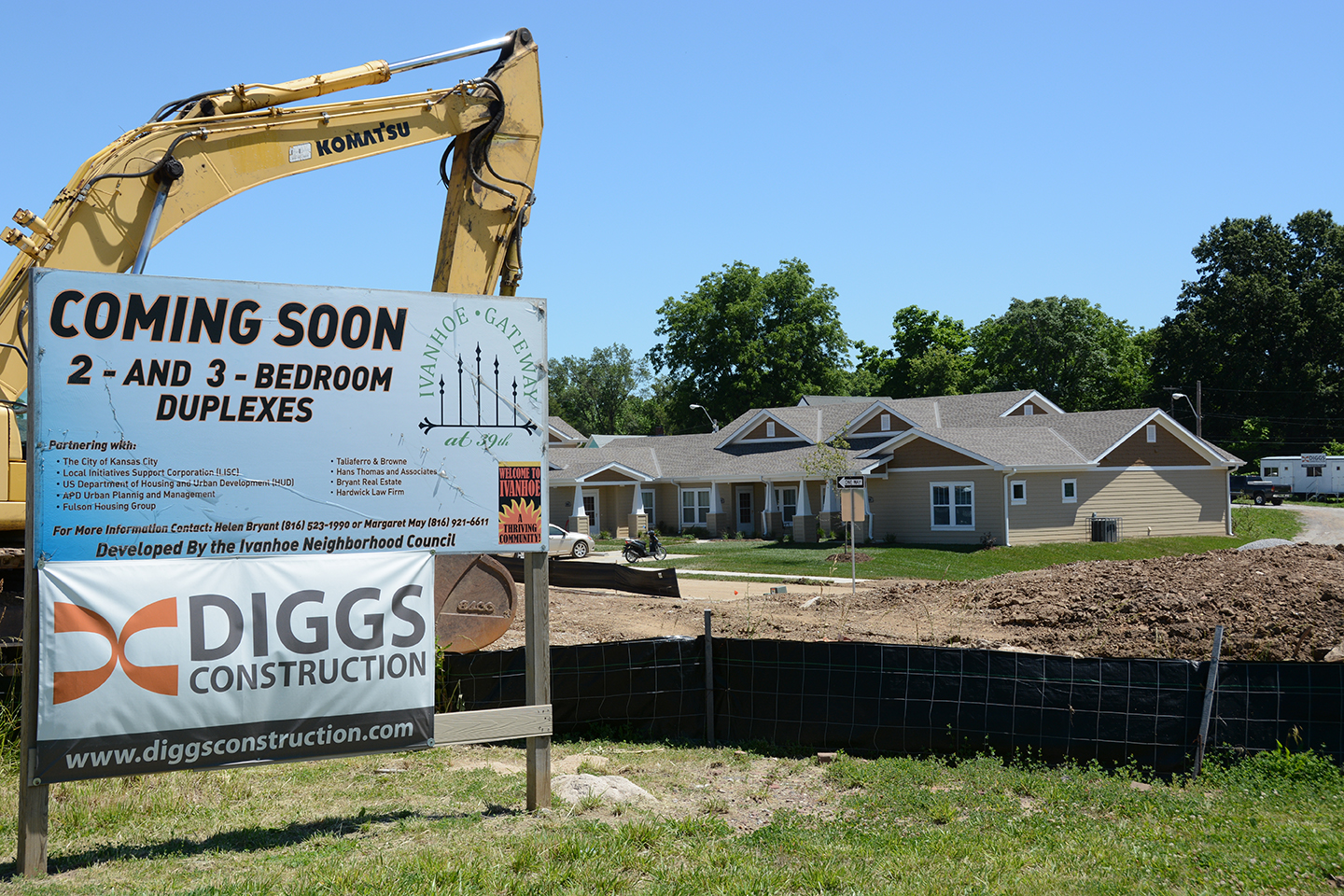
Fortunately, with help from EPA’s Brownfields Program, communities in the urban core have been able to address this environmental contamination and put run-down lots back to productive use. The city’s portfolio of revitalized brownfields projects includes affordable housing developments; a grocery store in a former food desert; expansion of an education center onto lands from a former gas station, garage, and car wash; an upcoming grocery co-op in a historic neighborhood; and numerous other projects throughout the KC metro area. EPA and its partners plan to continue supporting Kansas City communities as they work to build thriving communities.
Utah Station Grill
St. Louis, Missouri
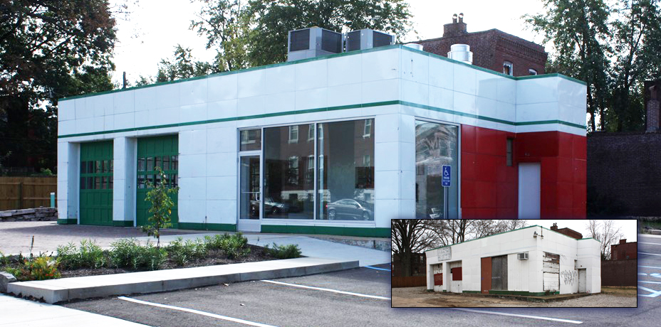 City officials asked EPA to help them develop reuse plans for an abandoned gas station at 3300 Wisconsin Street (intersection of Wisconsin and Utah streets) in south St. Louis. EPA remediated the site by removing eight large underground tanks; conducted a market analysis; met with local elected officials and the local neighborhood association; and developed conceptual site design drawings. The city used the information developed by EPA to offer the site for sale. The site was purchased from the city by a local developer to transform the site into a coffee shop and grill, which is anticipated to open sometime in 2019.
Nebraska
Nebraska Communities Discover Hidden Treasures in Plain Sight
-
Community Bandstand - Cozad
-
Fitness Center - Kimball
-
Student Apartment Complex - Omaha
 Cozad community bandstand. (Photo credit: City of Cozad.)In communities across the Heartland, brownfield sites remain hidden treasures full of untapped potential just waiting for new life.
Through grit, tenacity, and a little imagination, these sites can become community catalysts that spark economic growth, preserve greenspace, and prevent sprawl.
Nebraska communities did just that by transforming sights of blight and despair into new entertainment, fitness, and downtown living opportunities.
A crumbling theatre in Cozad was turned into a new local bandstand, providing year-round entertainment for the community.
 Student housing complex in Omaha. (Photo credit: Google Maps. *Permission rights: www.google.com/permissions/geoguidelines)In Kimball, a historical factory was given new life as a fitness center, benefiting the health and well-being of Kimball citizens.
And what was once an old industrial corridor in Omaha is now home to a new student apartment complex, serving Creighton Dental College just two blocks away.
Thanks to the support of local, state and federal partners, these communities have transformed three very different brownfield sites into new community treasures across the state.
Reuse of Former Gas Stations
Sutherland, Nebraska
 In 2007, EPA developed an inventory of all the abandoned gas stations along two historic highways that crossed the region, the former Route 66 and former Lincoln Highway. EPA identified 218 stations in 115 communities along these routes and ended up working with a number of communities to redevelop these sites. One of the communities was Sutherland, Nebraska, which had four abandoned stations. EPA engaged with local government officials to develop reuse options and scenarios for the sites; develop an assets and opportunities assessment; and solicit community input on the future vision of Sutherland. As a result of these efforts, the local government officials took the following actions:
- Demolished one dilapidated structure in the downtown area and sold property to an adjacent commercial property owner.
- Secured $10,000 of funding from Mid-Nebraska Community Action ($1,000) and the Lincoln County Convention Bureau ($9,000) to restore one of the publicly-owned gas station sites.
- Received labor and supply donations for a publicly-owned gas station cleanup that helped instill community pride.
- Worked with the Nebraska Department of Environmental Quality's (NDEQ's) Petroleum Remediation Section, which provided a “comfort letter” stating that one of the gas stations was investigated and no further actions were required. The site is now being used by a local business.
- Received $160,620 in U.S. Housing and Urban Development (HUD) Community Development Block Grant funding for the rehabilitation of five homes for low-income families.
- Cleaned up a privately-owned former gas station site that was rehabilitated for the Lincoln Highway 100-Year Anniversary celebration in the summer of 2013, where travelers could stop and take pictures.
- Fostered potential uses of the other former gas stations, including a leased café, a public stopping point with a kiosk and restrooms, and a small museum.