Collaborative Efforts in Merrimack River Watershed
The following links exit the site Exit
- EPA and Lawrence Work Together
- Protecting Merrimack River from Chemical Spills
- Watershed Protection Projects
EPA and Lawrence Work Together
Explore the Making a Visible Difference in Lawrence story map.
Stakeholder Involvement
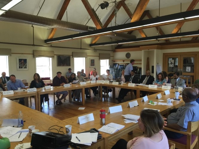
In 2016 EPA launched an effort to work with the Lawrence community to help prioritize needs with EPA's mission through a series of stakeholder meetings. EPA hosted six meetings with community partners. Participants included residents, City of Lawrence, non-profit organizations, state and federal agencies. This self-directed stakeholder group met to address the high-priority issues identified through facilitated meetings. Topics such as litter; urban waters (including water quality and water treatment plant resiliency); employment and job training; and community engagement and education came to the forefront as major issues of concern that we addressed through work in sub-teams. EPA continues to work with partners through our ongoing efforts to protect water quality and improve environmental outcomes in the Merrimack Valley.
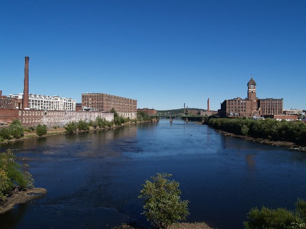
Water Strategy for Merrimack River
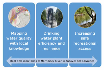
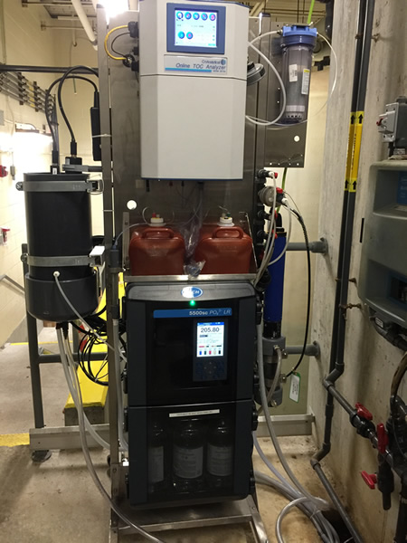
The Lawrence water strategy was developed as part of EPA's effort "Making a Visible Difference in Communities." It focuses on: 1) understanding more about the quality of Merrimack River water and mapping locations of potentially vulnerable sites and conditions; 2) ensuring that the facilities and infrastructure that provide safe drinking water are safe and secure; and 3) communicating the importance and value that the Merrimack River brings to Lawrence as both its source for drinking water and for recreation. EPA deployed two water quality monitors on the River to provide information on water quality every 15 minutes.
 View a larger version of this image. Real time information was collected from December 2016 through November 2018. The data that has been collected can be viewed here.
Understanding and mapping water quality
Based on the work that was done in Lawrence EPA embarked on a watershed mapping platform for the watershed. We created a story map of the Merrimack Watershed. The interactive maps brings together important geospatial data including water quality, flood risk and environmental justice information for the region. Explore the maps here.
Securing drinking water infrastructure by analyzing flooding risk
EPA developed a flooding vulnerability assessment of the Lawrence drinking water treatment plant, situated along the Merrimack River. EPA used the real-time water quality data along with precipitation data to analyze flood risk at the treatment plant. EPA provided an assessment report to the City to improve drinking water plant resiliency. The goal is to help Lawrence avoid impacts to important infrastructure, while protecting health in the event of extreme flooding.
Drinking Water Resilience
EPA and NH DES provided funding and assistance for above ground storage tank outreach and education. The project included working with local fire departments to perform inventories of petroleum and chemical storage tanks at facilities located within the 100-year floodplain of the N.H. portion of the Merrimack River. EPA's new Story Map identifies areas that have a 1 percent chance of flooding in any given year.
Protecting Merrimack River from Chemical Spills
As part of hazard mitigation planning for this valuable water supply and recreational resource, EPA focused on protecting the Merrimack from chemical spills. EPA, working with local emergency response personnel, conducted many exercises to help local officials and businesses become better prepared.
EPA created geographic based response plans for the Merrimack River. These plans identify community and ecological resources, locations for spill response equipment and recovery in the event of a spill emergency and emergency contact information.
EPA mapped the aboveground storage tanks located along the Merrimack which store greater than 10,000 gallons of petroleum and tanks which store hazardous materials within one mile of the river. Outreach to the 161 aboveground storage tank owners was completed in 2014 which emphasized the importance of the river as a public drinking water resource.
Working with aboveground storage tank owners, local emergency responders, public water suppliers, local officials and regulators, EPA held two table top exercises and workshops in Nashua, N.H. and North Chelmsford, Mass. in 2015. The workshops demonstrated that the notification of public water suppliers by state and local responders (and the National Spill Response Hotline) are critical for the downstream public water suppliers. This is critical if they must shut off water intakes, test their water supply for contaminants, assess the water storage available at their facilities, and activate or deactivate interconnections with communities.
Watershed Protection Projects
Protecting drinking water sources is key to sustaining safe drinking water supplies. Protecting source water also reduces risks to public health from exposures to contaminated water and can reduce treatment costs. EPA and many partners work on protecting the water in the Merrimack watershed.
Merrimack Conservation Partnership Project
The Society for the Protection of NH Forests' coordinates a bi-state effort to develop a comprehensive land conservation plan. The plan incorporates valuable water supply data, as well as wildlife and habitat information. The result of the bi-state collaborative approach is a plan that identifies priority parcels in both New Hampshire and Massachusetts. The project issued its first round of grants in the 2016 and continues to issue grant funding on a regular cycle. The grants are being used for land conservation based on the recommendations from the Merrimack Conservation plan. Details about the Merrimack Conservation Plan can be found here.
Riparian Buffer Project
In 2014, the Merrimack River Watershed Council (MRWC) received a $300,000 grant from the U.S. Forest Service for riparian buffers. The project partners include the Nashua River Watershed Association, the MA Department of Conservation and Recreation and UNH Cooperative Extension. The goal of this ambitious 3-year project was to restore, better manage, and protect land within the riparian buffers of six targeted subwatersheds within the Merrimack watershed. EPA attended partner meetings and assisted with identifying subwatersheds of drinking water sources in need of additional protection. Learn more about River Buffer Restoration and Protection.
NH Drinking Water Quality Improvement Project
The NH Drinking Water Quality Improvement Project received more than $3 million in funding from FY 2014 - FY 2017. This project was jointly managed by the U.S. Forest Service, White Mountain National Forest and USDA (NH Natural Resources Conservation Service). EPA and NHDES also assisted on this project, to target the funds towards protecting drinking water sources. It was the only project in New England selected as part of the "USDA Joint Chiefs Initiative," a partnership between the Chiefs of NRCS and Forest Service. The initial focus of this project was to improve drinking water quality for Grafton County communities within the Pemigewasset River Watershed (headwaters of the Merrimack River). The project has funded best management practices on U.S. Forest Service land, implemented water quality protection projects on private land; and protected land through conservation and easement programs. Get information about the NH Drinking Water Improvement Partnership.