An official website of the United States government.

This is not the current EPA website. To navigate to the current EPA website, please go to www.epa.gov. This website is historical material reflecting the EPA website as it existed on January 19, 2021. This website is no longer updated and links to external websites and some internal pages may not work. More information »

San Francisco Bay Delta

San Francisco Bay Water Quality Improvement Fund

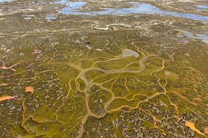
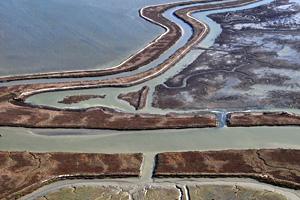
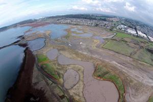
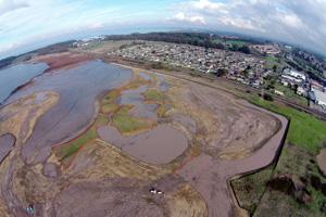
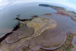
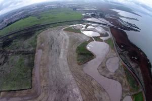
EPA manages a competitive grant program to support projects to protect and restore San Francisco Bay. This grant program, known as the San Francisco Bay Water Quality Improvement Fund (SFBWQIF) began in 2008. The SFBWQIF has invested over $63.5 million in 54 grant awards. These projects include over 80 partners who are contributing an additional $174 million to restore wetlands and watersheds, and reduce polluted runoff.

On this page:

San Francisco Bay Water Quality Improvement Fund Progress Report (2008 – 2014)

Cover image for SFBWQIF reportSince 2008, EPA has partnered with organizations across the nine Bay Area counties through the SFBWQIF, restoring streams, wetlands, and water quality from the Napa River in the North Bay to the salt ponds in the South Bay.

EPA is sharing this progress report as part of our continued effort to provide smart investments in protecting and restoring SF Bay and its watersheds. In this report, you'll find a summary of the grants, recipients, and results of our regional partnerships. We hope you find this assessment useful.
Read the Report »

Learn About the Projects
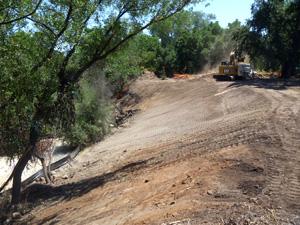
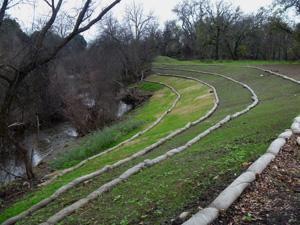
Project Photos

Grasses and other plants planted among stones instead of bare soil in a median strip with traffic on both sides.
Bioswale reduces polluted stormwater runoff along Cesar Chavez Street in San Francisco, 2014. Photo: Ananda Hirsch.
Construction equipment moving away after breaching a levee: water is pouring through the breach and flooding a lower area.
Sears Point Levee Breach, view 1, 2015. Photo: Corby Hines.
Aerial view looking down on an earthmover digging a breach in the levee at sears point. Water is pouring through the breach from right to left and flooding a pool.
Sears Point Levee Breach, view 2, 2015. Photo: Corby Hines.
Sears Point Post Levee Breach view from a distance of the work area, now flooded wetlands, with the Richmond Bridge and San Francisco in the distance.
Sears Point Levee Breach, view 3, 2015. Photo: Scott Hess.
Napa River, Rutherford Reach before restoration
Napa River, Rutherford Reach 6 during restoration construction: laying back eroding bank, 2014. Photo: Jeremy Sarrow.
Napa River, Rutherford Reach after construction: laying back eroding bank
Napa River, Rutherford Reach 6 after construction, 2014. Photo: Jeremy Sarrow.
A17 mudscape, before restoration
South Bay Salt Pond A17 mudscape. Photo: Cris Benton.
A17 near completion
South Bay Salt Pond A17 near completion, 2012. Photo: Judy Irving
Breuner Marsh restored, view 1
Breuner Marsh during construction, view 1, 2014. Photo: Syd Temple, Questa Engineering.
Breuner Marsh restored, view 2
Breuner Marsh during construction, view 2, 2014. Photo: Syd Temple, Questa Engineering.
Breuner Marsh restored, view 3
Breuner Marsh after construction, view 3, 2014. Photo: Syd Temple, Questa Engineering.
Breuner Marsh restored, view 4
Breuner Marsh during construction, view 4, 2014. Photo: Syd Temple, Questa Engineering.


The SFBWQIF priorities are to support projects that enhance aquatic habitat, restore impaired waters, and reduce polluted run-off. Consistent with program priorities, projects are tracked in three categories: restoring wetlands, restoring water quality, and greening development (e.g. Low Impact Development).

Past RFPs and Progress Reports

Related Resources

Many of the following links exit the site Exit

Contact Information

Luisa Valiela (valiela.luisa@epa.gov)
Program Lead
(415) 972-3400

Erica Yelensky (yelensky.erica@epa.gov)
Outreach Coordinator
(415) 972-3021

Mailing Address

US EPA Region 9 (WTR-2-2)
75 Hawthorne
San Francisco, CA 94105


Top of Page