Smart Growth Tools
EPA offers a wide variety of tools and resources to help communities learn about and implement smart growth approaches.
- General Smart Growth Tools
- Brownfields and Infill Development
- Climate Change
- Disaster Resilience and Recovery
- Economic Development
- Planning, Zoning, and Building Codes
- Transportation
- Water Quality
General Smart Growth Tools
- The Smart School Siting Tool – Helps communities align school site selection with planning policies and capital investments and compare school siting alternatives.
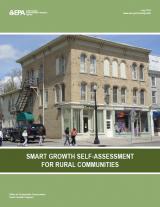
- Smart Growth Self-Assessment for Rural Communities – Tool that lets communities evaluate their existing policies to create healthy, environmentally resilient, and economically robust places.
- Tools and Key Resources for Sustainable Communities – List of useful tools and key resources for communities on a variety of topics.
Brownfields and Infill Development
- Attracting Infill Development in Distressed Communities: 30 Strategies to Help Local Governments Overcome Obstacles and Encourage Infill Development in Distressed Communities – Helps economically distressed communities determine their readiness to pursue infill development and identify strategies to better themselves to attract infill development.
- Equitable Redevelopment of Petroleum Brownfields for Zuni Pueblo and Other Tribal Communities Search EPA Archive – Step-by-step guide to redeveloping petroleum brownfield sites to bring new investment and opportunity to communities that focuses on sites in Zuni Pueblo in New Mexico but can be useful to tribal communities across the nation.
Climate Change
- Smart Growth Fixes for Climate Adaptation and Resilience – Offers more than 70 policy options local governments can consider to prepare for climate change while bringing other environmental, economic, health, and societal benefits.
- Planning Framework for a Climate-Resilient Economy – Helps communities assess how climate change could affect their economy, improve their economic resilience, and take advantage of new opportunities.
- Strategies for Sustainable Communities: A Guidebook Based on California Community Types – Helps local governments determine what combination of greenhouse gas reduction strategies, smart growth practices, and sustainability policies are best for their type of community. Developed for California but can be a model for other places.
Disaster Resilience and Recovery
- Regional Resilience Toolkit: 5 Steps to Build Large-Scale Resilience to Natural Disasters – Helps regions plan for disasters by working across multiple jurisdictions and with non-governmental partners.
- Flood Resilience Checklist – Checklist to help communities determine whether they are prepared for a flood.
- Building Resilient States: A Framework for Agencies Exit – Framework and policy options developed through the Governors' Institute on Community Design that can help states build their resilience to natural disasters.
Economic Development
- Leveraging Opportunity Zones for Community Revitalization – Tools designed to assist communities with promoting equitable and sustainable development; understanding types of financing and attracting and engaging investors; and viewing the data behind environmental, health, and economic conditions in Opportunity Zones.
- Cool & Connected: Nine Actions for Success – Specific actions small towns could take to use broadband to revitalize downtowns, create economic opportunities, and protect the environment.
- Local Foods, Local Places Toolkit: A Guide to Help Communities Revitalize Using Local Food Systems – Toolkit to help communities use local foods to support downtown and neighborhood revitalization. Provides step-by-step instructions for planning and hosting a community workshop and creating an action plan.
- Framework for Creating a Smart Growth Economic Development Strategy: A Tool for Small Cities and Towns – Step-by-step guide to building a place-based economic development strategy. It is intended for small and mid-sized cities, particularly those that have limited population growth, areas of disinvestment, and/or a struggling economy.
Planning, Zoning, and Building Codes

- Tribal Green Building Toolkit – Provides information on how tribes and other communities can prioritize and implement green building codes, policies, and practices.
- Essential Smart Growth Fixes for Rural Planning, Zoning, and Development Codes – Tool to help rural communities strengthen their economies while preserving rural character.
- Essential Smart Growth Fixes for Urban and Suburban Zoning Codes – Tool to help local governments apply targeted fixes to their zoning codes to address specific issues.
- Examples of Codes That Support Smart Growth Development – Sample codes and ordinances that support smart growth.
- Smart Growth Guidelines for Sustainable Design and Development – Guidelines that can serve as a checklist to ensure that programs, plans, and proposed developments incorporate the elements needed at the location, site, and building levels to result in more sustainable, affordable housing.
- Public Involvement Plan and Toolkit for Las Cruces – Can help communities develop strategies that invite and maintain the participation of all residents, especially ethnically diverse, low-income populations and others that have had little or no involvement in community planning and design.
- Sustainable Design and Green Building Toolkit for Local Governments – Toolkit on local codes of ordinances that affect the design, construction, renovation, and operation and maintenance of a building and its immediate site to help local governments, the development community, and other building professionals identify and remove barriers to sustainable design and green building in their permitting processes.
- Sample Requests for Proposals (RFPs) – Examples of RFPs issued by communities to find consultants experienced in smart growth to work on plan updates.
Transportation
- National Walkability Index – Nationwide geographic data resource that ranks block groups according to their relative walkability.
- Access to Jobs and Workers Via Transit Tool – Geospatial data resource and web mapping tool for comparing the accessibility of neighborhoods via public transit service.
- Infrastructure Financing Options for Transit-Oriented Development – Comprehensive overview of existing tools and implementation strategies for transit-oriented development and emerging, innovative models for financing.
- Mixed-Use Trip Generation Model – Spreadsheet tool that makes it easy to estimate trips generated by a new mixed-use development to more fairly assess these projects in development review processes.
- Smart Location Calculator – Simple tool, developed by EPA and the U.S. General Services Administration, for exploring how workplace location affects worker commute travel. Indicators include worker commute greenhouse gas emissions, mode-share, vehicle miles traveled, and workplace accessibility via transit.
- Smart Location Database – Nationwide geospatial database characterizing the built environment for use in travel demand studies and scenario planning.
Water Quality
- Impervious Surface Growth Model – Simple spreadsheet tool for estimating net impervious surface growth associated with development proposals based on the development location.
- Water Quality Scorecard – Tool to help local governments identify opportunities to remove barriers and revise and create codes, ordinances, and incentives to better protect water quality.