Superfund Sites in Reuse in Minnesota
If you are having trouble viewing the map in your browser, click the 'View larger map' link below
Adrian Municipal Well Field 
The Adrian Municipal Well Field Superfund site includes two municipal wells in Adrian, Minnesota. The State of Minnesota closed the contaminated wells and dug two new wells outside the area of contamination in 1984 and 1985. EPA placed the site on the National Priorities List (NPL) in 1986. EPA investigations identified nine leaking underground storage tanks as potential contamination sources. In 1989, the Minnesota Pollution Control Agency completed cleanup activities. EPA took the site off the NPL in 1992. The well field continues to provide water for the municipal water supply.
Last updated September 2019
As of December 2019, EPA did not have economic data related to on-site businesses, or economic data were not applicable due to site use. For additional information click here.
For more information:
Arrowhead Refinery Co.
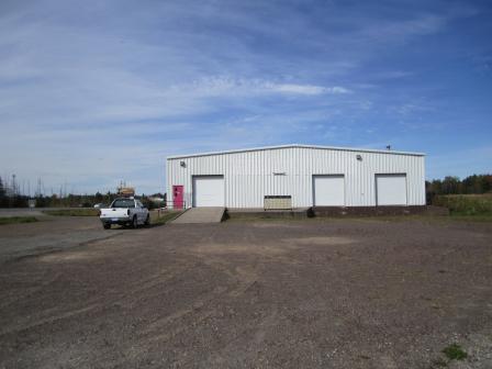 Arrowhead Refinery Co.The 10-acre Arrowhead Refinery Co. Superfund site is a former waste oil recycling facility near Duluth International Airport in Hermantown, Minnesota. From 1961 to 1977, Arrowhead Refinery Company re-refined oil on the property. Site operators disposed of waste in a wetland and a wastewater ditch. These practices resulted in soil and groundwater contamination. EPA placed the site on the National Priorities List (NPL) in 1984. Cleanup included removal and proper disposal of sludge, filter cake and contaminated soil as well as groundwater treatment. The site is zoned for commercial uses. In 2010, EPA supported a reuse assessment to assist the property owner and local government in evaluating reuse opportunities for the site. A medical equipment rental company currently operates on the site. A warehouse operates next to the site. EPA’s Superfund Redevelopment Initiative (SRI) is supporting a regional seed project at the site. An interagency working session in 2019 will help align regulatory permitting steps, redevelopment goals and site closeout activities. To support the inter-agency workgroup discussions, SRI compiled a reference tool in 2018 documenting site cleanup, reuse and institutional control issues. With EPA’s mission to protect human health and the environment in mind, EPA established the Superfund Task Force in May 2017 to provide recommendations for improving and expediting site cleanups and promoting redevelopment. Based on the Superfund Task Force recommendations, EPA identified the site as a Redevelopment Opportunity site – a site with the greatest expected redevelopment potential.
Last updated September 2019
As of December 2019, EPA had data on one on-site business. EPA did not have further economic details related to this business. For additional information click here.
For more information:
Baytown Township Ground Water Plume
The Baytown Township Ground Water Plume Superfund site covers 7 square miles and impacts three aquifers in Washington County, Minnesota. It consists of a contaminated groundwater plume and its source area. From 1940 to 1968, a metalworking facility used the source area property. Facility activities contaminated groundwater. In 1987, the Minnesota Department of Health detected contamination in private wells. EPA added the site to the National Priorities List (NPL) in 1994. Cleanup activities, managed by the Minnesota Pollution Control Agency, include well water treatment and treatment of source area groundwater. Land above the groundwater plume includes farmland, rural residences, a commercial building, Lake Elmo Airport and developed areas of the city of Bayport. A convenience store and gas station are currently located on the source area property.
Last updated September 2019
As of December 2019, EPA had data on 3 on-site businesses. These businesses employed 48 people and generated an estimated $9,093,000 in annual sales revenue. For additional information click here.
For more information:
Burlington Northern (Brainerd/Baxter Plant)
The 60-acre Burlington Northern (Brainerd/Baxter Plant) Superfund site is on the corporate boundary between the cities of Baxter and Brainerd, Minnesota. The site is divided by an active main line railroad. BNSF Railway and previous site users treated rail ties at the site from 1907 to 1985. Wastewater from the wood preserving operations contaminated soil and groundwater. EPA added the site to the National Priorities List (NPL) in 1983. Cleanup included removal of visibly contaminated soil and sludge, treatment and capping of remaining contaminated soil, and operation of an air injection system to treat groundwater. Soil treatment took place between 1987 and 1994. The air injection system continues to operate. In 2014, BNSF, with EPA’s oversight, completed an evaluation of remaining soil and groundwater contamination. EPA is now overseeing a focused feasibility study to update the remedy to better address current site conditions.
Last updated September 2019
As of December 2019, EPA did not have economic data related to on-site businesses, or economic data were not applicable due to site use. For additional information click here.
For more information:
Doc's Auto Salvage 
The Doc’s Auto Salvage Superfund site is located in Minneapolis, Minnesota. An auto service station and scrap yard operated on site until 1995. From the mid-1970s until the early 1990s, site operators illegally discharged contaminated stormwater and disposed of contaminated wastes. In 1997, the state of Minnesota placed the site on the state’s Superfund list. EPA did not place the site on the National Priorities List (NPL). In 1998, EPA awarded Hennepin County a grant for environmental assessment and cleanup activities. EPA worked with Hennepin County to accelerate site cleanup, enabling the locality to take the lead on cleanup and redevelopment efforts. EPA and the county removed over 3,000 tons of contaminated soil from the site. In 2000, the community held a groundbreaking ceremony to celebrate construction of a $3-million control center for the Metro Transit of North Minneapolis. The control center, used for bus and light rail, opened in 2002.
Last updated September 2019
As of December 2019, EPA had data on one on-site business. This business employed 20 people and generated an estimated $6,298,000 in annual sales revenue. For additional information click here.
For more information:
East Bethel Demolition Landfill 
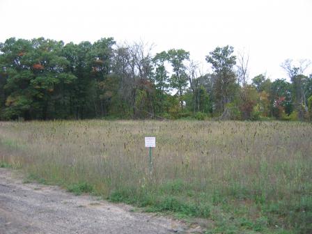 East Bethel Demolition LandfillThe 60-acre East Bethel Demolition Landfill Superfund site is located in East Bethel Township, Minnesota. The landfill covers 27 acres of the site. The landfill accepted demolition debris and other hazardous industrial wastes during the 1970s. In 1981, Anoka County identified high levels of contaminants and dissolved metals in the groundwater. EPA added the site to the National Priorities List (NPL) in 1986. Cleanup actions, managed by the Minnesota Pollution Control Agency’s (MPCA’s) Closed Landfill Program, included groundwater extraction and treatment, a new landfill cap, and active gas venting. EPA took the site off the NPL in 1996. MPCA currently maintains the site. MPCA has planted native grasses on part of the area to enhance wildlife habitat for sandhill cranes; much of the site is part of the Sandhill Crane Natural Area.
Last updated September 2019
As of December 2019, EPA did not have economic data related to on-site businesses, or economic data were not applicable due to site use. For additional information click here.
For more information:
General Mills/Henkel Corp.
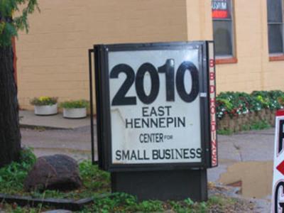 General Mills/Henkel Corp.The General Mills/Henkel Corp. Superfund site is located in Minneapolis, Minnesota. General Mills used the area as a food research facility beginning in 1930. From 1947 to 1977, the company also used the site for chemical research. Waste disposal operations between 1947 and 1962 contaminated soil and groundwater with hazardous chemicals. In 1984, EPA placed the site on the National Priorities List (NPL). The site’s potentially responsible party led groundwater treatment and other cleanup activities, with oversight provided by the Minnesota Pollution Control Agency. A private investment group purchased the site property in 1989. The group worked to transform the area into a business incubator enterprise development zone that supports the startup and growth of local small businesses. In 2012, a real estate company purchased the site and continues to support small business development. A variety of businesses currently operate at the site. Vapor intrusion mitigation and groundwater monitoring are ongoing.
Last updated September 2019
As of December 2019, EPA had data on 46 on-site businesses. These businesses employed 163 people and generated an estimated $24,940,859 in annual sales revenue. For additional information click here.
For more information:
- Reuse and the Benefit to Community: General Mills/Henkel Corp. Superfund Site (PDF) (11 pp, 877 K, About PDF)
- Superfund Site Profile Page
Joslyn Manufacturing & Supply Co.
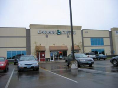 Joslyn Manufacturing & Supply Co.The 30-acre Joslyn Manufacturing & Supply Co. Superfund site is located in Brooklyn Center, Minnesota. Beginning in the 1920s and ending in 1980, a succession of companies operated a wood-treating facility on site. The companies placed wastes in waste disposal ponds, buried sludge on site and spilled wood-treating solutions onto the ground. These practices contaminated soil and groundwater. EPA added the site to the National Priorities List (NPL) in 1984. Site cleanup under Minnesota Pollution Control Agency (MPCA) oversight began in 1985. Cleanup activities included removal, treatment and disposal of contaminated soil for most of the site. Cleanup also includes ongoing groundwater treatment and removal of dense non-aqueous-phase liquids. EPA, state agencies and Real Estate Recycling (RER), a company specializing in redevelopment of once-contaminated lands, worked together to support reuse outcomes at the site. RER purchased the site property, continued cleanup and then redeveloped the area into the Twin Lakes Business Park. RER recognized that the property’s size, valuable infrastructure and direct access to highways, as well as the strength of Brooklyn Center’s labor force all represented significant business opportunities. EPA removed the redeveloped portion of the site from the NPL in 2002. The redevelopment has resulted in the beneficial use of a valuable property in the heart of the Minneapolis-St. Paul metropolitan area. This redevelopment has also spurred development nearby. Today, the business park provides 421,000 square feet of commercial and industrial space for a variety of tenants. In 2018, MPCA selected a cleanup plan for remaining soil contamination on the western portion of the site.
Last updated September 2019
As of December 2019, EPA had data on 5 on-site businesses. These businesses employed 331 people and generated an estimated $273,619,940 in annual sales revenue. For additional information click here.
For more information:
- Reuse and the Benefit to Community: Joslyn Manufacturing & Supply Co. Superfund Site (PDF) (12 pp, 670 K, About PDF)
- Superfund Site Profile Page
Kurt Manufacturing Co.
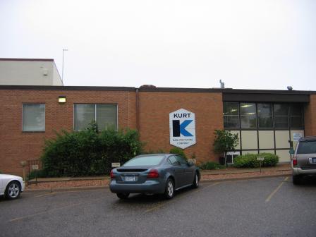 Kurt Manufacturing Co.The 10-acre Kurt Manufacturing Co. Superfund site is located in Fridley, Minnesota. Since 1960, Kurt Manufacturing has made machining and metal components on site. Operators spilled industrial solvents into a drainage pit beneath the company’s metal shavings bin storage. This spill contaminated soil and groundwater. EPA added the site to the National Priorities List (NPL) in 1986. Cleanup activities included soil and groundwater treatment. EPA also required land use controls to limit access to site groundwater and soils. Kurt Manufacturing continues to operate its precision machining and metal fabrication facility on site. The company’s die casting division operates on site, providing die casting solutions to commercial lawn and garden industries.
Last updated September 2019
As of December 2019, EPA had data on one on-site business. This business employed 175 people and generated an estimated $41,176,471 in annual sales revenue. For additional information click here.
For more information:
LaGrand Sanitary Landfill 

The 70-acre LaGrand Sanitary Landfill Superfund site is located in LaGrand Township, Minnesota. The landfill itself covers 5 acres. Between 1974 and 1984, the landfill accepted municipal and industrial wastes. Landfill wastes contaminated groundwater below the landfill. The Minnesota Pollution Control Agency (MPCA) addressed the site through the state’s Closed Landfill Program. EPA added the site to the National Priorities List (NPL) in 1987. Cleanup began in 1992. Workers conducted long-term groundwater monitoring, landfill gas venting and landfill cover maintenance. EPA removed the site from the NPL in 1997. In 2006, MPCA installed a new landfill cap and gas vents. In 2008, MPCA transferred 3 acres of the site property to Runestone Electric for reuse as an electric substation. In 2009, MPCA granted an easement to Great River Energy, an electrical company serving Minnesota and Wisconsin, for electrical power transmission lines to cross part of the site. In 2013, MPCA developed a Closed Landfill Use Plan for the site property and transmitted it to Douglas County. The plan outlines the property’s current use as a closed landfill and potential future use as a solar farm.
Last updated September 2019
As of December 2019, EPA did not have economic data related to on-site businesses, or economic data were not applicable due to site use. For additional information click here.
For more information:
Morris Arsenic Dump 
The Morris Arsenic Dump Superfund site is located in Morris, Minnesota. In the early 1940s, Stevens County buried surplus arsenic-based pesticide in a gravel pit on site. The Minnesota Department of Transportation built a highway through the gravel pit in 1978. After inconclusive groundwater and soil testing, the Minnesota Pollution Control Agency requested assistance from EPA. EPA found traces of arsenic in groundwater samples and added the site to the National Priorities List (NPL) in 1984. Further testing could not determine whether the arsenic in groundwater came from buried pesticides or from arsenic found naturally in the region. Because arsenic concentrations fell within the natural arsenic range for the area, EPA took the site off the NPL in 1986. Part of U.S. Highway 59 remains in use on the site.
Last updated September 2019
As of December 2019, EPA did not have economic data related to on-site businesses, or economic data were not applicable due to site use. For additional information click here.
For more information:
NL Industries/Taracorp/Golden Auto 
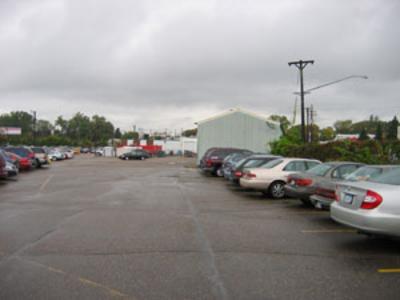 NL Industries/Taracorp/Golden AutoThe NL Industries/Taracorp/Golden Auto Superfund site is located in St. Louis Park, Minnesota. A secondary smelter operated on site from 1940 to 1982, recovering lead from lead plates, battery fragments and lead containers. Waste disposal activities at the smelter and the metal refining business resulted in high lead levels in the air, soil and groundwater. In 1983, EPA placed the site on the National Priorities List (NPL). Cleanup involved removing contaminated soil, refilling and revegetating the area, cleaning or demolishing buildings, and installing a protective asphalt cover. Restrictions limited access to the area during cleanup. EPA took the site off the NPL in 1998. Today, the site is home to the Highway 7 Business Center, which consists of an industrial/commercial office/warehouse building with associated parking, driveway and green space areas. Real Estate Recycling and its development subsidiary, Highway 7 Business Center LLC, own the site property. Long-term groundwater monitoring is ongoing.
Last updated September 2019
As of December 2019, EPA had data on 6 on-site businesses. These businesses employed 69 people and generated an estimated $15,603,658 in annual sales revenue. For additional information click here.
For more information:
Nutting Truck & Caster Co.
The 8.6-acre Nutting Truck & Caster Co. Superfund site is located in Faribault, Minnesota. Between 1891 and 1984, the Nutting Truck & Caster Company made and distributed casters, wheels, hand trucks and towline trucks at the site. From 1959 to 1979, the company operated a foundry waste disposal area on site, using a seepage pit for disposal of waste and sludges. These activities contaminated surface soil. In 1980, the company removed waste materials and contaminated soil from the pit. The company then backfilled and paved the area. In 1984, the company ended its operations at the site. EPA also placed the site on the National Priorities List (NPL) in 1984. EPA delegated authority to the Minnesota Pollution Control Agency to oversee the cleanup. Follow-on investigations identified groundwater contamination resulting from former disposal practices. Cleanup activities included the construction of a groundwater extraction and treatment system, which operated until 2004. Prairie Avenue Leasing Ltd. currently owns the site property and leases it for commercial and light industrial uses. A cell tower is also located on site. Groundwater monitoring is complete. EPA took the site off the NPL in 2017.
Last updated September 2019
As of December 2019, EPA had data on 2 on-site businesses. These businesses employed 68 people and generated an estimated $5,719,000 in annual sales revenue. For additional information click here.
For more information:
Oakdale Dump
The Oakdale Dump Superfund site is located in Oakdale, Minnesota. The site consists of three properties – the 55-acre Abresch property, the 5-acre Brockman property and the 2-acre Eberle property. In the 1940s and 1950s, industrial and non-industrial waste dumping took place at the three properties. In 1980, a Minnesota Pollution Control Agency investigation identified contamination in soils at the three properties. EPA placed the site on the National Priorities List (NPL) in 1983. Cleanup included the removal of contaminated soil and waste, treatment of soil, and collection and off-site treatment of contaminated water. A wooded vacant lot is located on the Brockman property. The Eberle property is now a city park. Active groundwater treatment is ongoing at the Abresch property. Groundwater monitoring is ongoing site wide.
Last updated September 2019
As of December 2019, EPA did not have economic data related to on-site businesses, or economic data were not applicable due to site use. For additional information click here.
For more information:
Olmsted County Sanitary Landfill 

The Olmsted County Sanitary Landfill Superfund site is located in Oronoco, Minnesota. The city of Rochester owned and operated the 50-acre area from 1972 to 1984, when Olmstead County purchased the property. The landfill accepted various industrial wastes, including electroplating sludge, asbestos, transformers, paint and solvents. Seeps from the landfill resulted in groundwater contamination. EPA placed the site on the National Priorities List (NPL) in 1986. The County led site investigations from 1989 to 1993 under Minnesota Pollution Control Agency (MPCA) oversight. In 1994, the County capped the landfill and installed a leachate collection system. MPCA’s Closed Landfill Program adequately addressed site risks. EPA took the site off the NPL in 1995. A local model aeronautics club has been operating a flying field for model airplanes on site since 2008.
Last updated September 2019
As of December 2019, EPA did not have economic data related to on-site businesses, or economic data were not applicable due to site use. For additional information click here.
For more information:
Perham Arsenic Site 
The Perham Arsenic Superfund site is located in Perham, Minnesota. From the 1930s until 1947, manufacturers on site made an arsenic pesticide to control grasshoppers. Site disposal practices contaminated groundwater. In 1971, Hammers Construction Company purchased the site property to build offices and a warehouse. The company installed a groundwater well to provide water to the facility. Eleven employees suffered from arsenic poisoning after drinking the contaminated groundwater. In response to this discovery, the city of Perham (the City) extended its municipal water supply to the facility and capped the well. The cleanup response included capping an arsenic burial pit and installing a groundwater treatment system. The City supplied water to a nearby school and residence. Land use controls protect human health and safety. Continued uses on site include the offices of Hammers Construction Company as well as fairground areas. Hammers Rental Properties currently owns the eastern part of the site property. Knuttila Financial Services owns the western part of the property. A Minnesota Department of Transportation truck station operates on the southern part of the site. EPA classified the site as Sitewide Ready for Anticipated Use (SWRAU) in 2010. Long-term monitoring and groundwater recovery and treatment are ongoing.
Last updated September 2019
As of December 2019, EPA had data on 5 on-site businesses. These businesses employed 8 people and generated an estimated $1,671,000 in annual sales revenue. For additional information click here.
For more information:
Reilly Tar & Chemical Corp. (St. Louis Park Unit) 

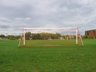 Reilly Tar & Chemical Corp. (St. Louis Park Plant)The 80-acre Reilly Tar & Chemical Corp. (St. Louis Park Plant) Superfund site is located in St. Louis Park, Minnesota. From 1917 to 1982, a coal tar distillation and wood-preserving facility operated on site. Wastewater handling practices resulted in soil and groundwater contamination at the site. In 1972, site owners sold the site and residential and recreational redevelopment began. In 1983, EPA placed the site on the National Priorities List (NPL). EPA, the state and the site’s potentially responsible party (PRP) conducted cleanup activities. The PRP addressed contamination in two on-site storage wells and filled an affected wetland. The PRP also installed groundwater extraction and treatment systems for several aquifers and installed treatment systems for affected city drinking water wells. Since the completion of investigation activities for the source area, most of the site is now a city park. Louisiana Oaks Park includes walking trails, a playground, athletic fields and an events pavilion. Rental condominium and apartment complexes as well as commercial businesses are also located at the site. Parties completed construction of a commercial building and a road improvement project in 2004. Additional road improvement projects have occurred since that time, including a major improvement to Highway 7. The city of St. Louis Park currently operates and maintains groundwater pumping and treatment systems and monitors groundwater quality at the site.
Last updated September 2019
As of December 2019, EPA had data on 14 on-site businesses. These businesses employed 127 people and generated an estimated $17,051,857 in annual sales revenue. For additional information click here.
For more information:
South Andover Site 
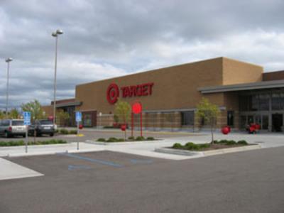 South Andover SiteThe 50-acre South Andover Site Superfund site is located in Andover, Minnesota. From 1954 to 1981, waste disposal and salvage facilities operated on site. Spills and practices resulted in the contamination of soils and groundwater. EPA placed the site on the National Priorities List (NPL) in 1983. Cleanup activities included removal and treatment or off-site disposal of contaminated soils. The potentially responsible parties completed cleanup activities in 1994. Groundwater monitoring is ongoing. In 1996 and 1997, the city of Andover bought the site property and led redevelopment efforts. Today, residential and commercial uses extend from the site onto neighboring properties. Most of this area is known as Andover Station. The pedestrian-oriented development fosters a more walkable and livable community. It also attracts shoppers and boosts the local tax base.
Last updated September 2019
As of December 2019, EPA had data on 15 on-site businesses. These businesses employed 362 people and generated an estimated $16,202,401 in annual sales revenue. For additional information click here.
For more information:
- Reuse and the Benefit to Community: South Andover Site (PDF) (11 pp, 398 K, About PDF)
- Superfund Site Profile Page
South Minneapolis Residential Soil Contamination Site
The South Minneapolis Residential Soil Contamination Superfund site is located in Minneapolis, Minnesota. The 1,480-acre site includes 3,500 residential properties as well as commercial, municipal and industrial areas. From 1938 to 1963, Reade Manufacturing operated an arsenic-based pesticide manufacturing facility at the site. During manufacturing, toxic arsenic became airborne and contaminated soils in surrounding neighborhoods. EPA added the site to the National Priorities List (NPL) in 2006. Cleanup activities included the excavation of contaminated soil and restoration of more than 600 properties. A commercial and light industrial facility currently operates on site. Medical and healthcare businesses are also active on site. Other businesses and homes in the area remain in use.
Last updated September 2019
As of December 2019, EPA had data on 4 on-site businesses. These businesses employed 91 people and generated an estimated $110,719,000 in annual sales revenue. For additional information click here.
For more information:
St. Louis River Site 
The 755-acre St. Louis River Superfund site consists of two state Superfund sites – the St. Louis River/Interlake/Duluth Tar site (SLRIDT) and the U.S. Steel site. The sites are located near Duluth, Minnesota, along the St. Louis River. Industrial operations occurred at the SLRIDT site as early as the 1890s, with iron companies operating on site since 1904. Until 1948, tar and chemical companies manufactured substances from iron production byproducts at the SLRIDT site. U.S Steel operated manufacturing facilities from 1915 to 1979. Past operations and improper waste disposal practices at both sites contaminated soils, sediments and groundwater. Site operations also contaminated the St. Louis River, an estuary with abundant wildlife and fisheries. EPA added the site to the NPL in 1984 and delegated authority for site management to the Minnesota Pollution Control Agency (MPCA). Cleanup activities at SLRIDT included tar and soil removal, and dredging and capping of contaminated river sediments in Stryker Bay, Slip 6 and Slip 7. In 2016, EPA conducted a reuse assessment for the site. In 2017, MPCA clarified the site boundary to assist with further redevelopment efforts. In addition, MPCA reconstructed wetland habitats to help fish productivity and health. The Duluth city government supported the development of a light industrial park on and around the SLRIDT part of the site. The facility includes light manufacturing, transportation, storage and commercial businesses. Other parts of the site remain undeveloped. Cleanup activities at the U.S. Steel site included building demolition, and removal and solidification of large volumes of tar and contaminated soil. EPA, U.S. Steel and MPCA are working on a sediment cleanup and beneficial use improvement for Spirit Lake, a section of the St. Louis River next to the site. With EPA’s mission to protect human health and the environment in mind, EPA established the Superfund Task Force in May 2017 to provide recommendations for improving and expediting site cleanups and promoting redevelopment. Based on the Superfund Task Force recommendations, EPA identified the site as a Redevelopment Opportunity site – a site with the greatest expected redevelopment potential.
Last updated September 2019
As of December 2019, EPA had data on 5 on-site businesses. These businesses employed 104 people and generated an estimated $24,354,000 in annual sales revenue. For additional information click here.
For more information:
St. Regis Paper Co.
The 125-acre St. Regis Paper Company Superfund site is located mainly on potentially responsible party (PRP)-owned property within the Leech Lake Band of Ojibwe Indian Reservation in Cass Lake, Minnesota. The paper company operated a wood treatment facility on site from the 1950s to the 1980s. Facility operations contaminated soil and groundwater. EPA added the site to the National Priorities List (NPL) in 1984. The PRPs are cleaning up the site under EPA, state and tribal regulatory oversight. Soil cleanup includes replacing contaminated soil with clean fill and vegetation at residential properties, cleaning contaminated indoor dust from homes, capping and containing contaminated soil on site, and off-site disposal of heavily-contaminated soil. Groundwater cleanup includes pumping and treating contaminated water. Cleanup efforts continue. Residential, commercial and industrial land uses continue on parts of the site.
Last updated September 2019
As of December 2019, EPA had data on one on-site business. This business employed one person and generated an estimated $113,000 in annual sales revenue. For additional information click here.
For more information:
University of Minnesota (Rosemount Research Center)
The University of Minnesota Rosemount Research Center (UMRRC) Superfund site is located in Rosemount, Minnesota. An agricultural research station was located on site. A former burn pit operated by the University of Minnesota resulted in the contamination of groundwater. Three university tenants – George’s Used Equipment, Porter Electric and Machine Company, and U.S. Transformed – disposed of wastes in three areas, resulting in soil contamination. EPA placed the site on the National Priorities List (NPL) in 1986. Cleanup included groundwater treatment, soil treatment and disposal, and extension of a community water supply line. After cleanup, EPA took the site off the NPL in 2001. Today, a University of Minnesota research center is located on site. The site is also part of a larger area known as UMore Park East. Current land uses in UMore Park East include agricultural areas and various university operations.
Last updated September 2019
As of December 2019, EPA had data on one on-site business. EPA did not have further economic details related to this business. For additional information click here.
For more information:
Waite Park Wells 

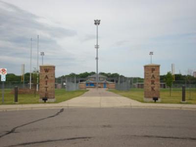 Waite Park WellsThe 200-acre Waite Park Wells Superfund site is located in the city of Waite Park and city of St. Cloud, Minnesota. The site currently includes two major areas – the Electric Machinery area and the Burlington Northern Car Shop area. Past land uses included a gas turbine and electric generator manufacturing facility and a railcar maintenance facility. Facility operations and waste disposal practices resulted in soil and groundwater contamination. In 1986, EPA added the site to the National Priorities List (NPL). The Minnesota Pollution Control Agency led the site’s cleanup. Cleanup activities included construction of a treatment facility for city of Waite Park’s municipal drinking water, and ongoing monitoring of drinking water quality. Cleanup at the Electric Machinery area included groundwater extraction and treatment, limited soil vapor removal, and long-term groundwater monitoring. Cleanup at the Burlington Northern Car Shop area included removal of lagoon and sandblast wastes, construction of an on-site containment facility and groundwater monitoring. After the cleanup, Burlington Northern transferred ownership of 126 acres of the site to the city of Waite Park (the City). The City has turned part of the area into River’s Edge Park. The park features baseball and softball fields, a batting cage, ice hockey and figure skating rinks, picnic tables, a concession stand, fishing access on the Sauk River, and parking. Redevelopment on another part of the site includes a warehouse, a restaurant, and office buildings in West River Business Park. A foundry and parts casting business continues to use the former Electric Machinery building. The City expanded the water treatment plant, which continues to operate. A rail trail provides recreational opportunities adjacent to the site.
Last updated September 2019
As of December 2019, EPA had data on 43 on-site businesses. These businesses employed 848 people and generated an estimated $232,601,591 in annual sales revenue. For additional information click here.
For more information:
- Reuse and the Benefit to Community: A Beneficial Effects Economic Case Study for the Waite Park Wells Superfund Site - Operable Unit 2 (PDF)(17 pp, 2 MB)
- Superfund Site Profile Page
Washington County Landfill
The 25-acre Washington County Landfill Superfund site is located in Lake Elmo, Minnesota. The landfill accepted a variety of residential, commercial, industrial and demolition wastes between 1969 and 1975. Over time, waste disposal at the unlined landfill resulted in contamination of site soil and surrounding groundwater. EPA added the site to the National Priorities List (NPL) in 1984. The Minnesota Pollution Control Agency (MPCA) cleaned up the site under its Closed Landfill Program. Early cleanup actions included groundwater extraction and treatment and providing safe drinking water for affected residences. From 2010 to 2012, MPCA excavated all landfill waste and placed it into a newly constructed triple-lined landfill on site with a leachate and gas control system. Currently, MPCA maintains the landfill. In a 2014 Closed Landfill Use Plan, MPCA identified several potential uses for the cleaned site. In 2015, MPCA constructed a solar energy system on the landfill to supply energy for ongoing operation of the leachate and gas collection systems.
Last updated September 2019
As of December 2019, EPA did not have economic data related to on-site businesses, or economic data were not applicable due to site use. For additional information click here.
For more information:
