New Bedford Harbor Cleanup Plans, Technical Documents and Environmental Data
You may need a PDF reader to view some of the files on this page. See EPA's About PDF page to learn more.
- After Action Reports
- Annual Seafood Monitoring
- Environmental Monitoring Data
- State Enhanced Remedy
- Additional Long Term Monitoring Activities
- Other Relevant Documents
After Action Reports
After each discrete portion of the shoreline is remediated, an After Action Report is prepared which summarizes the work performed, as well as the levels of PCBs that remain after the remediation is completed.
- Final Remedial Action Report for Operable Unit 1 Subtidal Dredging, September 2020 (PDF) (55 pp, 14.8 MB)
- Final Dredge Area H Hybrid Dredge Data Report, September 2019 (PDF) (20 pp, 5.5 MB)
- Final Dredge Areas I/N and O Hybrid Dredge Data Report, September 2019 (PDF) (29 pp, 12.1 MB)
- Final Cable Crossing Area Dredge Report - Revision 1, September 2019 (PDF) (21 pp, 9.1 MB)
- Final Between the Bridges After Action Report, April 2019 (PDF) (28 pp, 3.6 MB)
- Draft Closeout Report Upper and Lower Harbor Dredge Areas Disposed of in Lower Harbor Confined Aquatic Disposal Cell During 2016-2018, March 12, 2019 (PDF) (54 pp, 43.5 MB)
- Final North Street Saltmarsh After Action Report, November 2018 (PDF) (28 pp, 4.3 MB)
- Final Marsh Island After Action Report, August 2018 (PDF) (59 pp, 14.6 MB)
- Final Parcel 265 Intertidal After Action Report, August 2018 (PDF) (31 pp, 4.1 MB)
- North of Wood Street and Early Action Cleanups (2000-2003), Residual PCB Levels Remaining After Cleanup, April 9, 2004 (PDF) (1 pg, 214 K)
- View more After Action reports.
Annual Seafood Monitoring
To ensure that the there is adequate information about the levels of PCBs in locally caught seafood, EPA monitors data collected each year by the Massachusetts State Department of Environmental Protection. Multiple sample areas in and around New Bedford Harbor are revisited each year to collect good comparable data. Multiple samples of locally found fish and shellfish are studied each year to see if the cleanup work is having an impact on PCB levels, and to ensure that the public has the most up to date information on which fish are not safe to eat.
EPA Locally Caught Seafood Guidance
Annual Seafood Monitoring Reports:
- Monitoring Report for Seafood Harvested in 2019 from the New Bedford Harbor Superfund Site, March 2020 (PDF) (344 pp, 50.5 MB)
- Monitoring Report for Seafood Harvested in 2018 from the New Bedford Harbor Superfund Site, March 2019 (PDF) (52 pp, 1.5 MB)
- Monitoring Report for Seafood Harvested in 2017 from the New Bedford Harbor Superfund Site, March 2019 (Amended) (PDF) (62 pp, 2.4 MB)
- Monitoring Report for Seafood Harvested in 2016 from the New Bedford Harbor Superfund Site, January 2018 (Amended) (PDF) (52 pp, 2.3 MB)
- Monitoring Report for Seafood Harvested in 2015 from the New Bedford Harbor Superfund Site, January 2018 (Amended) (PDF) (41 pp, 6.5 MB)
- View more Annual Seafood Monitoring reports.
Environmental Monitoring Data
While the risk from the consumption of contaminated fish and shellfish is one of EPA's greatest concerns at this Superfund site, we continue to take all other potential environmental and public health impacts seriously. The reports and data provided here for air, water and sediment quality, help EPA track the cleanup progress and ensure that the work is protective of public health and the environment.
Fish Migration
- Final 2012 Fish Migration Impact Plan (PDF) (20 pp, 2.9 MB)
Air Monitoring
EPA performs air monitoring during the active cleanup of New Bedford Harbor to confirm that the dredging, de-sanding, de-watering or water treatment operations do not cause elevated levels of airborne PCBs that could pose an unacceptable risk to public health. To date all of the results during the hydraulic dredging operations have been well below risk based levels of concern.
- Air Monitoring Data Status as of December 2020 (PDF) (5 pp, 1.7 MB)
- View more Air Monitoring documents.
Water Quality Monitoring
The water quality of New Bedford Harbor is monitored one-week before dredging starts to determine existing conditions, as well as during cleanup work. EPA studies water quality to check for potential unintended impacts and to verify that the cleanup work is not creating conditions which could cause toxicity to marine organisms, contaminant movement or interference with seasonal bird and fish migrations within the Acushnet River and harbor.
Environmental scientists monitor water quality by: (i) boat-based measurement of turbidity and documenting fish and wildlife passage close to the dredge activity and further away, (ii) collecting stationary monitoring data from moored water quality sensors to supplement the boat-based monitoring, and (iii) collecting water samples to test the physical, chemical, and biological conditions in the harbor to verify the protectiveness of the project-based cleanup goals.
- Water Quality Monitoring Program - Turbidity Data for the Upper Harbor, October 2017 to March 2020 (PDF) (5 pp, 1.4 MB)
- Water Quality Monitoring Program - Turbidity Data for the Lower Harbor, September 2017 to April 2018 (PDF) (4 pp, 581 K)
- View more Water Quality Monitoring documents.
North of Wood Street Monitoring
Located at the far northern end of the upper harbor is the North of Wood (NWS) Street study area. This area extends for about a quarter of a mile north of the Wood Street Bridge between New Bedford and Acushnet, Massachusetts. The intertidal zone, shoreline, in-river sediment and marsh soil in this area was prioritized early on for cleanup and restoration activities based on the high levels of PCB contamination and the close proximity to shoreline residential and recreational land use. During the winter of 2002-2003 about 15,000 cubic yards of material was removed from the area. See photos of the cleanup.
Sampling occurs on an as needed basis, as part of an environmental monitoring program to assess any potential recontamination from tidal sediment transport from areas in the harbor that are undergoing or awaiting cleanup. The NWS area was last sampled in December 2020, and the results will be posted as soon as the data receives the final validation review.
- April 2012 "North of Wood Street Post-Remediation Monitoring" Report (PDF) (560 pp, 13.6 MB)
- April 2011 "North of Wood Street Post-Remediation Monitoring" Report (PDF) (pp 2,770 - 2,960 of 2,960 pp, 108 MB)
- April 2010 "North of Wood Street Post-Remediation Monitoring" Report (PDF) (211 pp, 7.2 MB)
- View more North of Wood Street Monitoring documents.
Sawyer Street Groundwater Monitoring
The Superfund subtidal dredging of PCB-contaminated sediments in both the upper and lower harbor was completed in March of 2020; this area extends from the Wood Street/Slocum Street Bridge in the north to the hurricane barrier in the south. The associated subtidal dredging support facilities and equipment located on the west side of the Sawyer Street Site are in the process of being demobilized.
Located on the East side of the Sawyer Street Site are cells 1,2,3, and the pilot confined disposal facility (CDF). This area was originally constructed as sediment storage and water treatment facilities for management of the most highly contaminated PCB "hot spot" sediments. Since that time, EPA gathered additional site information and refined the cleanup approach for the upper and lower harbor area, and issued ESD #1, which added the use of the pilot study CDF as an interim TSCA facility for PCB-contaminated sediments. This determination stated that the facility did not pose an unreasonable risk to human health and the environment as long as the following conditions are maintained: (1) groundwater and air monitoring of the area is continued as long as the dredged PCB-contaminated sediment remains in place; (2) subsurface conditions remain intact; (3) surface PCB levels remain low; and (4) a final resolution of the facility is made in a later decision document.
Cell 1 is temporarily storing approximately 20,941 cubic yards of TSCA material from dredging operations, and 5,000 cubic yards of mixed waste that was dredged near the former Aerovox facility. This interim disposal cell is underlain by a sixty-mil liner and underlying clay layer. Cell 2 and Cell 3 serve as stormwater run-off collection locations for the area. The contents of Cell 1 will remain on site until funding is available to remove the material, Cell 3 will be backfilled as part of demobilization activities, and Cell 2 will remain in use for stormwater management. EPA funding priorities have focused on the uncontrolled contaminated sediments that remain along the intertidal zones of the Harbor. The east side of Sawyer Street will continue to serve as a PCB material stockpiling, storage, trucking, and processing zone for the remaining intertidal shoreline cleanup work yet to be completed.
There are six groundwater wells located at the perimeter of the site to evaluate the integrity of storage areas and confirm that the stored contamination is not migrating or posing a risk to human health and environment. The groundwater monitoring as well as ambient air monitoring for PCBs and VOCs provide additional assurance that the facility is functioning as expected. The stormwater runoff stored in Cell 2 is tested and treated if necessary (has not required treatment to date) prior to being discharged into the City's sewerage system. No releases of contaminants from the area that exceed established risk levels have been documented to date, see below for monitoring results. The final remedy for addressing the stored contamination in Cell 1 will be addressed in a future Superfund decision document.
- 2019 Technical Memorandum- Sawyer Street Groundwater Sampling Report (PDF) (127 pp, 12.1 MB)
- 2018 Technical Memorandum - Sawyer Street Groundwater Sampling Report (PDF) (622 pp, 18.1 MB)
- 2017 Technical Memorandum - Sawyer Street Groundwater Sampling Report (PDF) (103 pp, 4.9 MB)
- 2014 Biannual Groundwater Monitoring, Sawyer Street Pilot Study Confined Disposal Facility (PDF) (610 pp, 16.2 MB)
- 2012 Biannual Groundwater Monitoring, Sawyer Street Pilot Study Confined Disposal Facility (PDF) (332 pp, 18.5 MB)
- View more Sawyer Street Groundwater Monitoring documents.
Intertidal Work Plans
The remaining shoreline/intertidal areas requiring PCB remediation in the upper harbor have been divided into ten separate zones to facilitate planning and implementation (intertidal refers to the area between the high and low tide lines). There are five zones on the east side of the Acushnet River (East Zones 1 through 5) and five zones on the west (West Zones 1 through 5). The numbering system is north to south on each side (i.e., East Zone 1 is the northern-most zone on the eastern shore of the river). Each work plan includes a detailed design of the shoreline areas to be remediated, as well as a design for the reconstruction and replanting of the remediated areas.
East Zone 1 and West Zone 1 were remediated in 2020. In 2021, East Zones 4 and 5 and West Zones 4 and 5 are planned for remediation.
- East Zones 1 through 5
- Draft Final Intertidal Work Plan for Parcel 25-24, East Zone 1, Revision 3, December 2019 (PDF) (52 pp, 11.7 MB)
- Draft Final Intertidal Work Plan for Parcel 25-31, East Zone 1, Revision 3, December 2019 (PDF) (52 pp, 12.6 MB)
- Draft Final Intertidal Work Plan for Parcel 25-34A, East Zone 1, Revision 2, September 2019 (PDF) (42 pp, 9 MB)
- Draft Final Intertidal Work Plan for Parcel 25-34, East Zone 1, September 2019 (PDF) (67 pp, 16 MB)
- Draft Final Intertidal Work Plan for East Zone 2, July 2019 (PDF) (93 pp, 47.5 MB)
- Draft Final Intertidal Work Plan for East Zone 3, February 2020 (PDF) (120 pp, 90.3 MB)
- Draft Final Intertidal Work Plan for East Zone 4, September 2019 (PDF) (60 pp, 15.6 MB)
- Draft Final Intertidal Work Plan for East Zone 5, March 2020 (PDF) (98 pp, 95.9 MB)
- West Zones 1 through 5
- Draft Final Intertidal Work Plan for West Zone 1 Revision 1, September 2019 (PDF) (101 pp, 35.1 MB)
- Draft Final Intertidal Work Plan for West Zone 2-3, August 2019 (PDF) (92 pp, 48.7 MB)
- Draft Final Intertidal Work Plan for West Zone 4, December 2019 (PDF) (67 pp, 15.8 MB)
- Draft Final Intertidal Work Plan for West Zone 5, May 2020 (PDF) (70 pp, 35.6 MB)
State Enhanced Remedy
The State Enhanced Remedy (SER) consists of navigational dredging and disposal activities within the New Bedford Harbor Superfund Site. Consistent with CERCLA and its implementing regulations, the Commonwealth of Massachusetts requested that EPA include the SER work in the remedy for the Upper and Lower Harbor (Operable Unit 1). After public review and comment, EPA integrated the SER into the 1998 Record of Decision for the Upper and Lower Harbor. Among other things, the SER benefits the remedy because navigational dredging removes sediment in the lower harbor contaminated with PCB concentrations up to 50 ppm and heavy metals that are below EPA's cleanup levels and that would not be otherwise addressed. SER work began in 2004, and through 2015 has involved dredging and CAD disposal of over 450,000 cubic yards through Phase IV. Phase V of the SER program started construction in May 2020 and involves the dredging of about another 500,000 cubic yards of contaminated sediment followed by CAD disposal.
Contact Paul Craffey of MassDEP for more information at 617-292-5591, or Diane Baxter (diane.baxter@state.ma.us).
- Status Update - TSCA Determination and PCB Concentrations Navigational CAD Cells Constructed Under the State Enhanced Remedy, June 2015 (PDF) (7 pp, 638 K)
- First Amendment to the Memorandum of Agreement Between MA DEP and US EPA Region 1, January 2015 (PDF) (10 pp, 1.1 MB)
- Administrative Record Index for the Third Modification to EPA's Final Determination for the South Terminal Project – Channel Widening and Additional Blasting, December 2014 (PDF) (31 pp, 944 K)
- View more State Enhanced Remedy documents.
Pilot Underwater Cap Monitoring
- Letter Regarding Cad Cell 1 and Borrows Pit Cad Cells - Capped Areas Operation and Maintenance (O&M) Reporting 2017, December 2017 (PDF) (31 pp, 3 MB)
- Final Technical Memorandum: Operable Unit #3 Pilot Cap Sediment Monitoring, May 2013 (PDF) (308 pp, 3.3 MB)
- U.S. Coast Guard Designates the Underwater Pilot Cap Area as a Restricted Navigation Area on June 2011 (PDF) (pp 3 of 3 pp, 311 K)
- View more Pilot Underwater Cap Monitoring documents.
Additional Long Term Monitoring Activities
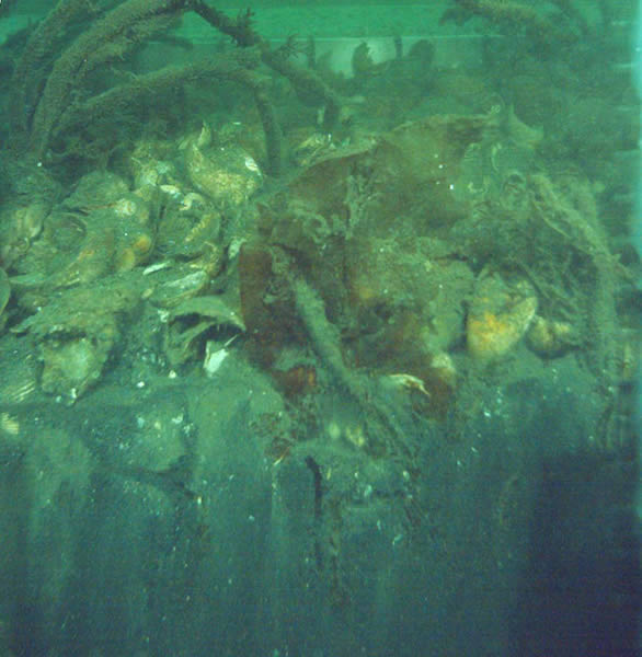
View a larger version of image.
In order to assess the effectiveness of the New Bedford Harbor Superfund cleanup efforts, a long-term environmental monitoring program has been in place since 1993. This is an intensive sampling and analysis effort conducted to quantify the environmental effects of reduced PCB levels in the sediment and water column of the New Bedford Harbor estuary as a result of the cleanup efforts. The initial, or baseline, round of sampling occurred in October 1993 (reported in Baseline Sampling, October 1996) and represents conditions prior to cleanup work. A second event was conducted immediately following the removal of "hot spot" sediment in 1995 (results were not compiled into a separate report but information about the results may be found in the 1998 ROD for this site, specifically pages 14 and 15 and Figures 18 - 20c) and a third event in 1999 (reported in Survey III: Summary Report, March 2001).
The sampling effort includes multiple stations within the designated project areas:
- Area 1 (upper harbor) - Wood Street to the Coggeshall Street Bridge (27 stations)
- Area 2 (lower harbor) - Coggeshall Street Bridge to Hurricane Barrier (29 stations)
- Area 3 (outer harbor) - Hurricane Barrier to edge of Fishing Closure Area 3
Long Term Harbor Monitoring Program
- Long Term Monitoring Program: Comparative Analysis of the 2014 LTM Collection, September 2015 (PDF) (21 pp, 1 MB)
- Long Term Monitoring Survey VI: Final Summary Report, September 2015 (PDF) (1,978 pp, 44 MB)
- Long Term Monitoring Survey V: Summary Report, November 2010 (PDF) (1,663 pp, 65.2 MB)
- View more Long Term Monitoring Activities Program documents.
The next long term monitoring report will be completed in 2020.
Other Relevant Documents
Feasibility Studies/Modeling Studies/Risk Assessments
- Focused Feasibility Evaluation (FFE): Comparison of Confined Disposal Facilities (CDFs) A, B & C versus Off-Site Disposal of PCB Contaminated Sediment, April 2015 (51 pp, 2.9 MB)
- Assessment of Contaminant Loss and Sizing for Proposed Upper Harbor Confined Aquatic Disposal (CAD) Cell (PDF) (111 pp, 5.2 MB)
- Draft Final Supplemental Feasibility Study Evaluation for Upper Buzzards Bay New Bedford Harbor RI/FS New Bedford, Massachusetts, May 1992, Prepared by EBASCO Services, Inc. for EPA (PDF) (173 pp, 27.2 MB)
- Overview of the New Bedford Harbor Physical/Chemical Modeling Program, April 1, 1991 (PDF) (30 pp, 603 K)
- Baseline Ecological Risk Assessment, April 1990 (PDF) (204 pp, 11.8 MB)
- Final Report for Modeling of Transport, Distribution, and Fate of PCBS and Heavy Metals in Acushnet River/Buzzards Bay System, September 1990
- Vol. 1 of 3 (PDF) (145 pp, 7.7 MB)
- Vol. 2 of 3 (PDF) (257 pp, 11.4 MB)
- Vol. 3 of 3 (PDF) (157 pp, 8.9 MB)
- Appendix Vol. 1, Appendices A-D (PDF) (226 pp, 6.3 MB)
- Appendix Vol. 2, Appendices E-F (PDF) (251 pp, 7.9 MB)
- Appendix Vol. 3, Appendices G-M (PDF) (189 pp, 8.9 MB)
- Natural Resource Damage ROD and the Final Environmental Assessment (Round II) (PDF) (137 pp, 1.3 MB) Exit
- Final NPL Listing (PDF) (42 pp, 475 K)
- NPL Site Narrative at Listing (PDF)(1 pg, 13 K)
Interim Aerovox Cap Construction
- Aerovox 100% design document (PDF) (819 pp, 98.5 MB)