EnviroAtlas Communities
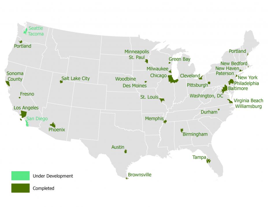
EnviroAtlas provides wall-to-wall data for the entire United States. More fine-scale data are provided for hundreds of U.S. communities. EnviroAtlas currently includes fine-scale data for more than 1400 cities and towns centered on 30 U.S. urbanized community areas (shown in the map above). Selection of these communities is based on:
- geography,
- ongoing local research,
- data availability,
- and opportunities to leverage other EPA projects.
In general, EnviroAtlas defines the community boundaries by the census block groups falling within the census urbanized area for the main community in the area. This means that EnviroAtlas communities often contain all or part of multiple municipalities.
Fact Sheet: Learn more about the EnviroAtlas community component.
Community Summary Fact Sheets
Community Summary Fact Sheets provide an overview of each EnviroAtlas community including land cover, demographics, and ecosystem service summaries.
- Austin, TX
- Baltimore, MD
- Birmingham, AL
- Brownsville, TX
- Chicago, IL
- Cleveland, OH
- Des Moines, IA
- Durham, NC
- Fresno, CA
- Green Bay, WI
- Los Angeles, CA
- Memphis, TN
- Milwaukee, WI
- Minneapolis / St. Paul, MN
- New Bedford, MA
- New Haven, CT
- New York, NY
- Paterson, NJ
- Philadelphia, PA
- Phoenix, AZ
- Pittsburgh, PA
- Portland, ME
- Portland, OR
- Salt Lake City, UT
- Sonoma County, CA
- St. Louis, MO
- Tampa, FL
- Virginia Beach/Williamsburg, VA
- Washington, DC
- Woodbine, IA
EnviroAtlas Spatial Extents
- Data are developed for the Nation at the subwatershed scale, and at a higher resolution for selected communities.
- The Interactive Map also includes supplemental and demographic data at both the national and community extents.
- Learn more: EnviroAtlas Spatial Extents page.
You may need a PDF reader to view some of the files on this page. See EPA’s About PDF page to learn more.