Superfund Sites in Reuse in Washington
If you are having trouble viewing the map in your browser, click the 'View larger map' link below
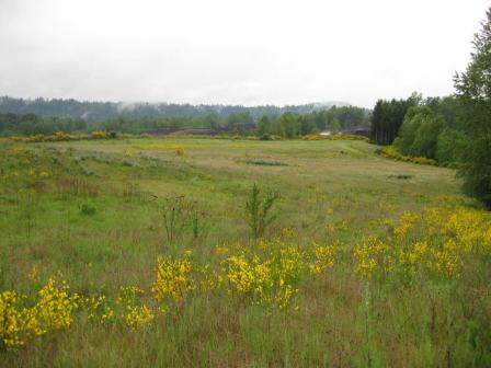
Alcoa (Vancouver Smelter)
The 300-acre Alcoa (Vancouver Smelter) Superfund site is located next to the Columbia River in Vancouver, Washington. The former Aluminum Company of America (Alcoa) constructed an aluminum smelter on part of the site in 1940. Alcoa operated the facility until 1985. From 1973 until 1981, operators dumped tons of potliner containing cyanide and fluoride on the ground outside the smelter. The dumping contaminated soil and groundwater. In 1990, EPA added the site to the National Priorities List (NPL). The state worked with Alcoa to dispose of the hazardous soil, making the riverfront property available for use. EPA took the site off the NPL in 1996. In 2002, Evergreen Aluminum (Glencore) purchased the facility, with Alcoa retaining ownership of some of the land. In 2009, the Port of Vancouver purchased about 218 acres of the land. The purchase allowed the Port to develop Terminal 5, its newest marine terminal. Terminal 5 is used for long-term storage and rail loading.
Last updated September 2019
As of December 2019, EPA did not have economic data related to on-site businesses, or economic data were not applicable due to site use. For additional information click here.
For more information:
Centralia Municipal Landfill
The 87-acre Centralia Municipal Landfill Superfund site is located in Centralia, Washington. Landfill operations contaminated groundwater and surface water. EPA placed the site on the National Priorities List (NPL) in 1990. The site’s long-term remedy included long-term groundwater and surface water monitoring and long-term operation and maintenance of the final landfill cover system. Remedy construction took place in 1999. Site monitoring is ongoing. In 1994, the Lewis County Central Transfer Station facility was built on site. It includes an administrative office building and a waste management facility.
Last updated September 2019
As of December 2019, EPA had data on one on-site business. This business employed one person and generated an estimated $116,923 in annual sales revenue. For additional information click here.
For more information:
Commencement Bay, Near Shore/Tide Flats
The Commencement Bay, Nearshore/Tide Flats Superfund site is located in the cities of Tacoma and Ruston, Washington. The site includes a commercial seaport at the southern end of Puget Sound, with 10 to 12 square miles of shallow water, shoreline and adjoining land. It also includes the former Asarco Tacoma Smelter Facility, the Tacoma Tar Pits, contaminated sediments offshore of the smelter, and areas of Tacoma and Ruston contaminated by smelter emissions. The site’s tidal areas support recreational and tribal fisheries. Beginning in the late 1800s, shipbuilding, oil refining, chemical manufacturing and storage, and other industrial activities occurred at the site. These activities resulted in contamination of soil, groundwater, surface water and sediment. In 1983, EPA added the site to the National Priorities List (NPL). EPA began working with the state of Washington and the Port of Tacoma on the cleanup of the Sitcum Waterway part of the bay. These activities resulted in newly available land on the Milwaukee Waterway. The additional space allowed for the expansion of a land-sea marine terminal facility. The expansion helped make the Port of Tacoma the seventh largest container port in the nation. St. Paul Waterway cleanup restored 11 acres of shallow marine habitat for ecological reuse. Cleanup activities also allowed for construction of the Museum of Glass and the Chihuly Bridge of Glass public art project as well as restoration of 70 acres of coastal habitat. EPA continues to work with landowners and local governments to coordinate cleanup plans with the community’s future land use goals. The former Asarco Tacoma Smelter Facility is located in Ruston and Tacoma, Washington, on Commencement Bay. From 1890 to 1985, Asarco smelted and refined lead and copper on site. In 2006, Point Ruston, LLC purchased the property and agreed to take over its cleanup. The developer coordinated with EPA on site development and remedial capping efforts. Buildings and hard surfaces would serve as part of the site’s capped area, and connect to the surrounding soil cap. Once complete, the Point Ruston development will include commercial, public, residential and recreation areas. EPA has also partnered with Metro Parks Tacoma to clean up and support the redevelopment of the 23-acre Breakwater Peninsula. Metro Parks constructed a public park over the capped area. The park opened in July 2019. There is a U.S. Army reserve center located between the Hyelbos and Blair waterways. Cleanup efforts are ongoing across the former Asarco Tacoma Smelter Facility. The Washington Department of Ecology and Tacoma-Pierce County Health Department partnered with EPA to clean up contaminated yards, including schools, playgrounds and parks, near the former smelter. To date, over 3,000 yards have been cleaned up.
Last updated September 2019
As of December 2019, EPA had data on 123 on-site businesses. These businesses employed 1,303 people and generated an estimated $283,442,239 in annual sales revenue. For additional information click here.
For more information:
Commencement Bay, South Tacoma Channel 
The Commencement Bay, South Tacoma Channel Superfund site is located in Tacoma, Washington. It consists of three separate areas – the South Tacoma Field, the Tacoma Landfill and Well 12A. EPA placed the site on the National Priorities List (NPL) in 1983. South Tacoma Field is a 260-acre area used by Burlington Northern Railroad for rail car manufacturing, repair and maintenance from 1892 to 1974. Two metal workshops also operated in the area, in support of the railroad. Tacoma City Light has continuously operated on the north end of South Tacoma Field since 1953. These activities caused site-wide soil contamination and localized groundwater contamination. Cleanup included soil removal, soil capping, development restrictions and monitoring of natural processes to clean up groundwater. Commercial and industrial businesses operate on the southern half of the South Tacoma Field. The Tacoma Landfill covers about 210 acres. The city of Tacoma operates the landfill. Since 1960, it has accepted municipal, industrial, construction, demolition and bulk wastes. Operations contaminated soil and groundwater with volatile organic compounds (VOCs) and heavy metals. Landfill gas also contains VOCs. Cleanup included landfill capping, management of landfill gas and treatment of groundwater. Uses of the closed landfill include a refuse compaction/ transfer center, a household hazardous waste facility, a recycling center, a city nursery, an environmental education facility, solid waste management offices, and a golf driving range. The Well 12A site has undergone remediation since 1983 to address soil and groundwater contamination from a number of small businesses in the vicinity of the city of Tacoma municipal water supply. Since 1983, cleanup has included excavating contaminated soils, heating soil and groundwater to remove solvents and petroleum, and using biological treatment to remove solvents in groundwater. In addition, wellhead treatment was added at Well 12A. Well 12A continues to provide drinking water for the city. A number of small businesses, including a moving-and-storage company and a communications company, continue to use the land above the contaminated groundwater.
Last updated September 2019
As of December 2019, EPA had data on 23 on-site businesses. These businesses employed 701 people and generated an estimated $130,610,353 in annual sales revenue. For additional information click here.
For more information:
FMC Corp. (Yakima Pit)
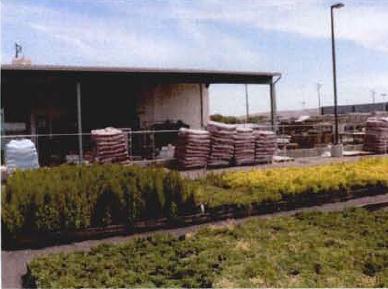 FMC Corp. (Yakima Pit)The 4-acre FMC Corp. (Yakima) Superfund site is located in Yakima, Washington. The site operated as a pesticide formulation facility from 1951 until 1986. From 1952 to 1969, FMC disposed of agricultural pesticides in a pit on site. Site activities contaminated groundwater and soil with pesticides. EPA listed the site on the National Priorities List (NPL) in 1983. Under an EPA order, FMC disposed of about 850 tons of contaminated soil in 1988 and 1989. In 1990, EPA required FMC to remove and incinerate contaminated soils on site. FMC completed cleanup in 1993. Land use controls are in place on a portion of the site to prevent exposure to remaining soil and groundwater contamination. The redeveloped site now has a combination of commercial and light industrial businesses.
Last updated September 2019
As of December 2019, EPA had data on one on-site business. This business employed one person and generated an estimated $750,000 in annual sales revenue. For additional information click here.
For more information:
- Reuse and the Benefit to Community: FMC Corp. (Yakima Pit) Superfund Site (PDF)(4 pp, 397 K, About PDF)
- Superfund Site Profile Page
Frontier Hard Chrome, Inc.
The half-acre Frontier Hard Chrome, Inc. Superfund site is located in Vancouver, Washington. From 1958 to 1983, operators plated chrome on site. Disposal practices from site operations resulted in the contamination of soil and groundwater. In 1982, officials identified contamination in an industrial supply well about a quarter-mile from the site. EPA added the site to the National Priorities List (NPL) in 1983. Cleanup activities included in-situ soil treatment, natural attenuation of groundwater, and groundwater monitoring. After completing the cleanup, EPA removed the site from the NPL in 2018. In the spring of 2018, a 65,000-square-foot pipe fabrication facility and company offices were constructed at the site. With EPA’s mission to protect human health and the environment in mind, EPA established the Superfund Task Force in May 2017 to provide recommendations for improving and expediting site cleanups and promoting redevelopment. Based on the Superfund Task Force recommendations, EPA identified the site as a Redevelopment Opportunity site – a site with the greatest expected redevelopment potential.
Last updated September 2019
As of December 2019, EPA had data on one on-site business. This business employed 100 people and generated an estimated $3,791,000 in annual sales revenue. For additional information click here.
For more information:
Harbor Island (Lead)
The Harbor Island (Lead) Superfund site is an industrial island located in Seattle’s Elliott Bay. Built in the early 1900s, the 420-acre island supports commercial and industrial activities, including ocean and rail transport operations. Site operations contaminated groundwater, sediment and soil with lead and other contaminants. In 1983, EPA listed the site on the National Priorities List (NPL). In 1991, the Port of Seattle expressed interest in expanding Terminal 18, which lies on the east side of the island. Before the expansion could take place, EPA required the Port and other responsible parties to clean up the contamination. Under a legal agreement with EPA, the Port demolished contaminated industrial buildings, removed most contaminated soils and began groundwater monitoring. It also paved much of the site to minimize the spread of contamination through infiltration of rain. The redevelopment project created a 1.1-acre public park with 380 feet of waterfront access, walking paths and benches. Other upgrades on Harbor Island included road improvements, new sidewalks and bike paths. The cleanup allowed the Port to move ahead with a $300-million, 90-acre expansion of Terminal 18. The expansion included a new dockside rail yard, two new truck gates, a larger container storage yard and other amenities to improve goods-handling capabilities. In 2004, the site received a prestigious Phoenix Award for achievement of excellence in Superfund site reuse. A ship repair and construction facility that began operating on the island in 1916, as well as separate oil storage facilities, continue to operate on the island. The ship construction facility employs over 400 workers and uses a petroleum extraction and treatment system for remaining underground petroleum contamination. Under EPA oversight, responsible parties have removed contaminated marine sediments and subtidal debris, and have created extensive beach habitat. EPA has finished additional characterization of the remaining marine sediments. It expects the cleanup will start before 2020 and will make the sediments healthier for fish and mud-dwelling creatures.
Last updated September 2019
As of December 2019, EPA had data on 43 on-site businesses. These businesses employed 1,583 people and generated an estimated $881,900,714 in annual sales revenue. For additional information click here.
For more information:
Lakewood
The 7-acre Lakewood Superfund site is located in Lakewood, Washington. A dry-cleaning business operated on site, contaminating soil, sludge and groundwater with solvents. EPA added the site to the National Priorities List (NPL) in 1982. Cleanup included removal and off-site disposal of septic tank contents and sludge, backfilling of the area with clean material, soil vapor extraction to address contaminated soil, and groundwater use restrictions. Operation and maintenance activities and monitoring are ongoing. An electrical supply and lighting company now operates out of the former dry-cleaning facility on site.
Last updated September 2019
As of December 2019, EPA had data on 2 on-site businesses. These businesses employed 21 people and generated an estimated $7,035,000 in annual sales revenue. For additional information click here.
For more information:
Lockheed West Seattle 
The Lockheed West Seattle Superfund site is located on the southwestern shoreline of the Elliott Bay in Seattle, Washington. The site is adjacent to the Port of Seattle’s Terminal 5 and the West Waterway and includes the former shipyard support operations area. The 40-acre site includes about 7 acres of aquatic tidelands owned by the Port of Seattle and 33 acres of state-owned aquatic lands. Historic shipbuilding practices at the former shipyard released contaminants into the bay. Before its transfer to the Superfund program, the state of Washington listed the site as a “sediment cleanup priority project” under state of Washington cleanup authority. EPA placed the site on the National Priorities List (NPL) in 2007. In 2012, EPA issued a proposed cleanup plan for contaminated sediments at the site, which included bringing contamination levels down to statewide standards and adding a thin layer of sediment to enhance natural recovery. In August 2013, EPA signed a Record of Decision, which included a cleanup plan. The cleanup began in 2018 and is being conducted by the Lockheed Martin Corporation. After this cleanup, there should be few restrictions to maritime activities and future uses near the site. As part of this effort, EPA and Lockheed Martin coordinated with Tribal members from the Muckleshoot and Suquamish Tribes who harvest seafood around Harbor Island. The West Waterway portion of the site includes a federal navigation channel that remains in use. The Port of Seattle envisions expanding Terminal 5, including pier structures, as a container terminal along the West Waterway. The U.S. Army Corps of Engineers has submitted a Water Resources Development Act request to Congress requesting authorization to deepen the navigation channel. Natural areas of the site support birds, crabs and fish, including salmon, as well as recreational use through net fishing, beach play, clamming or eating resident fish.
Last updated September 2019
As of December 2019, EPA did not have economic data related to on-site businesses, or economic data were not applicable due to site use. For additional information click here.
For more information:
Lower Duwamish Waterway 

The Lower Duwamish Waterway Superfund site is a five-mile stretch of the Duwamish River that flows into East and West Waterways (part of the Harbor Island Superfund site) then into Elliott Bay in Seattle, Washington. The South Park and Georgetown neighborhoods and industrial corridors flank the waterway. A century of heavy industrial use left the waterway contaminated with toxic chemicals from many sources. These include nearby industries; stormwater pipes; and runoff from upland activities, streets and roads from a 32-square-mile drainage basin. Native American tribes use the Lower Duwamish as a fishing resource and for cultural purposes. Diverse groups of regional fishers, many from communities with environmental justice characteristics, also use the Lower Duwamish. The Lower Duwamish Waterway also supports considerable commercial navigation, commercial salmon fishing and major shipping activities for containerized and bulk cargo. The central portion of the waterway is maintained as a federal navigation channel by the U.S. Army Corps of Engineers (USACE). Several houseboats anchor at two marinas on the waterway and there are continued residential uses of neighborhoods along the waterway. Recreational enthusiasts use the waterway for various activities, such as boating, kayaking, fishing and beach play. It also serves as a habitat for fish, shellfish, and wildlife. In response to contamination in sediments, fish and shellfish, EPA added the site to the National Priorities List (NPL) in 2001. The Washington Department of Ecology uses its state authorities to control ongoing contaminant sources in coordination with the in-waterway investigation and cleanup led by EPA. The city of Seattle, King County, the Port of Seattle and the Boeing Company, collectively known as the Lower Duwamish Waterway Group, led site investigations and several early cleanup activities under oversight by EPA and the state. In 2013, EPA issued a proposed cleanup plan to address long-term cleanup at the site. Following the public comment period, where EPA received over 2,300 public comments, EPA selected a cleanup plan in 2014. The plan includes active sediment cleanup through dredging, capping, and enhanced natural recovery over an estimated 177 acres. EPA will conduct monitored natural recovery for the remaining 235 acres, which are less contaminated areas. EPA also plans to work with the liable parties on the next steps in implementing its cleanup plan. The plan estimates that sediment cleanup will cost about $342 million. Around 2015, a startup called the Duwamish Rowing Club started using safe parts of the site for rowing. The rowing club aims to connect people of South Park and nearby neighborhoods to the natural resource flowing through the area.
Last updated September 2019
As of December 2019, EPA did not have economic data related to on-site businesses, or economic data were not applicable due to site use. For additional information click here.
For more information:
Midway Landfill
 Midway LandfillThe 60-acre Midway Landfill Superfund site is located in King County, Washington. The site is between U.S. Interstate 5 (I-5) and U.S. Highway 99. The former gravel quarry served as a municipal solid waste landfill from 1966 to 1983. Local officials created Midway Landfill primarily to accept demolition materials, wood waste and other slowly decomposing materials. Operators also put other industrial wastes in the landfill. In 1983, operators covered the landfill with silt and fine sands. In 1985, investigations identified combustible gas in structures around the landfill and contaminated groundwater beyond the landfill boundary. EPA placed the site on the National Priorities List (NPL) in 1986. In 1992, the city of Seattle constructed a final cap over the site, refined landfill gas controls, and installed a stormwater and drainage control system. These remedy components continue to function as planned. Washington State’s Department of Ecology is the lead agency for the site. The Washington Department of Transportation is using part the site, located in a right of way, for an Interstate 5 (I-5) road-widening project. Sound Transit, the area’s public transit system, is extending its Link light rail system. Sound Transit plans to use the edge of the Midway Landfill as part of the route extension, and is considering placing a maintenance facility at the site accessed via a rail spur. Sound Transit recently awarded a design/build contract for a light rail project that will cross the site and run next to I-5. The rest of the site remains a closed landfill and unused open space.
Last updated September 2019
As of December 2019, EPA did not have economic data related to on-site businesses, or economic data were not applicable due to site use. For additional information click here.
For more information:
- Kent and Midway Landfills, Kent, WA - Reuse Plan (PDF) (30 pp, 4.1 MB, About PDF)
- Superfund Site Profile Page
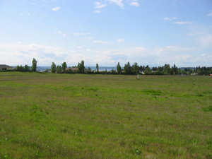
Moses Lake Wellfield Contamination
The Moses Lake Wellfield Contamination Superfund site is located in the city of Moses Lake, Washington. The site includes parts of the former Larson Air Force Base, Grant County Airport and some areas south of the airport. The U.S. government established the Larson Air Force Base in 1942 and closed the base in 1965. During this period, the Air Force, Boeing Company and the Strategic Air Command and Titan Missile program used the base at various points. Former base operations and associated industrial activities contaminated soil and about 1,000 acres of groundwater with hazardous chemicals. In 1966, the Port of Moses Lake acquired most of the former base and has since operated the property as the Grant County International Airport. Housing associated with the base also remains in use, now under ownership of the Grant County housing authority. The U.S. Air Force transferred other facilities to Big Bend Community College. In 1968, Boeing returned to the airport by purchasing 130 acres that included the Three-Place Hangar. In 1992, EPA listed the site on the National Priorities List (NPL) because of soil and groundwater contamination. In 2003, the U.S. Army Corps of Engineers (USACE) completed construction of a replacement water supply well for the nearby Skyline residential water system. This well continues to provide reliable, clean drinking water to the Skyline community. A 2008 EPA interim cleanup plan requires installation of groundwater pump-and-treat systems for two of five known areas of groundwater contamination. At EPA’s request, USACE is sampling private residential wells and installing and maintaining whole house filters for protection of residents. The cleanup design for the South Base Dump area is complete. The cleanup design for the South Groundwater Plume area is complete and under construction. New industries and businesses are developing this site, along with other areas within the institutional control boundary. Industrial and commercial activities continue on site around the airport today. The site also supports recreational uses including biking, parks and athletic fields.
Last updated September 2019
As of December 2019, EPA had data on 44 on-site businesses. These businesses employed 1,669 people and generated an estimated $402,742,153 in annual sales revenue. For additional information click here.
For more information:
North Market Street
The 50-acre North Market Street Superfund site is located in Spokane, Washington. The Phillips Petroleum Company, the Tosco Refining Company and Chevron operated a petroleum refining and distribution complex at the site beginning in the 1980s. Industrial activities and mishandling led to major oil spill incidents in 1985, 1989 and 1990. These spills contaminated soil and groundwater with petroleum and chemicals. EPA placed the site on the National Priorities List (NPL) in 1990. Cleanup included soil excavation, on-site soil treatment and passive groundwater cleanup. Cleanup finished in 2002. Spokane County set land use restrictions for the site. Holly Energy Partners now operates an industrial fuel distribution facility on the property. Commercial companies also use parts of the site.
Last updated September 2019
As of December 2019, EPA had data on 6 on-site businesses. These businesses employed 25 people and generated an estimated $73,457,000 in annual sales revenue. For additional information click here.
For more information:
Northside Landfill
 Northside LandfillThe Northside Landfill Superfund site is located on a 345-acre parcel of land in Spokane, Washington. Established as a city landfill in 1931, the landfill was the largest refuse disposal operation in Spokane County. Open burning took place at the landfill until the mid-1950s. The city of Spokane (the City) extended municipal water supplies to the area in 1984. In 1986, EPA listed the site on the National Priorities List (NPL) because of contaminated groundwater and sludge. In 1989, EPA selected a cleanup approach for the landfill that included closing and capping the old landfill units, treating and monitoring groundwater, collecting landfill gas and restricting land use. The City closed the old landfill units and completed the landfill caps by 1993. That same year, the City began long-term treatment of groundwater. The City has since constructed an active waste disposal cell that meets all new state landfill requirements. The City plans to continue operations at this landfill until all remaining landfill cells reach capacity. EPA has discontinued groundwater pumping and treatment from the pilot extraction well. The state requires continued monitoring of the perimeter and residential wells. City monitoring results show that drinking water standards are being met. EPA’s Superfund Redevelopment Initiative began supporting a regional seed project at the site in 2017. The purpose is to evaluate reuse opportunities for four landfill sites in and near Spokane, Washington.
Last updated September 2019
As of December 2019, EPA had data on one on-site business. This business employed 6 people. For additional information click here.
For more information:
Northwest Transformer (South Harkness Street)
The Northwest Transformer (South Harkness Street) Superfund site is located in Everson, Washington. The Northwest Transformer Service Company operated a transformer reclamation, storage and manufacturing facility on site until its bankruptcy in 1987. The company left behind a property contaminated with polychlorinated biphenyls. In 1990, EPA placed the site on the National Priorities List (NPL). In 1992, EPA began working closely with local government officials, the site’s potentially responsible parties and nearby residents to develop cleanup and reuse plans for the 1-acre property. By 1995, the potentially responsible parties had removed the contaminated soil and constructed a new parking lot. EPA took the site off the NPL in 1997. Today, the site provides much-needed parking space for the nearby town hall and an adjacent senior center.
Last updated September 2019
As of December 2019, EPA did not have economic data related to on-site businesses, or economic data were not applicable due to site use. For additional information click here.
For more information:
Oeser Co.
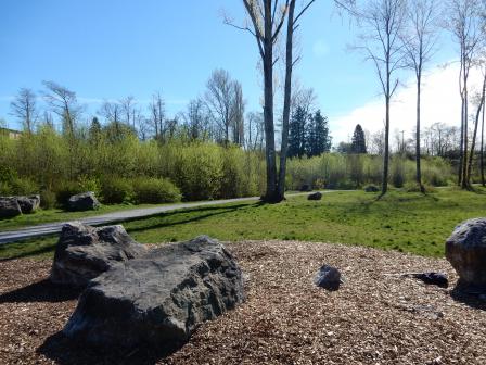 Oeser Co.The Oeser Co. Superfund site is located in a mixed residential and industrial area of Bellingham, Washington. The site includes the Oeser Company (Oeser) property (an active wood-treating facility) and the Little Squalicum Creek Area, located within Little Squalicum Park. Since 1943, Oeser has prepared and treated wood poles for utility companies on a 26-acre property. Treating practices resulted in soil and groundwater contaminated with various chemicals, including dioxin. In 1997, EPA listed the site on the National Priorities List (NPL). In 2003, Oeser began removing or capping contaminated soils, placing use controls to limit groundwater use and non-industrial land use, and monitoring groundwater. Oeser completed the cleanup actions in 2009. In 2010, Oeser initiated cleanup of the creek area. Due to a lack of funds, EPA took over and completed cleanup of the creek area in 2011. Cleanup included the restoration of creeks and wetland habitats, and the restoration and reopening of Little Squalicum Park. The restored park includes beach trails, interpretive displays and parking. The trails connect the site to the larger Bay-to-Baker Trail network, which connects the city of Bellingham to Mount Baker. EPA and the city of Bellingham (the City) enhanced bicycling and walking paths in the park with a new layer of crushed limestone. Little Squalicum Creek also meanders through the site. The City contributed to park restoration by revegetating stream banks with native plants and wetland shrubs, including native red alder, cottonwood, cedar and maple tree seedlings. The mature trees will help stabilize stream banks in the future. Restoration work also provided an opportunity to remove invasive plant species and weeds from the park. Migratory birds, including peregrine falcons and bald eagles, and other wildlife species now make their home in Little Squalicum Park. Groundwater and surface water monitoring as well as maintenance of the caps is ongoing.
Last updated September 2019
As of December 2019, EPA had data on 3 on-site businesses. These businesses employed 95 people and generated an estimated $13,920,000 in annual sales revenue. For additional information click here.
For more information:
- Redevelopment of the Oeser Company Superfund Site (PDF)(3 pp, 2.5 MB, About PDF)
- EPA Region 10 Howard Orlean Excellence in Site Reuse Award
- Superfund Site Profile Page
Palermo Well Field Ground Water Contamination
The Palermo Well Field Groundwater Contamination Superfund site is located in Tumwater, Washington. The site spans about three-quarters of a mile. It consists of three identified sources and corresponding plumes. Sampling detected contamination in three city drinking water wells in 1993. Identified sources include former and current Washington Department of Transportation facilities and a dry cleaner. EPA placed the site on the National Priorities List (NPL) in 1997. Cleanup activities included installing a system to extract vapor from soil beneath the dry-cleaning facility, using an air stripper to treat drinking water, putting in an underground drainage system, and monitoring air in houses above the contaminated groundwater. EPA is working with the Washington State Department of Transportation (WSDOT) to determine if additional cleanup is necessary. Commercial and residential areas are located on site. Government facilities such as the former and current WSDOT materials labs are located on site. The Palermo Well Field consists of several active water supply wells that provide a portion of the drinking water for the city of Tumwater.
Last updated September 2019
As of December 2019, EPA had data on 3 on-site businesses. These businesses employed 116 people and generated an estimated $4,458,000 in annual sales revenue. For additional information click here.
For more information:
Queen City Farms
 Queen City FarmsThe Queen City Farms Superfund site is located in Maple Valley, Washington. The 324-acre site is immediately south of the King County Cedar Hills Landfill. Previous site uses included a pig farm, an airport, a chemical repackaging operation and a waste disposal area for industrial chemicals generated in the Seattle area. From 1955 to the late 1960s, industrial waste was dumped in two on-site ponds prior to burning the wastes and collecting drums. Sludge and residue were left in the ponds, buried drums were located near the ponds, and chemicals leached from the ponds into groundwater. EPA added the site to the National Priorities List (NPL) in 1984. Queen City Farms, the current site owner, and The Boeing Company conducted cleanup activities, with oversight from EPA. Responsible parties removed and disposed of wastes and drums and constructed a containment area to secure wastes remaining at the site. Monitored natural attenuation, supplemented by groundwater extraction and treatment, have addressed groundwater contamination. Long-term groundwater monitoring is ongoing. Today, part of the site is undeveloped; it supports wetlands and wooded wildlife habitat areas. A regional composting business uses about 26 acres of the site to recycle organic materials into soil.
Last updated September 2019
As of December 2019, EPA had data on one on-site business. This business employed 5 people and generated an estimated $1,538,000 in annual sales revenue. For additional information click here.
For more information:
Seattle Municipal Landfill (Kent Highlands)
The 90-acre Seattle Municipal Landfill (Kent Highlands) Superfund site is located in Kent, Washington. From 1968 to 1986, the city of Seattle leased the site and disposed of refuse on about 60 acres. The landfill accepted municipal wastes, paint residues, industrial sludge and other industrial wastes. Landfill operations contaminated groundwater and air. EPA added the site to the National Priorities List (NPL) in 1990. Cleanup activities included fencing, landfill capping, drainage improvements, and water and landfill gas collection systems. In 2017, an apartment complex was built on the northern part of the site.
Last updated September 2019
As of December 2019, EPA did not have economic data related to on-site businesses, or economic data were not applicable due to site use. For additional information click here.
For more information:
Silver Mountain Mine
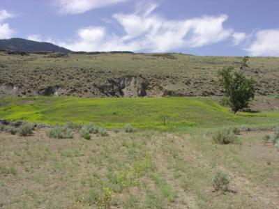 Silver Mountain MineThe 5-acre Silver Mountain Mine Superfund site is an abandoned silver and gold mine in Horse Springs Coulee, Washington. From 1902 until the 1960s, the Silver Mountain Mine operated periodically, producing small amounts of silver and gold. From 1980 to 1981, speculators returned to the mine and used chemicals to extract precious metals from the old ore tailings. By July 1981, speculators abandoned the operation. They left behind more than 7,000 tons of cyanide-laced mine tailings and a basin filled with 20,000 gallons of cyanide-contaminated water. In November 1981, the Washington State Department of Ecology (Ecology) investigated the site. Ecology treated the cyanide-contaminated water in 1982. EPA listed the site on the National Priorities List (NPL) in 1986. EPA closed the mine entrance and placed the contaminated mine tailings under a protective cap. With the capped area fenced off, EPA revegetated the land around the mine. The site is currently used for grazing cattle. In 1997, EPA deleted the site from the NPL. The state continues to perform annual inspections and maintenance of the site’s cap.
Last updated September 2019
As of December 2019, EPA did not have economic data related to on-site businesses, or economic data were not applicable due to site use. For additional information click here.
For more information:
Spokane Junkyard/Associated Properties 
The 16-acre Spokane Junkyard/Associated Properties Superfund site is located in Spokane, Washington. The Spokane Junkyard accepted military surplus items, automobiles, heavy equipment, appliances and electrical transformers from the 1940s until the 1980s. In 1987, an explosive fire destroyed the junkyard. During an investigation, EPA found heavy metals in the soil. EPA placed the site on the National Priorities List (NPL) in 1994. EPA and the site’s responsible parties removed asbestos, contaminated soil and waste, and covered the area. Parties completed these activities in 1997 and EPA took the site off the NPL. After cleanup, the Bemiss Neighborhood Council worked to identify reuses for the site property that could best serve the needs of the Spokane community. The Spokane Youth Sports Association headed a team to plan, fund and build a multi-use sports complex for area youth. The Association coordinated redevelopment with EPA to ensure that the site’s remedy remained protective and that redevelopment was in line with the site’s land use restrictions. Completed in 2002, the Andrew Rypien Field sports complex includes a baseball field and soccer fields. One section on the southern end of the site is used as a community garden. Recipient of the national Phoenix Community Impact Award in 2004 for achievement of excellence in Superfund site reuse, the complex serves over 4,500 neighborhood children.
Last updated September 2019
As of December 2019, EPA did not have economic data related to on-site businesses, or economic data were not applicable due to site use. For additional information click here.
For more information:
Toftdahl Drums
The 15-acre Toftdahl Drums Superfund site is located in Brush Prairie, Washington. In the early 1970s, the property owner cleaned drums for resale. During this time, the property owner reportedly had drums of industrial waste delivered to the property. Unsalvageable drums buried at the site contaminated soil, surface water and groundwater. In 1986, EPA placed the site on the National Priorities List (NPL). EPA and the state investigated the site and removed and disposed of all contaminated soils. After cleanup, EPA took the site off the NPL in 1988. Developers have since built eight single-family homes on site.
Last updated September 2019
As of December 2019, EPA did not have economic data related to on-site businesses, or economic data were not applicable due to site use. For additional information click here.
For more information:
Vancouver Water Station #1 Contamination
The Vancouver Water Station #1 Contamination Superfund site is located in Vancouver, Washington. The well field on site supplies drinking water to about 150,000 people throughout the Vancouver area. In 1988, the city of Vancouver (the City) discovered traces of chemical dry-cleaning liquids in the wells. EPA placed the site on the National Priorities List (NPL) in 1994. In 1998, the City finished construction of a groundwater treatment system that uses air stripping techniques to separate contaminants from the water. After treatment, the City uses the groundwater as drinking water. EPA deleted the site from the NPL in 2018. The site lies within Waterworks Park.
Last updated September 2019
As of December 2019, EPA had data on one on-site business. EPA did not have further economic details related to this business. For additional information click here.
For more information:
Vancouver Water Station #4 Contamination
The Vancouver Water Station #4 Contamination Superfund site is located in Vancouver, Washington. The well field is part of the City of Vancouver water supply system that supplies drinking water to about 150,000 people throughout the Vancouver area. In 1988, the city of Vancouver (the City) discovered traces of chemical dry-cleaning liquids in wells at the station. EPA added the site to the National Priorities List (NPL) in 1992. The City treated the groundwater using air stripping techniques to separate contaminants from the water. The treated water continues to be used as part of the City’s drinking water supply system. EPA deleted the site from the NPL in 2018.
Last updated September 2019
As of December 2019, EPA did not have economic data related to on-site businesses, or economic data were not applicable due to site use. For additional information click here.
For more information:
Western Processing Co., Inc.
The 13-acre Western Processing Co., Inc. Superfund site is in Kent, Washington. From 1961 to 1983, a recycling and reclamation business operated on site. Its operations resulted in soil, groundwater and sediment contamination. EPA added the site to the National Priorities List (NPL) in 1983. Cleanup included removal of contaminated soil, surface structures and debris, groundwater treatment, sediment removal, and placement of a cap to prevent stormwater infiltration. Operation and maintenance activities and monitoring are ongoing. A roadway extends over part of the capped area of the site. Mill Creek, monitored as part of the site, supports continued local wildlife, including beavers and birds.
Last updated September 2019
As of December 2019, EPA did not have economic data related to on-site businesses, or economic data were not applicable due to site use. For additional information click here.
For more information:
Wyckoff Co./Eagle Harbor
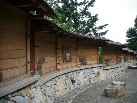 Wyckoff Co./Eagle HarborThe Wyckoff Co./Eagle Harbor Superfund site is located on Bainbridge Island, west of Seattle in Puget Sound, Washington. For nearly a century, a wood treatment facility and a shipyard operated at the site. Years of site operations contaminated soil, groundwater and the bottom sediments of the adjacent Eagle Harbor. EPA added the site to the National Priorities List (NPL) in 1987. EPA divided the site into three areas for cleanup; bottom sediments in East Harbor, a former wood treatment plant and a former shipyard. East Harbor includes more than 70 acres of bottom sediments and beaches on the south side of Eagle Harbor. The bottom sediments became heavily contaminated with creosote released from the former wood treatment plant. EPA, working with the U.S. Army Corps of Engineers, obtained clean sand from a river dredging project and used the sand to bury, or “cap,” contaminated portions of the harbor in 1994. EPA added several extensions to the cap in later years. EPA regularly monitors the condition of the cap. In 2012, EPA found that part of the cap in the middle of the harbor had eroded, exposing contaminated sediment below. EPA completed repairs to 9 acres of the sediment cap in 2017. In 2018, EPA released a plan to dredge and backfill portions of the intertidal beaches next to the former wood treatment plant. Restrictions on shellfish consumption and limits on marine activities that could disturb the capped areas of the beach are in place. When functioning, the cap provides clean habitat that supports a diverse population of fish, crabs and clams. The former Wyckoff Wood Treatment Plant is located on the south side of Eagle Harbor. The plant processed wood for use as railroad ties, utility poles, pier pilings and other outdoor structures. Soil and groundwater in the area became heavily contaminated with creosote and other chemicals over nearly 100 years of operations. Current containment measures include a steel sheet pile wall around the perimeter of the facility and a groundwater extraction and treatment system. The perimeter wall is a critical element of the containment system, because it prevents contaminated soil and groundwater from moving into Eagle Harbor. The above-ground portion of the wall is corroding and must be replaced. EPA issued a modified cleanup plan in 2018. Plans include a reinforced concrete barrier wall and improvements to a road on the site, allowing construction equipment and materials for the new wall construction. EPA issued another cleanup plan in 2019, which identified in-situ stabilization/solidification to immobilize contaminated soil and groundwater at the former wood treatment plant. Post cleanup, the site will become part of an adjacent city park and provide more than 15 acres of open space with spectacular views of Puget Sound and the Seattle skyline. The city of Bainbridge Island (the City) purchased the site property in 2007 for use as a park. The City converted the beach west of the former treatment plant and the hillside behind it to park land, as part of Pritchard Park. West Beach is a popular recreation area used by beachgoers, dog-walkers, kayakers and paddle boarders. The wooded hillside above the beach features a network of hiking trails. The westernmost portion of the park is now the Bainbridge Island Japanese American Exclusion Memorial. Bainbridge Island was home to many Japanese Americans who were sent to internment camps during World War II. The Memorial is located on the site of a former ferry dock, where detainees boarded boats to Seattle on their way to the camps. The Memorial includes several paths and a 276-foot-long memorial wall – one foot for each relocated resident. West Harbor is a former shipyard. At this part of the site, EPA worked with the state to dismantle on-site buildings and remove polluted sediments. Remedial workers placed the most-polluted sediments inside a partially submerged containment facility. Crews then paved over the containment facility. Today, the area is a maintenance yard for Washington State Ferries. EPA and the state of Washington conduct regular inspections and sampling of the area to make sure the remedy continues to protect adjacent marine habitat. Runners and cyclists use a trail that runs along the edge of the area.
Last updated September 2019
As of December 2019, EPA had data on 2 on-site businesses. EPA did not have further economic details related to these businesses. For additional information click here.
For more information:
- Recreational and Ecological Use at Superfund Sites Story MapEXIT
- Restoration and Rememberance: Integrating Community Priorities and Cleanup Plans: The Wyckoff Company/Eagle Harbor Superfund Site on Bainbridge Island, Washington (PDF)(16 pp, 10.7 MB)
- Superfund Site Profile Page
Yakima Plating Co.
The 1-acre Yakima Plating Company Superfund site is located in Yakima, Washington. From 1962 to 1990, Yakima Plating electroplated bumpers for cars and other objects on the property. Operators disposed of wastewaters in an on-site drain field. Operations at the facility contaminated groundwater and soil. EPA added the site to the National Priorities List (NPL) in 1989. In 1991, EPA funded and conducted an early action removal and disposed of contaminated soil. Following cleanup, EPA took the site off the NPL in 1994. Operation and maintenance activities and monitoring are ongoing. An automobile painting and body works facility currently operates on site.
Last updated September 2019
As of December 2019, EPA had data on one on-site business. This business employed 11 people and generated an estimated $519,000 in annual sales revenue. For additional information click here.
For more information: